
Kent County is located in east-central New Brunswick, Canada. The county features a unique blend of cultures including Mi'kmaq, Acadian and English Speaking Settlers. Some larger tourist attractions include la dune de Bouctouche, Kouchibouguac National Park, and Bonar Law Commons.

The Times & Transcript is a newspaper from Moncton, New Brunswick. It serves Greater Moncton and eastern New Brunswick. Its offices and printing facilities are located on Main Street in Downtown Moncton. The paper is published by Brunswick News, privately owned by J.K. Irving.

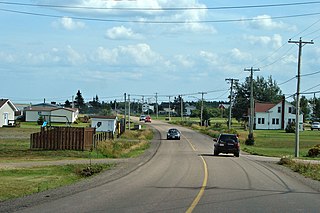
Saint-Antoine is a village in Kent County, New Brunswick, Canada. It is 35 km north of Moncton and 18 km Southwest of Bouctouche. Saint-Antoine's residents are Acadian; most speak French in its local variant, Chiac. Saint-Antoine is on Route 115 and Route 525. The village is called St. Anthony by English area residents.

The Roman Catholic Archdiocese of Moncton is a Roman Catholic archdiocese that includes part of the Province of New Brunswick and includes the suffragan dioceses of Roman Catholic Diocese of Bathurst (Canada) Edmundston, and Saint John, New Brunswick.
Kiwanis Park is a 3,500 seat baseball field located in Moncton, New Brunswick. The field was donated to the City of Moncton in 1953 by the local Kiwanis Club. It is the largest baseball field in Canada east of Quebec City. The field is the current home of the Moncton Fisher Cats and also, the Junior and Minor league Metro Mudcats. It has played host to many baseball tournaments including the 1975 Intercontinental Cup, the 1997 World Junior Baseball Championship, and the 2004 Baseball Canada Senior Championships.

Ammon is a Canadian community in Moncton Parish, New Brunswick. Ammon includes the Intersection at Ammon Rd and New Brunswick Route 490. Ammon is in part of Greater Moncton.

This article refers to a park in Canada. If you are looking for information about a park in Dublin, see Irishtown Nature Park, Dublin.
Indian Island 28 is a Mi'kmaq First Nation reserve on Indian Island in Canada located in Kent County, New Brunswick.
Haut-Lamèque is a settlement in Gloucester County, New Brunswick, Canada.

Casino New Brunswick is located in the Magnetic Hill Area of Moncton, New Brunswick, Canada.
Lutes Mountain is a Canadian Community, located in Westmorland County, New Brunswick. It is named after famous railroad conductor, Neil Lutes. The Community is situated in southeastern New Brunswick, to the North West of Moncton, located partially within Moncton and Magnetic Hill Limits. Lutes Mountain is located around the intersection of New Brunswick Route 126 and New Brunswick Route 128.
Harrisville is a neighbourhood in Moncton, New Brunswick. It is notable for being in the vicinity of the Greater Moncton International Airport.
Route 475 is a 21-kilometre (13 mi) long west-east secondary highway in the northwest portion of New Brunswick, Canada.
Route 480 is a 21-kilometre (13 mi) long west-east secondary highway in the northwest portion of New Brunswick, Canada.
Mundleville is a community in the Local Service District of Weldford located at the confluence of the Richibucto River and the St. Nicholas River. Today the community features some of the most beautiful homes along the Richibucto River, has a few small businesses and hosts an Annual Winter Carnival. Mundleville is located mainly around the Intersection of Route 510 and Route 470.
Buctouche 16 is a Mi'kmaq reserve in Canada located in Kent County, New Brunswick.
Route 940 is a 35.2-kilometre (21.9 mi) long north to south secondary highway in the southeastern portion of New Brunswick, Canada.

Shediac is a Canadian parish in Westmorland County, New Brunswick.
Meadow Brook is an unincorporated community in Westmorland County, New Brunswick. The community is situated in Southeastern New Brunswick, to the east of Moncton. Meadow Brook is part of Greater Moncton.
Calhoun is an unincorporated community in Westmorland County, New Brunswick. The community is situated in southeastern New Brunswick, to the east of Moncton, and is part of Greater Moncton.


