
The British Virgin Islands are located in the Caribbean, between the Caribbean Sea and the North Atlantic Ocean, east of Puerto Rico.Its geographic coordinates are 18°30′N64°30′W. Map references include Central America and the Caribbean. The area totals 151 km² and comprises 16 inhabited and more than 20 uninhabited islands; includes the islands of Tortola, Anegada, Virgin Gorda and Jost van Dyke. There are no bodies of water on the land. There are no land boundaries. There is 80 km of coastline. Maritime claims include 3 nmi of territorial sea and exclusive a 200 nmi fishing zone. It has a tropical, humid climate, with temperatures moderated by trade winds. Its terrain consists of coral islands, and is relatively flat. It has volcanic islands and is steep and hilly. Its lowest point is the Caribbean Sea and its highest point is Mount Sage at 521 metres (1,709 ft) above sea level. Its natural resources are negligible. In terms of land use, it is 20% arable land, 6.67% permanent crops and 73.33% other as of a 2005 figure. Its natural hazards consist of hurricanes and tropical storms from July to October. There is limited natural fresh water resources. It has strong ties to nearby U.S. Virgin Islands and Puerto Rico.

Geography of the United States Virgin Islands

The Virgin Islands are geologically and biogeographically the easternmost part of the Greater Antilles, the northern islands belonging to the Puerto Rican Bank and St. Croix being a displaced part of the same geologic structure. Politically, the British Virgin Islands have been governed as the western island group of the Leeward Islands, which are the northern part of the Lesser Antilles, and form the border between the Caribbean Sea and the Atlantic Ocean. The archipelago is separated from the true Lesser Antilles by the Anegada Passage and from the main island of Puerto Rico by the Virgin Passage.

Table Grove is a village in Fulton County, Illinois, United States. Its population was 416 as of the 2010 census.
Sylvania Township is a township in Potter County, Pennsylvania, United States. The population was 61 at the 2000 census.

Cruz Bay, U.S. Virgin Islands is the main town on the island of Saint John in the United States Virgin Islands. According to the 2000 Census, Cruz Bay has a population of 2,743 people.
The area code (340) is the local telephone area code of U.S. Virgin Islands. The (340) area code was created during a split from the original (809) area code, which began permissive dialing on 1 June 1997 and ended 30 June 1998.
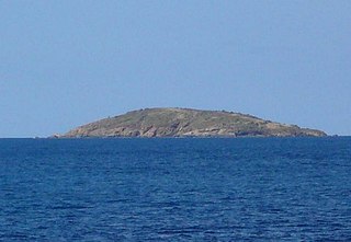
Flanagan Island is an island located within the Virgin Islands archipelago in the Caribbean and forms part of the U.S. Virgin Islands.
The U.S. Virgin Islands Paradise Jam is a college basketball tournament that takes place in late November of each year, with the men usually playing the week before Thanksgiving and the women playing Thanksgiving week. It normally takes place in St. Thomas at the Sports and Fitness Center on the campus of the University of the Virgin Islands.

York Island is one of the Apostle Islands in northern Wisconsin, in Lake Superior, and is part of the Apostle Islands National Lakeshore. It is located in the Town of Russell in Bayfield County.
Resolution is a settlement on the island of Saint Thomas in the United States Virgin Islands. It is part of the Northside Administrative District. Crown Mountain, the highest point in the US Virgin Islands, is in Resolution.
Adrian is a neighborhood on the island of Saint John in the United States Virgin Islands. Much of this area is part of Virgin Islands National Park. The Catherineburg Sugar Mill Ruins are in Adrian. The only grove of bamboo on St. John can be found here, to the east of John Head Road.
Annaberg is a former sugar factory and plantation on the island of Saint John in the United States Virgin Islands. It is uninhabited and part of Virgin Islands National Park.
Bordeaux is a neighborhood on the island of Saint John in the United States Virgin Islands. It is named for Mount Bordeaux, the highest point on the island. Most of this area is part of Virgin Islands National Park.
Fish Bay is a bay and neighborhood on the island of Saint John in the United States Virgin Islands. Most of this area is part of Virgin Islands National Park.
Lameshur is a former plantation on the island of Saint John in the United States Virgin Islands. It is inside Virgin Islands National Park and home to the Virgin Islands Environmental Resource Station (VIERS). The Tektite program placed two underwater habitats in Great Lameshur Bay and the Tektite Underwater Habitat Museum is located in the VIERS camp. The road to Lameshur is unmaintained and 4 wheel drive vehicles are often required. The University of the Virgin Islands has a research station and dock in Lameshur on Yawzi Point.
Mount Pleasant is an area of Virgin Islands National Park on the island of Saint John in the United States Virgin Islands. It is located between Maho Bay and Centerline Road. This area is uninhabited and its name has fallen out of use.
Bitch Mountain is a summit in Essex County, New York, in the United States. With an elevation of 2,615 feet (797 m), Bitch Mountain is the 424th highest summit in the state of New York.

Trotter Crossing is an unincorporated community in Stampers Creek Township, Orange County, in the U.S. state of Indiana.

