
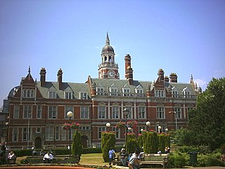
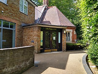
The Coroner's Court for South London is located on the 2nd Floor of Davis House in Croydon. The offices of the Coroner for South London are located at the same address. The court covers the London Boroughs of Bexley, Bromley, Croydon and Sutton. [1]
The Coroner's Court for South London is located on the 2nd Floor of Davis House in Croydon. The offices of the Coroner for South London are located at the same address. The court covers the London Boroughs of Bexley, Bromley, Croydon and Sutton. [1]
The County Borough of Croydon was a local government district in and around the town of Croydon in north east Surrey, England from 1889 to 1965. Since 1965 the district has been part of the London Borough of Croydon within Greater London.

Hannibal House was a 1960s office building positioned above the Elephant and Castle shopping centre in Southwark, south London.

Arena tram stop is a light rail stop in the Woodside area of South Norwood in the London Borough of Croydon in the southern suburbs of London. The stop is located by the Croydon Sports Arena and serves the council estates of Longheath Gardens Estate and Tollgate Estate.

Woodside tram stop is a light rail stop situated between Woodside Green and Ashburton Park in the London Borough of Croydon in the southern suburbs of London. The stop is located on the site of the former Woodside railway station of the Woodside and South Croydon Railway; the old station buildings survive, though not used by Tramlink.

Addiscombe tram stop is a light rail stop in the London Borough of Croydon in the southern suburbs of London.

Bandon Halt was a station on the 1847 London, Brighton and South Coast Railway extension from West Croydon to Epsom. It was situated between Waddon and Wallington stations in what is now the London Borough of Sutton, and opened on 11 June 1906 and closed 7 June 1914. It takes its name from the immediate area which is called Bandon Hill. It was located at grid reference TQ301644 and was accessed from Plough Lane, the platforms lying to the immediate west of the overbridge.
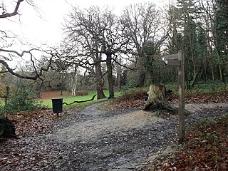
Beaulieu Heights 16 acres (6.5 ha) is an area of ancient woodland between South Norwood and Upper Norwood in the London Borough of Croydon, London. It is located between South Norwood Hill and Auckland Road with Auckland Rise to the north and Tummonds Gardens to the south. There are pedestrian entrances from South Norwood Hill and Auckland Rise, and a pond. The name is pronounced as if spelled "Beulah" like the nearby Beulah Hill, and not like the French word or the town of Beaulieu, Hampshire.

South Norwood Recreation Ground is a park located in South Norwood in the London Borough of Croydon. In 1889, Croydon Corporation acquired the land and the borough surveyor estimated that it would cost just over £1,300 to lay out. Over a quarter of the projected cost was to install land drainage, which indicates that the site was quite wet. The recreation ground includes a sports area, football pitches, tennis court, floodlit courts, bowling green with pavilion and a children's playground.
Heavers Meadow is a meadow located in South Norwood and Selhurst in the London Borough of Croydon. South Norwood Recreation Ground is on the other side of the road. The meadow covers an area of 83⁄4 acres. With meadows there are not usually many facilities. Heavers is no exception; the only facility stated on the council's website is a footpath through a flood meadow.

South Norwood Lake and Grounds is a park in South Norwood in the London Borough of Croydon. The main entrance is in Woodvale Avenue while other entrances are located in Auckland Road and Sylvan Road. The area measures up to 281⁄2 acres.
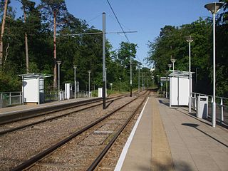
Coombe Lane tram stop is a light rail stop in the London Borough of Croydon in the southern suburbs of London. It is located south of Addington Hills and serves Royal Russell School and the Ballards residential estate.
Addington Vale is a 48 acres (19 ha) park situated in New Addington in the London Borough of Croydon. The park extends from King Henrys Drive in the north to Arnhem Drive in the south. It is bordered by Queen Elizabeths Drive to the west and Godric Crescent and Hares Bank to the east. The nearest Tramlink station is New Addington.

Addiscombe Recreation Ground, commonly known as Bingham Park, is a park situated in Addiscombe, London. The park is managed by London Borough of Croydon. Addiscombe tram stop is located just next to the recreation ground and is served by Tramlink. The area covers 8 acres (3.2 ha).

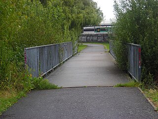
Apsley Road Playground is a park and playground situated in South Norwood, London, England. It is managed by the London Borough of Croydon and covers an area of 0.25 acres (0.10 ha). The park is mainly located on Apsley Road which is also the main entrance for the park. It is more targeted to the surrounding residential area. The playground's nearest Tramlink stop is Harrington Road.

Grangewood Park is an extensive woodland area situated in South Norwood, London. It is managed by the London Borough of Croydon. It is bounded by Grange Road, Wharncliffe Road, and Ross Road. It covers an area of 27.7 acres. The park is located on the main A212 road between Thornton Heath and Upper Norwood/Crystal Palace. The nearest stations are Thornton Heath, Selhurst and Norwood Junction.

Croydon Central Library is Croydon's main public library located inside the Croydon Clocktower in Croydon, south London. It is owned by the London Borough of Croydon on behalf of Croydon Council. The library is located on four floors inside the building. There are also children's reading sessions.

The Colonnades Leisure Park or Croydon Colonnades is an out-of-town leisure park located in the Purley Way retail and industrial district of the London Borough of Croydon, South London. It opened in the late 1990s on the former site of the Croydon Water Palace, an indoor water park complex that operated from 1990 to 1996. It lies alongside the Purley Way Playing Fields, and opposite the former Croydon Airport site.

Apollo House is a 22-storey high-rise office building at 36 Wellesley Road in the London Borough of Croydon, London, England. In common with a neighbouring building Lunar House and others developed by Harry Hyams, the building's name was inspired by the Apollo 11 Moon landing in 1969.
St Pancras Coroner's Court is the Coroner's Court for inner north London. It is located at Camley Street, St Pancras, London. The court covers cases for the London boroughs of Camden, Islington, Hackney and Tower Hamlets.
Southwark Coroner's Court is the Coroner's Court for inner south London. It is located at Tennis Street, London. The court covers cases for the London boroughs of Greenwich, Lambeth, Lewisham and Southwark.
51°22′17″N0°05′59″W / 51.3713°N 0.0997°W
| | This article about a London building or structure is a stub. You can help Wikipedia by expanding it. |