Spodnji Žerjavci

Last updated
Spodnji Žerjavci
Slovenia location map.svg
Red pog.svg
Spodnji Žerjavci
Location in Slovenia
Coordinates: 46°36′21.47″N15°51′30.88″E / 46.6059639°N 15.8585778°E / 46.6059639; 15.8585778 Coordinates: 46°36′21.47″N15°51′30.88″E / 46.6059639°N 15.8585778°E / 46.6059639; 15.8585778
Country Flag of Slovenia.svg Slovenia
Traditional region Styria
Statistical region Drava
Municipality Lenart
Area
  Total 2.41 km2 (0.93 sq mi)
Elevation 287.5 m (943.2 ft)
Population (2002)
  Total 320
[1]

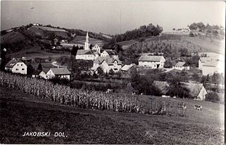
Spodnji Žerjavci (pronounced  [ˈspoːdnji ʒɛˈɾjaːu̯tsi] ) is a settlement in the Municipality of Lenart in northeastern Slovenia. It lies in the Slovene Hills (Slovene : Slovenske gorice), just off the road from Lenart towards Benedikt. The area was part of the traditional region of Styria. It is now included in the Drava Statistical Region. [2]

Municipality of Lenart Municipality in Slovenia

The Municipality of Lenart is a municipality in northeastern Slovenia. It has just over 11,000 inhabitants. It is considered the centre of the Slovene Hills. The area was part of the traditional region of Styria. It is now included in the Drava Statistical Region. The seat of the municipality is Lenart v Slovenskih Goricah.

Slovenia republic in Central Europe

Slovenia, officially the Republic of Slovenia, is a sovereign state located in southern Central Europe at a crossroads of important European cultural and trade routes. It is bordered by Italy to the west, Austria to the north, Hungary to the northeast, Croatia to the southeast, and the Adriatic Sea to the southwest. It covers 20,273 square kilometers (7,827 sq mi) and has a population of 2.07 million. One of the successor states of the former Yugoslavia, Slovenia is a parliamentary republic and a member of the United Nations, of the European Union, and of NATO. The capital and largest city is Ljubljana.

Slovene Hills

The Slovene Hills or the Slovenian Hills is the largest hilly region of Slovenia, a smaller part is located in the Austrian province of Styria. It is situated in the northeast of the country and has an area of 1,017 square kilometres (393 sq mi). It comprises the Western Slovene Hills and the Eastern Slovene Hills. The region is known for its vineyards and wines. The central town and municipality is Lenart.

There are two small chapels in the settlement. One dates to 1869 and the second dates to the early 20th century. [3]
Chapel Religious place of fellowship attached to a larger institution

The term chapel usually refers to a Christian place of prayer and worship that is attached to a larger, often nonreligious institution or that is considered an extension of a primary religious institution. It may be part of a larger structure or complex, such as a college, hospital, palace, prison, funeral home, church, synagogue or mosque, located on board a military or commercial ship, or it may be an entirely free-standing building, sometimes with its own grounds. Chapel has also referred to independent or nonconformist places of worship in Great Britain—outside the established church.

Related Research Articles

Trnovska Vas Place in Styria, Slovenia

Trnovska Vas is a settlement in the Municipality of Trnovska Vas in northeastern Slovenia. It is the seat of the municipality. The area was part of the traditional region of Styria. It is now included in the Drava Statistical Region. The settlement lies on the regional road from Ptuj to Lenart v Slovenskih Goricah in the Pesnica Valley.

Spodnji Ključarovci in Styria, Slovenia

Spodnji Ključarovci is a settlement in the Slovene Hills northwest of Ormož in northeastern Slovenia. The area traditionally belonged to the region of Styria. It is now included in the Drava Statistical Region.

Dolge Njive, Lenart in Styria, Slovenia

Dolge Njive is a settlement in the Slovene Hills in the Municipality of Lenart in northeastern Slovenia. The area was part of the traditional region of Styria. It is now included in the Drava Statistical Region.

Močna in Styria, Slovenia

Močna is a settlement in the Municipality of Lenart in northeastern Slovenia. It lies in the Slovene Hills on the main regional road from Maribor to Lenart. The area was part of the traditional region of Styria. It is now included in the Drava Statistical Region.

Selce, Lenart in Styria, Slovenia

Selce is a settlement in the Slovene Hills in the Municipality of Lenart in northeastern Slovenia. The area was traditionally part of the Styria region. The entire municipality is now included in the Drava Statistical Region.

Spodnji Porčič in Styria, Slovenia

Spodnji Porčič is a settlement in the Slovene Hills in the Municipality of Lenart in northeastern Slovenia. The southern part of the settlement is part of the Lenart industrial zone. The area was part of the traditional region of Styria. It is now included in the Drava Statistical Region.

Straže in Styria, Slovenia

Straže is a small settlement in the Slovene Hills in the Municipality of Lenart in northeastern Slovenia. The area was part of the traditional region of Styria. It is now included in the Drava Statistical Region.

Vinička Vas in Styria, Slovenia

Vinička Vas is a settlement in the Municipality of Lenart in northeastern Slovenia. It lies in the Slovene Hills southwest of Hrastovec. The area was part of the traditional region of Styria. It is now included in the Drava Statistical Region.

Zamarkova Place in Styria, Slovenia

Zamarkova is a settlement in the Municipality of Lenart in northeastern Slovenia. It lies on the left bank of the Pesnica River in the Slovene Hills. The area was part of the traditional region of Styria. It is now included in the Drava Statistical Region.

Zavrh, Lenart Place in Styria, Slovenia

Zavrh is a settlement in the Municipality of Lenart in northeastern Slovenia. It lies in the Slovene Hills above the valley of the Pesnica River The area was part of the traditional region of Styria. It is now included in the Drava Statistical Region.

Zgornji Žerjavci in Styria, Slovenia

Zgornji Žerjavci is a settlement in the Municipality of Lenart in northeastern Slovenia. It lies in the valley of Velka Creek, a left tributary of the Pesnica River in the Slovene Hills. The area was part of the traditional region of Styria. It is now included in the Drava Statistical Region.

Spodnji Jakobski Dol in Styria, Slovenia

Spodnji Jakobski Dol is a settlement in the Municipality of Pesnica in northeastern Slovenia. It lies in the Slovene Hills, part of the traditional region of Styria. The municipality is now included in the Drava Statistical Region.

Spodnji Jernej in Styria, Slovenia

Spodnji Jernej is a settlement in the hills northeast of Loče in the Municipality of Slovenske Konjice in eastern Slovenia. Traditionally the area was part of the Styria region. The municipality is now included in the Savinja Statistical Region. In 1999 a part of the settlement was administratively separated to form the new settlement of Štajerska Vas.

Štajerska Vas in Styria, Slovenia

Štajerska Vas is a small village in the Municipality of Slovenske Konjice in eastern Slovenia. It lies immediately northeast of Loče. The area is part of the traditional region of Styria and is now included in the Savinja Statistical Region. The settlement of Štajerska Vas was created in 1999, when it was administratively separated from Spodnji Jernej.

Šmarčna in Lower Carniola, Slovenia

Šmarčna is a settlement on the right bank of the Sava River in the Municipality of Sevnica in east-central Slovenia. The area is part of the historical region of Lower Carniola. The municipality is now included in the Lower Sava Statistical Region. The settlement includes the hamlet of Gomila.

Lenart v Slovenskih Goricah Place in Styria, Slovenia

Lenart v Slovenskih goricah is a settlement in the Slovene Hills in the Municipality of Lenart in northeastern Slovenia. The area was part of the traditional region of Styria. It is now included in the Drava Statistical Region. It is the seat of the municipality.

Spodnji Pokštajn in Lower Carniola, Slovenia

Spodnji Pokštajn is a former village in the Municipality of Kočevje in southern Slovenia. The area is part of the traditional region of Lower Carniola and is now included in the Southeast Slovenia Statistical Region. Its territory is now part of the village of Podlesje.

Municipality of Benedikt Municipality in Slovenia

The Municipality of Benedikt is a municipality in northeastern Slovenia. Its seat is the settlement of Benedikt. Before 1 January 1999 it was part of the Municipality of Lenart. It lies in the Slovene Hills. The area was part of the traditional region of Styria. It is now included in the Drava Statistical Region.

Spodnji Kašelj in Upper Carniola, Slovenia

Spodnji Kašelj is a formerly independent settlement in the eastern part of the capital Ljubljana in central Slovenia. It is a compact settlement above the left bank of the Ljubljanica River between Zgornji Kašelj and Zalog. It was part of the traditional region of Upper Carniola and is now included with the rest of the municipality in the Central Slovenia Statistical Region.

References