St. Mark's Church
St Mark's Church, St Mark's is Registered Building #182, listed 9 May 2001. [1] 54°08′02″N4°36′36″W / 54.133836°N 4.610035°W

It was consecrated in 1772. [1]
St. Mark's on the Isle of Man is a hamlet or other unincorporated area within the parish of Malew. It includes St. Mark's Church and two other Registered Buildings, and is the center of a Conservation Area.
St Mark's Church, St Mark's is Registered Building #182, listed 9 May 2001. [1] 54°08′02″N4°36′36″W / 54.133836°N 4.610035°W

It was consecrated in 1772. [1]
Old School/House, St Mark's is Registered Building #181, listed 6 December 2000. [2]
54°08′03″N4°36′37″W / 54.134151°N 4.610225°W
The school and a house for its master were built c.1845 in "Manx vernacular style". The school library had 302 volumes in 1847. [2]
Church Cottages, St Mark's are Registered Building #184, listed 9 May 2001. [3]
54°08′00″N4°36′37″W / 54.133464°N 4.610185°W
They are a row of cottages at St. Mark's. Two of the row of cottages were rebuilt from a previous school in 1846; a third was added in 1899. [3]
St. Mark's is the centre of the St. Mark's Village Conservation Area, established in 2003, one of Isle of Man's 21 Conservation Areas. [4]

Lamlash is a village on the Isle of Arran, in the Firth of Clyde, Scotland. It lies three miles south of the island's main settlement and ferry port Brodick, in a sheltered bay on the island's east coast, facing the Holy Isle. Lamlash is the seat of Arran's local government offices, and is also the location of the island's police station, secondary school and hospital. In common with the rest of the island, the village's main industry is tourism and the public sector is also an important employer. Lamlash has an RNLI Lifeboat station with a B class Atlantic 75 lifeboat, covering the inshore waters around the coast of Arran, and in summer, there is a regular ferry service from Lamlash harbour to Holy Isle. The village has several buildings of historical interest, including Hamilton Terrace, which consists of two rows of single storey-and-attic cottages on the Lamlash seafront, arranged in pairs.

Pittington is a village and civil parish in County Durham, in England. It is situated a few miles north-east of Durham. The population as taken at the 2011 census was 2,534.

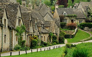
Bibury is a village and civil parish in Gloucestershire, England. It is on the River Coln, a Thames tributary that rises in the same (Cotswold) District. The village centre is 6+1⁄2 miles northeast of Cirencester. Arlington Row is a nationally notable architectural conservation area depicted on the inside cover of some British passports. It is a major destination for tourists visiting the traditional rural villages, tea houses and many historic buildings of the Cotswold District; it is one of six places in the country featured in Mini-Europe, Brussels.

Roose or Roosecote is a suburb and ward of Barrow-in-Furness, Cumbria, England. The word 'roose' is Celtic for "moor" or "heath" and the suffix 'cote' of Roosecote means "hut" or "huts". Before the building of Roose Cottages and the arrival of the Cornish miners Roose was pronounced with a hard S, as in goose; now it is locally pronounced 'Rooze', due to the Cornish accent. Roose is served by Roose railway station, one of the few remaining stations on the Furness Line in the Barrow area.

Morcott is a village and civil parish in the county of Rutland in the East Midlands of England. The population at the 2001 census was 329 falling slightly to 321 at the 2011 census. It is located about 7 miles (11 km) south-east of the county town of Oakham on the A47 and A6121 roads. A prominent reconstructed windmill can be seen from both East and West-bound approaches to Morcott along the A47.
Weston is a village in Tophill on the Isle of Portland, Dorset, England. It abuts the main village Easton. As with the rest of Portland's villages and settlements, Weston has been designated as a conservation area, as it is a place of special architectural and historic interest. The village was designated in 1994.
Wilberforce is a small town in New South Wales, Australia, in the local government area of the City of Hawkesbury. It is just beyond the outer suburbs of north-west Sydney and lies on the western bank of the Hawkesbury River.

Ormesby a village in North Yorkshire, England. Its governance is split between two unitary authorities, to the north Middlesbrough and to the south Redcar and Cleveland, both are part of the devolved Tees Valley area. It is in the Middlesbrough part of the Teesside built up area.

Attenborough is a village in the Borough of Broxtowe in Nottinghamshire, England. It forms part of the Greater Nottingham area and is 4+1⁄2 miles (7.2 km) to the south-west of the city of Nottingham, between Long Eaton and Beeston. It adjoins the suburbs of Toton to the west and Chilwell to the north. The population of the ward, as at the 2011 Census, was 2,328.

Liverton is a village in the civil parish of Loftus, in the borough of Redcar and Cleveland and the ceremonial county of North Yorkshire, England.

Wake Green is a historical area in south Birmingham, England between Moseley, Kings Heath, and Hall Green.

Wolverley is a village; with nearby Cookley, it forms a civil parish in the Wyre Forest District of Worcestershire, England. It is 2 miles north of Kidderminster and lies on the River Stour and the Staffordshire and Worcestershire Canal. At the time of the 2001 census, it had a population of 2,096.

Highlander is situated between the 5th and 6th Milestone road-side markers on the Snaefell Mountain Course used for the Isle of Man TT races on the primary A1 Douglas to Peel road in the parish of Marown in the Isle of Man.

The Winchester Repeating Arms Company Historic District is a historic district in New Haven, Connecticut that was listed on the National Register of Historic Places in 1988. It includes 867 properties, which "include 858 major structures and 131 notable outbuildings." Of these structures, 876 are buildings deemed to contribute to the historical and/or architectural significance of the area, and most of these are residential. However the center of the district is "dominated" by the 75-acre (30 ha) tract of the former Winchester Repeating Arms Company, which contains industrial buildings.

Midhopestones is a village in the civil parish of Bradfield within the Stocksbridge and Upper Don electoral ward in the borough of the City of Sheffield, England.

Up Nately is a small village and former civil parish, now in the parish of Mapledurwell and Up Nately, in the Basingstoke and Deane district, in Hampshire, England, located to the south east of Basingstoke. Its nearest railway station is in Hook, three miles to the east of the village. The Basingstoke Canal runs through the village from the former Penny Bridge in the west, under Brick Kiln Bridge, Slades Bridge and Eastrop Bridge, and, to the east of the village, through the collapsed Greywell Tunnel. In 1931 the parish had a population of 128.
This is a list of Registered Buildings and Conservation Areas of the Isle of Man. It includes buildings and structures in the Isle of Man designated by Isle of Man's Department of Environment, Food and Agriculture (DEFA) "as having special architectural or historical interest". Over 250 buildings and structures are listed, and 275 more have been identified as having potential for listing. It also lists the 21 Conservation Areas, historic districts" which protect "period"-type architecture, quality of building materials, relationships of enclosures and open spaces, and other aspects of the look and feel of historic buildings and areas.

Mechell is a community in the north of the Isle of Anglesey, Wales. Llanfechell is the largest village within the community area. Tregele, Llanfflewyn, Mynydd Mechell, Bodewryd, Rhosbeirio and Carreglefn have a more dispersed settlement pattern. The antiquity of these settlements is shown by the presence of 6 medieval churches and some 16 more ancient sites dating back into prehistory.

The Twin City Historic District in Twin City in Emanuel County, Georgia is a historic district which was listed on the National Register of Historic Places in 2014.

High Orchard was an industrial area of the city of Gloucester in England that was developed in the 19th century on the former orchard of the Priory of Llanthony Secunda (1136). The area was closely associated with Gloucester Docks immediately to the north, and served by the Gloucester and Sharpness Canal and railway transport. It was the site of Fielding & Platt's Atlas Works and a number of other significant local employers.