The University of Fukuoka or Fukuoka University is a private research university located in Fukuoka, on the island of Kyushu, in Japan. The University has nine faculties with a total of around 20,000 students, 800 of whom are foreign. Its two campuses are in Nanakuma and Kitakyushu. Fukuoka University Hospital is one of Japan's top hospitals.

The Fukuoka earthquake struck Fukuoka Prefecture, Japan at 10:53 am JST on March 20, 2005, and lasted for approximately 1 minute. The Japan Meteorological Agency (JMA) measured it as peaking at a magnitude of 7.0 (6.6) and named it and its subsequent aftershocks the Fukuoka Prefecture western offshore earthquakes. The quake occurred along a previously unknown fault in the Genkai Sea, North of Fukuoka city, and the residents of Genkai island were forced to evacuate as houses collapsed and landslides occurred in places. Investigations subsequent to the earthquake determined that the new fault was most likely an extension of the known Kego fault that runs through the centre of the city.
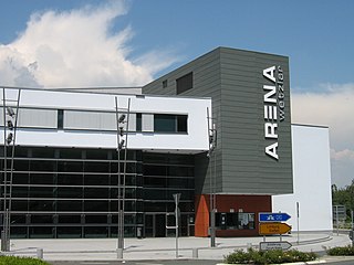
Rittal Arena Wetzlar is an indoor sporting arena located in Wetzlar, Germany. The capacity of the arena is 5,000 people and it was opened in 2005. It is the home to the Handball Bundesliga club HSG Wetzlar. The arena previously carried the name Mittelhessen-Arena until the naming rights to the stadium were sold in March 2006 to the German company Rittal.

HMS Arno was a unique destroyer of the Royal Navy that saw service and was lost during First World War. She was under construction in Genoa, Italy for the friendly Portuguese Navy as Liz in 1914 when she was bought by the Royal Navy for service in the Mediterranean.

Li County or Lixian is a county in Ngawa Tibetan and Qiang Autonomous Prefecture, Sichuan, China. China National Highway G317 and the Zagunao River run through the whole territory.

Yaghdan, is a village in the Lori Province of Armenia. It has a majority of Greeks.
Kłobia Nowa is a village in the administrative district of Gmina Lubraniec, within Włocławek County, Kuyavian-Pomeranian Voivodeship, in north-central Poland.

Sól is a village in the administrative district of Gmina Biłgoraj, within Biłgoraj County, Lublin Voivodeship, in eastern Poland. It lies approximately 8 kilometres (5 mi) south-west of Biłgoraj and 83 km (52 mi) south of the regional capital Lublin.
Charzykowy is a village in the administrative district of Gmina Chojnice, within Chojnice County, Pomeranian Voivodeship, in northern Poland. It lies approximately 5 kilometres (3 mi) north-west of Chojnice and 102 km (63 mi) south-west of the regional capital Gdańsk.
Szatarpy is a village in the administrative district of Gmina Nowa Karczma, within Kościerzyna County, Pomeranian Voivodeship, in northern Poland. It lies approximately 7 kilometres (4 mi) east of Nowa Karczma, 22 km (14 mi) east of Kościerzyna, and 33 km (21 mi) south-west of the regional capital Gdańsk.
Nowotki is a village in the administrative district of Gmina Elbląg, within Elbląg County, Warmian-Masurian Voivodeship, in northern Poland. It lies approximately 20 kilometres (12 mi) north of Elbląg and 95 km (59 mi) north-west of the regional capital Olsztyn.
Łącko is a settlement in the administrative district of Gmina Grunwald, within Ostróda County, Warmian-Masurian Voivodeship, in northern Poland.
Dębce is a village in the administrative district of Gmina Gryfino, within Gryfino County, West Pomeranian Voivodeship, in north-western Poland, close to the German border.

Roja Municipality is a municipality in Courland, Latvia. The municipality was formed in 2009 by merging Mērsrags parish and Roja parish the administrative centre being Roja. Since 2010 a separate Mērsrags municipality has been created.

Ouled Madhi is a town and commune in M'Sila Province, Algeria. According to the 1998 census it has a population of 6,525.

Dobri Do is a village in the municipality of Ivanjica, Serbia. According to the 2011 census, the village has a population of 244 inhabitants.

Aït Mahmoud is a town and commune in Tizi Ouzou Province in northern Algeria.

Kotobuki Station is a railway station on the Fujikyuko Line in Fujiyoshida, Yamanashi, Japan, operated by the private railway operator Fuji Kyuko (Fujikyu).
Kankakee is an unincorporated community in LaPorte County, Indiana, in the United States. It took its name from the Kankakee River.
Glendon is an unincorporated community in Fayette County, in the U.S. state of Ohio.

