
Kennington is a district in South London, England. It is mainly within the London Borough of Lambeth, running along the boundary with the London Borough of Southwark, a boundary which can be discerned from the early medieval period between the Lambeth and St George's parishes of those boroughs respectively. It is located 1.4 miles (2.3 km) south of Charing Cross in Inner London and is identified as a local centre in the London Plan. It was a royal manor in the parish of St Mary, Lambeth in the county of Surrey and was the administrative centre of the parish from 1853. Proximity to central London was key to the development of the area as a residential suburb and it was incorporated into the metropolitan area of London in 1855.

Newington is a district of South London, just south of the River Thames, and part of the London Borough of Southwark. It was an ancient parish and the site of the early administration of the county of Surrey. It was the location of the County of London Sessions House from 1917, in a building now occupied by the Inner London Crown Court.
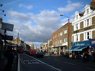
Walworth is a district of south London, England, within the London Borough of Southwark. It adjoins Camberwell to the south and Elephant and Castle to the north, and is 1.9 miles (3.1 km) south-east of Charing Cross.

Lambeth is a district in South London, England, in the London Borough of Lambeth. Lambeth was an ancient parish in the county of Surrey. It is situated 1 mile (1.6 km) south of Charing Cross. The population of the London Borough of Lambeth was 303,086 in 2011. The area experienced some slight growth in the medieval period as part of the manor of Lambeth Palace. By the Victorian era the area had seen significant development as London expanded, with dense industrial, commercial and residential buildings located adjacent to one another. The changes brought by World War II altered much of the fabric of Lambeth. Subsequent development in the late 20th and early 21st centuries has seen an increase in the number of high-rise buildings. The area is home to the International Maritime Organization. Lambeth is home to one of the largest Portuguese-speaking communities in the UK, and Portuguese is the second most commonly spoken language in Lambeth after English.

Lambeth was a civil parish and metropolitan borough in south London, England. It was an ancient parish in the county of Surrey. The parish was included in the area of responsibility of the Metropolitan Board of Works in 1855 and became part of the County of London in 1889. The parish of Lambeth became a metropolitan borough in 1900, following the London Government Act 1899, with the parish vestry replaced by a borough council.
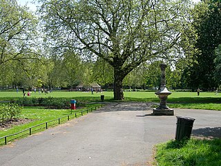
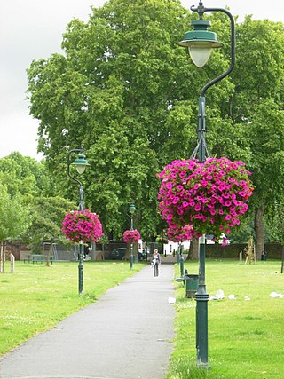
Kennington Park is a public park in Kennington, south London and lies between Kennington Park Road and St. Agnes Place. It was opened in 1854 on the site of what had been Kennington Common, where the Chartists gathered for their biggest "monster rally" on 10 April 1848. Soon after this demonstration the common was enclosed and, sponsored by the royal family, made into a public park.

Lambeth Walk is a street in Lambeth, London, England, off Lambeth Road. It was at the heart of a working-class residential area and there was a street market.

Westminster Bridge Road is a road in London, England. It runs on an east–west axis and passes through the boroughs of Lambeth and Southwark.

Kennington Road is a long straight road, approximately a mile in length, in the London Borough of Lambeth in London, England, running south from Westminster Bridge Road to Kennington Park Road.
West Square is a historic square in south London, England, just south from St George's Road. The square is within the London Borough of Southwark, but as it is located in postcode SE11, it is commonly said to be in Lambeth.
Lorrimore Square is a 1.5-acre (0.6 ha) garden square in the far south-west of Southwark, London, England, centred 500 metres south-east of Kennington tube station. It is divided into four sections, a church with integrated drop-in centre; a small enclosed garden without paths; a public playground/gardens; and a basketball/netball pitch. One side of the square is classical architecture of four storeys, the other two sides — the fourth side marks the end of units on another road — are late 20th century rows of apartments of slightly lower height.

Christchurch was a civil parish in the metropolitan area of London, England. It was located south of the River Thames straddling either side of Blackfriars Road. It originated as the manor of Paris Garden in the parish of St Margaret, Southwark. The parish of St Margaret was replaced by St Saviour in 1541 and then in 1670 the area was split off as a parish in its own right when Christ Church was constructed. It was prone to flooding and was not heavily built upon until after 1809. In 1855 the parish was included in the metropolitan area of London where local government was reformed. The parish was united with St Saviour to form part of the St Saviour's District. When the district was abolished in 1900 the parish became part of the Metropolitan Borough of Southwark. It was abolished as a civil parish in 1930. The area now forms the northwestern part of the London Borough of Southwark.

Vassall ward was an administrative division of the London Borough of Lambeth, United Kingdom, from 1965 to 2022. It was located in the north of borough bordering Southwark, in the SW9 and SE5 postcode area. The ward was named after Henry Vassall-Fox, 3rd Baron Holland who was responsible for the first building development in the area in the 1820s.
Geraldine Mary Harmsworth Park is a public park in Kennington, South London. Maintained by the London Borough of Southwark, it is bounded by Lambeth Road, Kennington Road, St George's Road and Brook Drive. It covers an area of 5.9 hectares. The grounds of the park surround its central feature, the Imperial War Museum London.
St Matthew's Church is a Church of England church in the London Borough of Lambeth. It is a Grade II* listed building which occupies a prominent position at the junction of Brixton Road, Brixton Hill and Effra Road. The church was constructed following the Church Building Act 1818 and was consecrated in 1824.

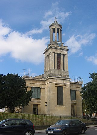
St Anselm's Church is a Grade II listed church at 286 Kennington Road, Kennington, London SE11, built in 1932–33 by Stanley Davenport Adshead and Stanley Churchill Ramsey, on the foundations of an earlier church whose building was interrupted by the First World War; the present church is famously described as "barn-like".

The Brandon Estate is a social housing estate in Walworth, London Borough of Southwark, south London. Situated to the south of Kennington Park, it was built in 1958 by the London County Council, to designs by Edward Hollamby and Roger Westman.
This is a list of the etymology of street names in the London districts of Kennington and Lambeth. The areas have no formally defined boundaries – those utilised here are Westminster Bridge Road/St George's Circus/London Road to the north, Newington Butts/Kennington Park Road to the east, Kennington Road and Black Prince Road to the south and the river Thames to the west.

Walcot Square is an 18th century garden triangle in Central London. The "square" is in the London Borough of Lambeth and has a very rare triangular shape. Since 1968 in planning policy it is a Conservation Area. Three rows of houses front its communal green, granted Grade II listed status under the statutory protective and recognition scheme in 1981.

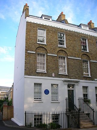
Cleaver Square is an 18th-century garden square in the London Borough of Lambeth, dating from 1789. It is notable for having been the first garden square in South London.
