
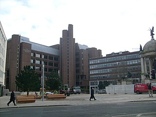
St Paul's Square is a square in Liverpool City Centre and is bordered by Old Hall Street, East Street and Rigby Street

St Paul's Square is a square in Liverpool City Centre and is bordered by Old Hall Street, East Street and Rigby Street
The square takes its name from St. Paul's Church, which originally stood on the site. [1] Designed by Timothy Lightholer and built around 1709, it was designed as a miniature imitation of St Paul's, London. [2]
The church served what would have been an affluent area of the city. Towards the end of the 17th century Old Hall Street and St Paul's Square were fashionable areas for the merchants of the city and residencies were built on Old Hall Street during this period, stretching up towards St Paul's Square. [3]
As the city of Liverpool grew with the rapid expansion of the port, the area became heavily populated and many of the Georgian Terraces were converted into multi-occupancy residences. [4] The east-side of the square was demolished in the late 1840s to make way for the construction of Liverpool Exchange railway station. By the 19th century, the church found itself with dwindling congregations and it was closed in 1901, before being demolished in 1931.
St. Paul's Eye and Ear Infirmary was originally on Old Hall Street in 1871 but moved to 6, St. Paul's Square. [5] The hospital stayed there, except during World War 2 when it was moved to Childwall, until 1992 when it was moved to Royal Liverpool Hospital.
The square was the site of a 3,700 capacity boxing arena, known as Liverpool Stadium, which was the first of its kind in Great Britain. [6] Built on the site of the former graveyard of St Paul's Church, the venue opened on 20 October 1932. In addition to boxing, the venue hosted concerts by The Beatles, David Bowie, and Lou Reed as well as the 1951 Conservate Party Conference. The venue closed in 1985 and was demolished two years' later.
Today, the square is part of Liverpool's central business district and is the home to offices for some of the city's legal and financial firms. [7]

Madison Square Garden, colloquially known as the Garden or by its initials MSG, is a multi-purpose indoor arena in New York City. It is located in Midtown Manhattan between Seventh and Eighth Avenues from 31st to 33rd Street above Pennsylvania Station. It is the fourth venue to bear the name "Madison Square Garden"; the first two, opened in 1879 and 1890 respectively, were located on Madison Square, on East 26th Street and Madison Avenue, with the third Madison Square Garden (1925) farther uptown at Eighth Avenue and 50th Street.

Birkenhead is a town in the Metropolitan Borough of Wirral, Merseyside, England; It was part of Cheshire until 1974. The town is on the Wirral Peninsula, along the west bank of the River Mersey, opposite Liverpool. At the 2011 census, it had a population of 88,818.
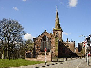
Prescot is a town and civil parish within the Metropolitan Borough of Knowsley in Merseyside, United Kingdom. It lies about eight miles (13 km) to the east of Liverpool city centre. At the 2001 Census, the civil parish population was 11,184. The population of the larger Prescot East and West wards at the 2011 census totalled 14,139. Prescot marks the beginning of the A58 road which runs through to Wetherby, near Leeds in West Yorkshire. The town is served by Prescot railway station and Eccleston Park railway station in neighbouring Eccleston.

Rainhill is a village and civil parish in the Metropolitan Borough of St Helens, Merseyside, England. The population at the 2011 census was 10,853.

The Strand is a major street in the City of Westminster, Central London. The street, which is part of London's West End theatreland, runs just over 3⁄4 mile (1.2 km) from Trafalgar Square eastwards to Temple Bar, where it becomes Fleet Street in the City of London, and is part of the A4, a main road running west from inner London.

Toxteth is an inner-city area of Liverpool in the county of Merseyside.
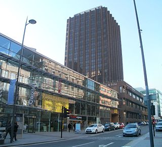
The Liverpool Echo is a newspaper published by Trinity Mirror North West & North Wales – a subsidiary company of Reach plc and is based in St. Paul's Square, Liverpool, England. It is published Monday through Sunday, and is Liverpool's daily newspaper. Until January 13, 2012, it had a sister morning paper, the Liverpool Daily Post. Between July and December 2022, it had an average daily circulation of 15,395.

Walton is an area of Liverpool, England, north of Anfield and east of Bootle and Orrell Park. Historically in Lancashire, it is largely residential, with a diverse population.

Liverpool Road is a street in Islington, North London. It covers a distance of 1+1⁄4 miles (2.0 km) between Islington High Street and Holloway Road, running roughly parallel to Upper Street through the area of Barnsbury. It contains several attractive terraces of Georgian houses and Victorian villas, many of which are listed buildings. There are a number of pubs, small businesses and restaurants along its route, as well as some secluded garden squares. The vast majority of the street is residential, with a bustling shopping and business area at the southern, Angel, end.

As with other cities in Ireland, Limerick has a history of great architecture. A 1574 document, prepared for the Spanish ambassador, describes some of the wealth and architecture in the city:

Nottingham city centre is the cultural, commercial, financial and historical heart of Nottingham, England, and represents the central area of the Greater Nottingham conurbation.
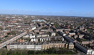
The Georgian Quarter is an area on the eastern edge of Liverpool city centre, England, characterised by almost entirely residential Georgian architecture. Parts of the district are also included in Liverpool's Knowledge Quarter. It borders the rest of the Knowledge Quarter to the north, the district of Toxteth to the south, Edge Hill to the east and Ropewalks, Chinatown and the Baltic Triangle to the west. The name 'Canning' comes from one of its principal thoroughfares, Canning Street, which is named after George Canning, (1770–1827), a British politician who served as Foreign Secretary and, briefly, Prime Minister.

Liverpool Stadium was a 3,700 capacity boxing arena on St Paul's Square, Bixteth Street, Liverpool, England. It was the UK's first purpose built boxing arena. The foundation stone was laid by the Earl of Lonsdale on 22 July 1932, and it was opened to the public on 20 October 1932 by Liverpool's Lord Mayor. The facade was finished in faience tiling with Art Deco detail, as were the lobby, corridors and public areas inside. The arena itself was wood panelled. The architect was Kenmure Kinna.

Liverpool Arena, known for sponsorship reasons as the M&S Bank Arena and previously the Echo Arena, is a multi-purpose indoor arena in the city centre of Liverpool, England. The venue hosts live music, comedy performances and sporting events, and forms part of Liverpool event campus ACC Liverpool – an interconnected arena, exhibition and convention centre. The venue serves a regional population of 2.5 million people and over 6.6 million across England's North West.

The architecture of Liverpool is rooted in the city's development into a major port of the British Empire. It encompasses a variety of architectural styles of the past 300 years, while next to nothing remains of its medieval structures which would have dated back as far as the 13th century. Erected 1716–18, Bluecoat Chambers is supposed to be the oldest surviving building in central Liverpool.
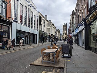
Ropewalks is a district of Liverpool city centre bounded by Hanover Street to the north-west, Lydia Ann Street to the west, Roscoe Street to the east and Back Bold Street to north-east.
The following is a timeline of the history of the city of Liverpool, England.

Old Hall Street is a road in Liverpool, England. Situated in the city centre, it runs between Leeds Street and Chapel Street and is part of Liverpool business district.
Derby Square is in the city centre of Liverpool, England.