Stone, Montana

Last updated
Stone
Country United States
State Montana
County Granite

Stone is an unincorporated community in Granite County, Montana located 11.9 miles south of Drummond and 12.43 mi north of Phillipsburg on the Pintler Veterans Memorial Scenic Highway. Stone is serviced by the post office in Hall.

Unincorporated area Region of land not governed by own local government

In law, an unincorporated area is a region of land that is not governed by a local municipal corporation; similarly an unincorporated community is a settlement that is not governed by its own local municipal corporation, but rather is administered as part of larger administrative divisions, such as a township, parish, borough, county, city, canton, state, province or country. Occasionally, municipalities dissolve or disincorporate, which may happen if they become fiscally insolvent, and services become the responsibility of a higher administration. Widespread unincorporated communities and areas are a distinguishing feature of the United States and Canada. In most other countries of the world, there are either no unincorporated areas at all, or these are very rare; typically remote, outlying, sparsely populated or uninhabited areas.

Granite County, Montana County in the United States

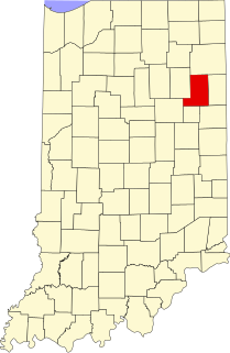
Granite County is a county located in the U.S. state of Montana. As of the 2010 United States Census, the population was 3,079. Its county seat is Philipsburg. The county was founded in 1893, and was named for a mountain which contains the Granite Mountain silver mine.

Montana State of the United States of America

Montana is a state in the Northwestern United States. Montana has several nicknames, although none are official, including "Big Sky Country" and "The Treasure State", and slogans that include "Land of the Shining Mountains" and more recently "The Last Best Place".

Resources

  1. Stone on Google Maps

Coordinates: 46°30′19″N113°13′34″W / 46.50528°N 113.22611°W / 46.50528; -113.22611

Geographic coordinate system Coordinate system

A geographic coordinate system is a coordinate system that enables every location on Earth to be specified by a set of numbers, letters or symbols. The coordinates are often chosen such that one of the numbers represents a vertical position and two or three of the numbers represent a horizontal position; alternatively, a geographic position may be expressed in a combined three-dimensional Cartesian vector. A common choice of coordinates is latitude, longitude and elevation. To specify a location on a plane requires a map projection.

Related Research Articles

Knapp is a town in Jackson County, Wisconsin, in the United States. As of the 2000 census, the town population was 275. The unincorporated community of Lapham Junction is located in the town.

Khasbag Stadium is a national wrestling stadium in Kolhapur city. This is a biggest Wrestling Stadium in India. The stadium was built in the time of Rajarshi Shahu Maharaj and is almost a hundred year old stadium. And this is heritage site also.

Nanjō is a district located in Fukui, Japan.

Peel Park is an area of the East Kilbride in South Lanarkshire, Scotland. It is a business park, and home to the following companies:

WXOK Radio station in Port Allen, Louisiana

WXOK is a Black Gospel formatted radio station licensed to Port Allen, Louisiana. The Cumulus Media station broadcasts with a transmitter power of 4,700 watts day and 290 watts night. Its studios are located in downtown Baton Rouge, Louisiana.

Lake Lashaway lake of the United States of America

Lake Lashaway is a 293-acre (1.19 km2) pond located near the East Brookfield and North Brookfield, Massachusetts town line. The town line cuts the lake approximately in half. The lake lies just to the north of state Route 9 as it passes through East Brookfield.

East Brookfield River river in the United States of America

The East Brookfield River is a 2.4-mile-long (3.9 km) river in Massachusetts that heads at Lake Lashaway in East Brookfield at an elevation of 614 feet (187 m) above sea level. It continues to Quaboag Pond, at an elevation of 594 feet (181 m).

Cabot Square one of the central squares of the Canary Wharf Development on the Isle of Dogs

Cabot Square is one of the central squares of the Canary Wharf Development on the Isle of Dogs.

Wallville is an unincorporated community located along MD 265 in Calvert County, Maryland, United States. The Patterson's Archeological District was listed on the National Register of Historic Places in 1982.

The Net River is a 14.9-mile-long (24.0 km) river in Michigan in the United States. Its headwaters rise in Baraga County and flow southwest into Iron County, where the main stem forms and flows to the Paint River above Crystal Falls.

Dornblaser Field

Dornblaser Field is the name of two outdoor athletic stadiums in the western United States, located in Missoula, Montana. Both were former home fields of the University of Montana Grizzlies football teams and were named for Paul Dornblaser, a captain of the football team in 1912 who was killed in World War I. Both stadiums had conventional north-south orientations at an approximate elevation of 3,200 feet (980 m) above sea level.

Kragmont is an unincorporated community in Richmond County, in the U.S. state of Virginia.

Harcum is an unincorporated community in Gloucester County, in the U. S. state of Virginia.

Hue is an unincorporated community in Swan Township, Vinton County, Ohio, in the United States.

Perth is an unincorporated community in Sumner County, Kansas, United States.

Greenville, Wells County, Indiana Unincorporated community in Indiana, United States

Greenville is an unincorporated community in Chester Township, Wells County, in the U.S. state of Indiana.

Cincinnati, Parke County, Indiana Unincorporated community in Indiana, United States

Cincinnati is an unincorporated community in Washington Township, Parke County, in the U.S. state of Indiana.

Tülomsaş Museum is a transport technology museum in Eskişehir, Turkey.