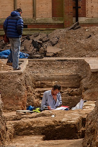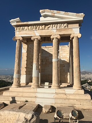
In archaeology, excavation is the exposure, processing and recording of archaeological remains. An excavation site or "dig" is the area being studied. These locations range from one to several areas at a time during a project and can be conducted over a few weeks to several years.

An archaeological site is a place in which evidence of past activity is preserved, and which has been, or may be, investigated using the discipline of archaeology and represents a part of the archaeological record. Sites may range from those with few or no remains visible above ground, to buildings and other structures still in use.

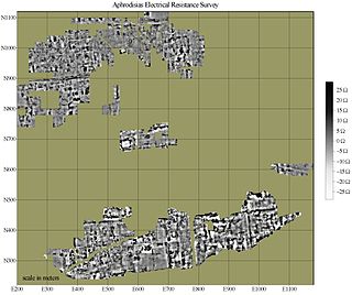
In archaeology, geophysical survey is ground-based physical sensing techniques used for archaeological imaging or mapping. Remote sensing and marine surveys are also used in archaeology, but are generally considered separate disciplines. Other terms, such as "geophysical prospection" and "archaeological geophysics" are generally synonymous.

Paleoethnobotany, or archaeobotany, is the study of past human-plant interactions through the recovery and analysis of ancient plant remains. Both terms are synonymous, though paleoethnobotany is generally used in North America and acknowledges the contribution that ethnographic studies have made towards our current understanding of ancient plant exploitation practices, while the term archaeobotany is preferred in Europe and emphasizes the discipline's role within archaeology.
Planning Policy Guidance 16: Archaeology and Planning commonly abbreviated as PPG 16, was a document produced by the UK Government to advise local planning authorities in England and Wales on the treatment of archaeology within the planning process. It was introduced in November 1990 following public outcry after a number of high-profile scandals such as the threatened destruction of the Rose Theatre in London by developers. It replaced the earlier Circular 8/87 which was criticized for being ill-focused in both practical and geographical terms. On 23 March 2010 the Government published 'Planning Policy Statement 5:Planning and the Historic Environment' replacing and cancelling PPG16 and PPG15 which had dealt with the rest of the historic environment.

Trial trenching is a rapid and relatively inexpensive method of archaeological evaluation used to estimate the archaeological potential of a site.
In British archaeology a watching brief is a method of preserving archaeological remains by record in the face of development threat. An archaeologist is employed by the developer to monitor the excavation of foundation and service trenches, landscaping and any other intrusive work the developer undertakes to give the archaeologist sufficient time to identify and record any archaeological finds and features; however, the arrangement is rarely satisfactory for either party.

Urban archaeology is a sub discipline of archaeology specializing in the material past of towns and cities where long-term human habitation has often left a rich record of the past. In modern times, when someone talks about living in a city, they are in an area with many surrounding people and buildings, generally quite tall ones. In archaeological terms, cities give great information because of the infrastructure they have and amounts of people that were around one another. Through the years there has been one big method used for urban archaeology along with significant historic developments.
Archaeological science consists of the application of scientific techniques to the analysis of archaeological materials and sites. It is related to methodologies of archaeology. Martinón-Torres and Killick distinguish ‘scientific archaeology’ from ‘archaeological science’. Martinón-Torres and Killick claim that ‘archaeological science’ has promoted the development of high-level theory in archaeology. However, Smith rejects both concepts of archaeological science because neither emphasize falsification or a search for causality.

Environmental archaeology is a sub-field of archaeology which emerged in 1970s and is the science of reconstructing the relationships between past societies and the environments they lived in. The field represents an archaeological-palaeoecological approach to studying the palaeoenvironment through the methods of human palaeoecology and other geosciences. Reconstructing past environments and past peoples' relationships and interactions with the landscapes they inhabited provide archaeologists with insights into the origins and evolution of anthropogenic environments and human systems. This includes subjects such as including prehistoric lifestyle adaptations to change and economic practices.

In archaeology, survey or field survey is a type of field research by which archaeologists search for archaeological sites and collect information about the location, distribution and organization of past human cultures across a large area. Archaeologists conduct surveys to search for particular archaeological sites or kinds of sites, to detect patterns in the distribution of material culture over regions, to make generalizations or test hypotheses about past cultures, and to assess the risks that development projects will have adverse impacts on archaeological heritage.
The archaeological record is the body of physical evidence about the past. It is one of the core concepts in archaeology, the academic discipline concerned with documenting and interpreting the archaeological record. Archaeological theory is used to interpret the archaeological record for a better understanding of human cultures. The archaeological record can consist of the earliest ancient findings as well as contemporary artifacts. Human activity has had a large impact on the archaeological record. Destructive human processes, such as agriculture and land development, may damage or destroy potential archaeological sites. Other threats to the archaeological record include natural phenomena and scavenging. Archaeology can be a destructive science for the finite resources of the archaeological record are lost to excavation. Therefore, archaeologists limit the amount of excavation that they do at each site and keep meticulous records of what is found. The archaeological record is the physical record of human prehistory and history, of why ancient civilizations prospered or failed and why those cultures changed and grew. It is the story of the human world.
Post-excavation analysis constitutes processes that are used to study archaeological materials after an excavation is completed. Since the advent of "New Archaeology" in the 1960s, the use of scientific techniques in archaeology has grown in importance. This trend is directly reflected in the increasing application of the scientific method to post-excavation analysis. The first step in post-excavation analysis should be to determine what one is trying to find out and what techniques can be used to provide answers. Techniques chosen will ultimately depend on what type of artifact(s) one wishes to study. This article outlines processes for analyzing different artifact classes and describes popular techniques used to analyze each class of artifact. Keep in mind that archaeologists frequently alter or add techniques in the process of analysis as observations can alter original research questions.

Angkor Borei is a district located in Takéo Province, in southern Cambodia. According to the 1998 census of Cambodia, it had a population of 44,980.

In archaeology, a biofact is any organic material including flora or fauna material found at an archaeological site that has not been technologically altered by humans yet still has cultural relevance. Biofacts can include but are not limited to plants, seeds, pollen, animal bones, insects, fish bones and mollusks. The study of biofacts, alongside other archaeological remains such as artifacts are a key element to understanding how past societies interacted with their surrounding environment and with each other. Biofacts also play a role in helping archaeologists understand questions of subsistence and reveals information about the domestication of certain plant species and animals which demonstrates, for example, the transition from a hunter-gatherer society to a farming society.

Archaeology or archeology is the study of human activity through the recovery and analysis of material culture. The archaeological record consists of artifacts, architecture, biofacts or ecofacts, sites, and cultural landscapes. Archaeology can be considered both a social science and a branch of the humanities. It is usually considered an independent academic discipline, but may also be classified as part of anthropology, history or geography.
William Salthouse was the first merchant vessel to sail with a cargo of merchandise from the British Dominion of Canada to British Colonies of Australia. The ship was lost on 28 November 1841 while attempting to enter Port Phillip Heads en route to Melbourne Harbor. The wreck of William Salthouse has been the site of several maritime archaeological investigations as well as experimental in situ conservation efforts.

The conservation and restoration of archaeological sites is the collaborative effort between archaeologists, conservators, and visitors to preserve an archaeological site, and if deemed appropriate, to restore it to its previous state. Considerations about aesthetic, historic, scientific, religious, symbolic, educational, economic, and ecological values all need to be assessed prior to deciding the methods of conservation or needs for restoration. The process of archaeology is essentially destructive, as excavation permanently changes the nature and context of the site and the associated information. Therefore, archaeologists and conservators have an ethical responsibility to care for and conserve the sites they put at risk.

Munsa is an archaeological site in Uganda, located in the south-eastern part of Bunyoro, and is commonly recognized by a rocky hill known by the locals as "Bikegete", which is enclosed within an earthworks system of ancient ditches. The site is approximately 5 kilometres (3.1 mi) north-west of Kakumiro township in Bugangaizi County, Kakumiro District. "Munsa" is a Runyoro(Lunyoro/Runyoro Edited by Nicholas Aliganyira Nkuuna) name that means "in the trenches". The architects of the earthworks are unknown, although it has been speculated that the site can be linked to the Bachwezi. There is no evidence for this, however, and it seems likely that association of Munsa with the Bachwezi or Chwezi is a recent development.
This page is a glossary of archaeology, the study of the human past from material remains.


