Related Research Articles

Hydrology is the scientific study of the movement, distribution and management of water on Earth and other planets, including the water cycle, water resources and environmental watershed sustainability. A practitioner of hydrology is called a "hydrologic engineer", working within the fields of civil and environmental engineering. Hydrologists can also be scientists studying earth or environmental science and physical geography. Using various analytical methods and scientific techniques, they collect and analyze data to help solve water related problems such as environmental preservation, natural disasters, and water management.

An aquifer is an underground layer of water-bearing permeable rock, rock fractures or unconsolidated materials. Groundwater can be extracted using a water well. The study of water flow in aquifers and the characterization of aquifers is called hydrogeology. Related terms include aquitard, which is a bed of low permeability along an aquifer, and aquiclude, which is a solid, impermeable area underlying or overlying an aquifer. If the impermeable area overlies the aquifer, pressure could cause it to become a confined aquifer.

Groundwater is the water present beneath Earth's surface in soil pore spaces and in the fractures of rock formations. A unit of rock or an unconsolidated deposit is called an aquifer when it can yield a usable quantity of water. The depth at which soil pore spaces or fractures and voids in rock become completely saturated with water is called the water table. Groundwater is recharged from the surface; it may discharge from the surface naturally at springs and seeps, and can form oases or wetlands. Groundwater is also often withdrawn for agricultural, municipal, and industrial use by constructing and operating extraction wells. The study of the distribution and movement of groundwater is hydrogeology, also called groundwater hydrology.
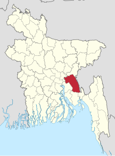
Comilla District, officially known as Cumilla District It is a district of Bangladesh located about 100 kilometres south east of Dhaka. Comilla is bordered by Brahmanbaria and Narayanganj districts to the north, Noakhali and Feni districts to the south, Tripura of India to the east and Munshiganj and Chandpur districts to the west. Comilla district is located in the south eastern part of Bangladesh.

Fālgun or Phālgun is the eleventh month in the Bengali calendar and Nepali calendar. This month is named after the star Uttorfalguni. It marks the arrival of spring, the sixth and final season in Bangladesh, Nepāl and Assam. The first of Falgun usually falls on 13 February of the Gregorian Calendar.

The Bangladesh Army is the land forces branch and the largest of the three defence service of the Bangladesh Armed Forces. The primary mission of the Army is to provide necessary forces and capabilities in support of Bangladesh's security and defence strategies including defence of the nation's territorial integrity against external attack. Control and operations are administered by the Department of the Army of the Armed Forces Division. In addition to its primary mission the Bangladesh Army is also constitutionally obligated to assist the civilian government during times of national emergency. This role is commonly referred to as "aid to civil administration".
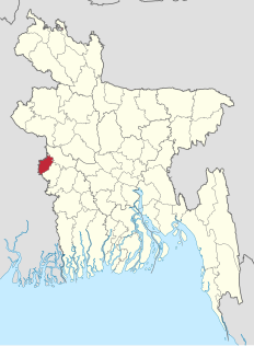
Meherpur is a district in South-western Bangladesh.

Surface runoff is the flow of water that occurs when excess stormwater, meltwater, or other sources flow over the Earth's surface. This can occur when the soil is saturated to full capacity, and rain arrives more quickly than soil can absorb it. Surface runoff often occurs because impervious areas do not allow water to soak into the ground. Surface runoff is a major component of the water cycle. It is the primary agent of soil erosion by water. The land area producing runoff that drains to a common point is called a drainage basin.
Sustainable landscape architecture is a category of sustainable design concerned with the planning and design of outdoor space.
Jat Area is a term of Jute cultivation that indicates the inner North-Eastern part of Bangladesh. This geographical area comprises part of the districts of Dhaka, Mymensingh, Tangail, and Comilla of Bangladesh. The area annually receives fresh deposit of silts carried down by the flood water. Soils are acidic, the texture varies from sand loam to clay loam. According to commercial quality, the best quality Jute, the Jat type, grows in this area. Due to high quality jute in the world, Adamjee Jute Mills was established in this region at Narayanganj. Later, the mill became the largest jute mill in the world. However, the mill closed its doors in 2002.

Bangladesh for Rural Development (EPARD) is an autonomous institution that strives for research and training of local people as well as practitioners on rural development. The academy is known for implementing the Comilla Model in the 1960s that has been internationally recognised as a model project for rural development in the developing countries.

In 1971 the Pakistan Army and their local collaborators, most notably the extreme right wing Islamist militia group Al-Badr, engaged in the systematic execution of Bengali pro-liberation intellectuals during the Bangladesh Liberation War of 1971, a war crime. Intellectuals were killed throughout the entire duration of the war. The largest number of executions took place on 25 March and 14 December 1971, as it became apparent that Bangladesh would become independent. 14 December is commemorated in Bangladesh as Martyred Intellectuals Day.

Bhairab River is a river in south-western Bangladesh, a distributary of the Ganges. It passes through Khulna, dividing the city into two parts. Bhairab River originates from Tengamari border of Meherpur District and passes through Jessore city. The river is approximately 160 kilometres (100 mi) long and 91 metres (300 ft) wide. Its average depth is 1.2 to 1.5 metres and with minimal water flow, it has plenty of silt.
Bangladesh Meteorological Department (BMD) also known as Abohawa Office is the national meteorological organization of Bangladesh, working under Ministry of Defense of the Government of Bangladesh. It is responsible for maintaining the network of surface and upper air observatories, radar and satellite stations, agrometeorological observatories, geomagnetic and seismological observatories and meteorological telecommunication system of Bangladesh.
Bangladesh Fisheries Research Institute is an autonomous government research institution for fisheries and related research. The present Director General of the institution is Yahia Mahmud.
Bangladesh Water Development Board is government agency which is responsible for surface water and groundwater management in Bangladesh and is located in Dhaka. Md Mahfuzur Rahman is the present Director General of the board.
Bangladesh Agricultural Development Corporation or BADC, is an autonomous government body that manages the agricultural Inputs Supplier i.e. agricultural seeds, non-nitrogen fertilizer and Minor Irrigation facilitating to farmers of Bangladesh and is located in Motijheel Thana, Dhaka, Bangladesh.
River Research Institute or BPI is an autonomous national research institute working as a statutory organization that carries out research and plans water resource management projects in Bangladesh and is located in Faridpur, Bangladesh.
Bangladesh Institute of Peace Support Operation Training or BIPSOT is a military owned and operated institution that trains Bangladesh military and police personnel on peacekeeping in UN missions. It is located in Rajendrapur Cantonment, Gazipur, Bangladesh. It also trains military personnel of friendly nations.
Institute of Water Modeling or IWM, is a government owned-national research institute and think tank that carries out research, planning and technology transfer related to water management projects in Bangladesh and is located in Dhaka, Bangladesh.
References
- ↑ "Institute of Water Modelling". iwmbd.org. Retrieved 21 November 2016.
- ↑ "Surface Water Modelling Centre - Banglapedia". en.banglapedia.org. Retrieved 4 December 2017.
| This article about a Bangladeshi organisation is a stub. You can help Wikipedia by expanding it. |