
The Herzegovina-Neretva Canton is one of 10 cantons of the Federation of Bosnia and Herzegovina in Bosnia and Herzegovina.
The Sarajevo Canton, officially the Canton of Sarajevo is one of 10 cantons of the Federation of Bosnia and Herzegovina in Bosnia and Herzegovina. Its cantonal capital is Sarajevo, also the capital city of Bosnia and Herzegovina.

Živinice is a town and municipality located in Tuzla Canton of the Federation of Bosnia and Herzegovina, an entity of Bosnia and Herzegovina. It is located in northeastern Bosnia and Herzegovina, south of Tuzla. As of 2013, it has a population of 57,765 inhabitants.

The SAO of Bosanska Krajina was a self-proclaimed Serbian Autonomous Oblast within today's Bosnia and Herzegovina. It was sometimes called the Autonomous Oblast of Krajina, or the Autonomous Region of Krajina (ARK). SAO Bosanska Krajina was located in the geographical region named Bosanska Krajina. Its capital was Banja Luka. The region was subsequently included into Republika Srpska.
The SAO of Herzegovina was a self-proclaimed Serbian Autonomous Oblast within today's Bosnia and Herzegovina. It was proclaimed by the Assembly of the Association of Municipalities of Bosnian Krajina in 1991 and was subsequently included into Republika Srpska. SAO Herzegovina was located in the geographical region of Herzegovina. It was also known as SAO Eastern Herzegovina.

Novi Travnik is a town and municipality located in Central Bosnia Canton of the Federation of Bosnia and Herzegovina, an entity of Bosnia and Herzegovina. As of 2013, it has a population of 25,107 inhabitants.

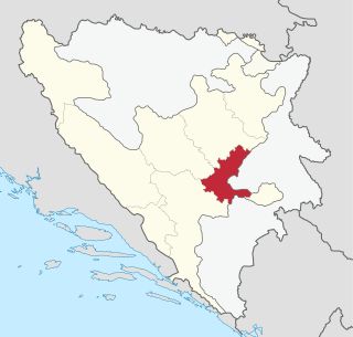
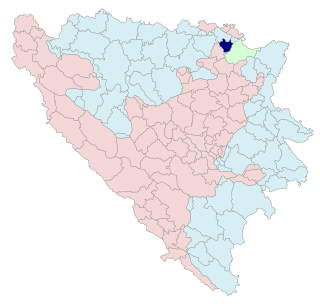
Teočak is a town and municipality located in Tuzla Canton of the Federation of Bosnia and Herzegovina, an entity of Bosnia and Herzegovina.

This article is about the Demographic history of Bosnia and Herzegovina, and deals with the country's documented demographics over time. For an overview of the various ethnic groups and their historical development, see Ethnic groups in Bosnia and Herzegovina.

Čajniče is a town and municipality located in Republika Srpska, an entity of Bosnia and Herzegovina. As of 2013, the town has a population of 2,401 inhabitants, while the municipality has 4,895 inhabitants.

Donji Žabar is a village and municipality located in Republika Srpska, an entity of Bosnia and Herzegovina. As of 2013, it has a population of 3,809 inhabitants.

Kostajnica, is a town and municipality located in northern Republika Srpska, an entity of Bosnia and Herzegovina. It is situated in the part of the Кrajina region. As of 2013, it has a population of 5,977 inhabitants.

Maglaj is a town and municipality located in Zenica-Doboj Canton of the Federation of Bosnia and Herzegovina, an entity of Bosnia and Herzegovina. It is located in northern Bosnia and Herzegovina, 25 km (16 mi) south of Doboj. It has a population of 24,980 inhabitants.
Pelagićevo is a town and municipality located in Republika Srpska, an entity of Bosnia and Herzegovina. It is located in the Posavina geographical region. As of 2013, the town has a population of 2,796 inhabitants, while the municipality has 5,220 inhabitants.
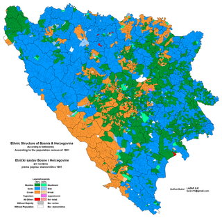
The 1991 population census in Bosnia and Herzegovina was the last census of the population undertaken in the Socialist Republic of Bosnia and Herzegovina before the Bosnian War. It was conducted during the final week of March 1991. For the 1991 census there were 109 municipalities of which ten were part of Sarajevo.

Herzegovina is the southern region of Bosnia and Herzegovina. While there is no official border distinguishing it from the Bosnian geographical region, it is sometimes asserted that the borders of the region are Dalmatia to the southwest, Montenegro to the east, Mount Maglić to the northeast, and Mount Ivan to the north. Measurements of the area range from 11,419 km2 (4,409 sq mi), or around 22% of the total area of the present-day country, to 12,276 km2 (4,740 sq mi), around 24% of the country.
Donja Jagodina is a village in the municipality of Višegrad, Bosnia and Herzegovina.
Donji Dobrun is a village in the municipality of Višegrad, Bosnia and Herzegovina.
Dragomilje is a village in the municipality of Višegrad, Bosnia and Herzegovina.
Orahovci is a village in the municipality of Višegrad, Bosnia and Herzegovina.
Smriječje is a village in the municipality of Višegrad, Bosnia and Herzegovina.


