Sycamore Canyon may refer to:

Yavapai County is near the center of the U.S. state of Arizona. As of the 2020 census, its population was 236,209, making it the fourth-most populous county in Arizona. The county seat is Prescott.
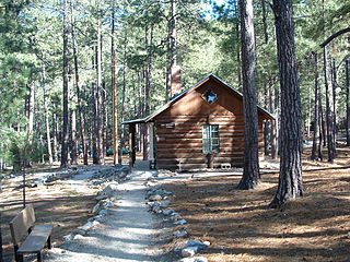
Scouting in Arizona has a long history, from the 1910s to the present day, serving thousands of youth in programs that suit the environment in which they live.
Eagle's Nest, The Eagle's Nest, Eagle Nest, Eagles Nest or Eaglenest may refer to a bird nest for eagles.
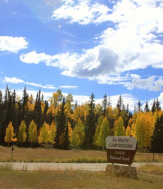
Kaibab National Forest borders both the north and south rims of the Grand Canyon, in north-central Arizona. Its 1.6 million acres is divided into three sections: the North Kaibab Ranger District, the Tusayan Ranger District, and the Williams Ranger District. It is managed by the United States Forest Service. Grand Canyon National Park separates the North Kaibab and the South Kaibab. The South Kaibab covers 1,422 square miles (3,680 km2) and the North Kaibab stretches over 1,010 square miles (2,600 km2). Elevations vary on the forest from 5,500 feet in the southwest corner to 10,418 feet at the summit of Kendrick Peak on the Williams Ranger District. The forest as a whole is headquartered in Williams.
Clear Creek may refer to:

The Coconino National Forest is a 1.856-million acre United States National Forest located in northern Arizona in the vicinity of Flagstaff, with elevations ranging from 2,600 feet to the highest point in Arizona at 12,633 feet. Originally established in 1898 as the "San Francisco Mountains National Forest Reserve", the area was designated a U.S. National Forest by Pres. Theodore Roosevelt on July 2, 1908, when the San Francisco Mountains National Forest Reserve was merged with lands from other surrounding forest reserves to create the Coconino National Forest. Today, the Coconino National Forest contains diverse landscapes, including deserts, ponderosa pine forests, flatlands, mesas, alpine tundra, and ancient volcanic peaks. The forest surrounds the towns of Sedona and Flagstaff and borders four other national forests; the Kaibab National Forest to the west and northwest, the Prescott National Forest to the southwest, the Tonto National Forest to the south, and the Apache-Sitgreaves National Forest to the southeast. The forest contains all or parts of nine designated wilderness areas, including the Kachina Peaks Wilderness, which includes the summit of the San Francisco Peaks. The headquarters are in Flagstaff. The Coconino National Forest consists of three districts: Flagstaff Ranger District, Mogollon Rim Ranger District, and Red Rock Ranger District, which have local ranger district offices in Flagstaff, Happy Jack, and Sedona.
Devil's Canyon may refer to:
Red Rock Canyon may refer to:
Rattlesnake Canyon is the name of a number of scenic canyons in the Southwestern United States:

Point Mugu State Park is a state park located in the Santa Monica Mountains National Recreation Area in Southern California. The rugged, nearly impassible shoreline of the western Santa Monica Mountains gives way to tidal lagoons and coastal sand dunes at Mugu Rock. The western edge of the park adjoins Mugu Lagoon which is a protected area within Naval Air Station Point Mugu.
Sycamore is the common name for several different species of trees.

Sycamore Canyon is the second largest canyon in the Arizona redrock country, after Oak Creek Canyon. The 21-mile (34 km) long scenic canyon reaches a maximum width of about 7 miles (11 km). It is in North Central Arizona bordering and below the Mogollon Rim, and is located west and northwest of Sedona in Yavapai and Coconino counties.
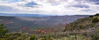
Sycamore Canyon Wilderness is a 56,000-acre wilderness area in the Coconino, Kaibab and Prescott national forests in the U.S. state of Arizona. Encompassing Sycamore Canyon and its surrounds from south of Williams to the confluence of Sycamore Creek with the Verde River, the wilderness is about 40 miles (64 km) southwest of Flagstaff. The canyon is one of several in Arizona that cut through the Mogollon Rim. Relevant United States Geological Survey (USGS) map quadrangles are Davenport Hill, White Horse Lake, May Tank Pocket, Perkinsville, Sycamore Basin, and Clarkdale. Red Rock-Secret Mountain Wilderness borders Sycamore Canyon Wilderness on the east.
Havasu may refer to the following:
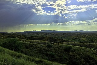
The Pajarito Mountains is a small mountain range of western Santa Cruz County, Arizona, United States, that extend south into Sonora, Mexico. The range is adjacent the Atascosa Mountains at its north, with both ranges in the center of a north-south sequence of ranges called the Tumacacori Highlands. The Highlands have the Tumacacori Mountains at the north, and south of the U.S.-Mexico border, the Sierra La Esmeralda range. The Tumacacori Highlands are part of a regional conservancy study of "travel corridors" for cats, called Cuatro Gatos, Four Cats, for mountain lions, ocelot, bobcat, and jaguar.

The Black Hills of Yavapai County are a large mountain range of central Arizona in southeast Yavapai County. It is bordered by the Verde Valley to the east. The northwest section of the range is bisected from the southeast section by Interstate 17, which is the main route connecting Phoenix to Sedona, Oak Creek Canyon, and Flagstaff. This bisection point is the approximate center of the mostly northwest by southeast trending range. The northwest section contains a steep escarpment on the northeast with the Verde Valley, the escarpment being the location of the fault-block that created the historic mining district at Jerome. The United Verde Mine was one of the largest copper mines in the United States, producing large quantities of copper, gold, silver and zinc.

The Arizona Mountains forests are a temperate coniferous forests ecoregion of the southwest United States with a rich variety of woodland habitats and wildlife.
Juniper Mesa Wilderness is a 7,406-acre wilderness area in the Prescott National Forest in the U.S. state of Arizona. The mesa is about an hour's drive northwest of Prescott in the Juniper Mountains of Yavapai County. The wilderness varies in elevation from 5,600 to 7,000 feet. It is entirely within the Juniper Mountain quadrangle of the United States Geological Survey (USGS) topographic map.
Aliso may refer to:
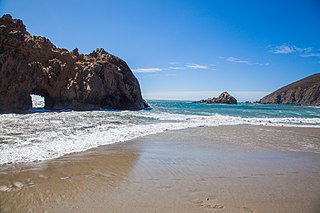
Pfeiffer Beach is located in the Big Sur region of California. It is one of the most popular beaches on the Central Coast and is well known for Keyhole Rock, a popular photography subject. On a limited number of days in December and January each year, photographers crowd the beach to obtain pictures of the setting sun visible through the arch. Due to the steep terrain prevalent along the Big Sur coast, it is one of the few ocean access points within Big Sur