
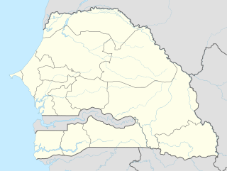
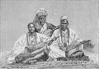
Senegal, officially the Republic of Senegal, is a country in West Africa. Senegal is bordered by Mauritania in the north, Mali to the east, Guinea to the southeast, and Guinea-Bissau to the southwest. Senegal also borders The Gambia, a country occupying a narrow sliver of land along the banks of the Gambia River, which separates Senegal's southern region of Casamance from the rest of the country. Senegal also shares a maritime border with Cape Verde. Senegal's economic and political capital is Dakar.

Senegal is a coastal West African nation located 14 degrees north of the Equator and 14 degrees west of the Prime Meridian. The country's total area is 196 190 km2 of which 192 000 km2 is land and 4 190 km2 is water.
This article describes the system of transport in Senegal, both public and private. This system comprises roads, rail transport, water transport, and air transportation.

The Superior Hiking Trail, also known as the SHT, is a 310-mile (499 km) long footpath in northeastern Minnesota that follows the ridgeline overlooking Lake Superior for most of its length. The path is 18 inches (46 cm) wide and is set in the middle of a 4-foot clearing. The footpath travels through forests of birch, aspen, pine, fir, and cedar. Hikers enjoy views of boreal forests, the Sawtooth Mountains, babbling brooks, rushing waterfalls, and abundant wildlife. The lowest point in the path is 602 feet above sea level and the highest point is 1,829 feet above sea level. The footpath is intended for hiking only. Motorized vehicles, mountain bikes, and horses are not allowed on the trail. Many people use the footpath for long-distance hiking. Facilitating this purpose are 93 backcountry, fee-free campsites.

Cloudland Canyon State Park is a 3,485 acres (14.10 km2) Georgia state park located near Trenton and Cooper Heights on the western edge of Lookout Mountain. One of the largest and most scenic parks in Georgia, it contains rugged geology, and offers visitors a range of vistas across the deep gorge cut through the mountain by Sitton Gulch Creek, where the elevation varies from 800 to over 1,800 feet. Views of the canyon can be seen from the picnic area parking lot, in addition to additional views located along the rim trail. At the bottom of the gorge, two waterfalls cascade across layers of sandstone and shale, ending in small pools below.
Baxter State Park is a large wilderness area permanently preserved as a state park, located in Northeast Piscataquis, Piscataquis County in north-central Maine, United States. It is in the North Maine Woods region, and the Katahdin Woods and Waters National Monument borders Baxter State Park.

Tambacounda is the largest city in eastern Senegal, 400 kilometres (250 mi) southeast of Dakar, and is the regional capital of the province of the same name. Its estimated population in 2007 was 78,800.

Thiès is the third largest city in Senegal with a population officially estimated at 320,000 in 2005. It lies 72 km (45 mi) east of Dakar on the N2 road and at the junction of railway lines to Dakar, Bamako and St-Louis. It is the capital of Thiès Region and is a major industrial city.

Colorado Bend State Park is a 5,328.3-acre (2,156 ha) Texas state park in the Hill Country region. It was purchased in 1984 and opened to public in 1987. It is representative of the karst features typically seen in the Hill Country, with many sinkholes, caves, and springs.
Linguère is a town located in the Linguère Department, Louga Region of Senegal.
Kédougou Department is one of the 45 departments of Senegal, located in the Kédougou Region, formerly part of the Tambacounda Region.
W.A.I.S.T. is the acronym for the West Africa Invitational Softball Tournament organized each January/February in Dakar by the local U.S. Embassy and Peace Corps Senegal.
Gaston Berger University (GBU), or L'Université Gaston Berger (UGB), located some 12 km (7.5 mi) outside Saint-Louis, was the second university established in Senegal. Originally the University of Saint-Louis, it was renamed for Gaston Berger, an important French-Senegalese philosopher, on December 4, 1996.
Bandafassi is town in south-eastern Senegal about 750 km from Dakar near the borders with Mali and Guinea.<. It constitutes about half of the territory of the Arrondissement of Bandafassi of the Kédougou Department, eastern Senegal, The area constitutes the Bandafassi DSS of the INDEPTH Network.

The Old Loggers Path (OLP) is a 27.1 mi (43.6 km) loop hiking trail in Lycoming County in north-central Pennsylvania in the United States. Marked with international orange blazes, the Old Loggers Path is located entirely within the Loyalsock State Forest. Most hikers take two and a half to three days and two nights to complete the Old Loggers Path, making it popular for weekend hikes. Highlights of the trail include waterfalls, several scenic streams and creeks, and panoramic vistas.
Médine is a village and principal settlement (chef-lieu) of the commune of Hawa Dembaya in the Cercle of Kayes in the Kayes Region of south-western Mali. The village is located 12 km east of Kayes on the left bank of the Sénégal River just downstream of the Félou Falls. The site of the village was historically important as the falls were the furthest point up the Sénégal River from Saint Louis that could be reached by boat. Navigation was only possible after the rainy season when the river was in flood.
Nepen Diakha is a locality situated in the Kédougou Region, Senegal. The highest point of the country is located 2.7 km southeast of Nepen Diakha on an unnamed ridge defining the border with Guinea. There is a 648 meters above sea level spot height here on the 1983, very detailed, five-meter contour interval 1:25,000 scale topographic map sheet 2049I SE produced by the joint Senegal-Guinea Organization for the Development of the River Gambia with "topography by photogrammetric methods" from US-flown aerial images. SRTM data shows a 642 meter elevation here.
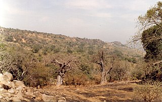
Dindéfelo is a village near Segou in southeast Senegal. It is home to the tourist attraction and park at Dindefelo Falls which can be reached by following a creek-side trail to the south. The town is 38 km southeast of Kedougou, 6 km from the town of Segou Senegal, and was historically a part of Kedougou kingdom in the Senegalese foothills of the Fouta Djallon mountains. The region is traditionally home to the Bassari people.
Yaboyabo is an ancient village in the rural community of Séssène, in the Thies Region of Senegal.


