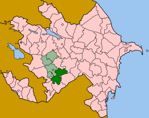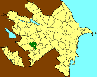
Khojavend is a rayon of Azerbaijan. It has been controlled by the breakaway Nagorno-Karabakh Republic since the Nagorno-Karabakh War except easternmost part, with its northeast half as part of Martuni Province and the rest as part of Hadrut Province.

Khojali, also called Khojaly, Khodjaly and Hojaly, is a rayon in the Nagorno-Karabakh break away region of Azerbaijan, now under de facto control of the Nagorno-Karabakh Republic. Its capital is Khojali. The region was once a site of prehistoric Khojaly-Gadabay culture. It was the location of the Khojaly Massacre in February 1992.

This is a list of the extreme points of Azerbaijan, the points that are farther north, south, east or west than any other location.

Qaratağlar is a village in the Dashkasan Rayon of Azerbaijan. The village forms part of the municipality of Qaraqullar.

Qarikənd is a village in the Gadabay Rayon of Azerbaijan. The village forms part of the municipality of Gərgər.

Qarasüleymanlı is a village in the Goranboy Rayon of Azerbaijan. The village forms part of the municipality of Goranboy.

Güyüm is a village in the Ismailli Rayon of Azerbaijan. The village forms part of the municipality of Diyallı.

Qərsələ is a village in the Ismailli Rayon of Azerbaijan. The village forms part of the municipality of Birinci Yeniyol.

Godaksar is a village in the Tartar Rayon of Azerbaijan.

Musayal is a village in the Gadabay Rayon of Azerbaijan. The village forms part of the municipality of Dəyəqarabulaq.
Sədiyan is a village in the municipality of Diyallı in the Ismailli Rayon of Azerbaijan.
Rəmə is a village in the municipality of Samanlıq in the Gadabay Rayon of Azerbaijan.
Çorçorbinə is a village in the municipality of Poştbinə in the Balakan Rayon of Azerbaijan.
Əsgərxanlı is a village in the Jabrayil Rayon of Azerbaijan.
Nüsüs is a village in the Jabrayil Rayon of Azerbaijan.
Şeidlər is a village and municipality in the Shamkir Rayon of Azerbaijan. It has a population of 568.
Sofular is a village and municipality in the Tovuz Rayon of Azerbaijan. It has a population of 443.
Qoşa is a village in the municipality of Çatax in the Tovuz Rayon of Azerbaijan.

Magyarföld is a village in Zala County, Hungary.


