This page is based on this
Wikipedia article Text is available under the
CC BY-SA 4.0 license; additional terms may apply.
Images, videos and audio are available under their respective licenses.
Franklin-Gordon Wild Rivers is a national park in Tasmania, 117 km west of Hobart. It is named after the two main river systems lying within the bounds of the park - the Franklin River and the Gordon River.

The Derwent River is a river located in Tasmania, Australia. It is also known by the palawa kani name timtumili minanya. The river rises in the state's Central Highlands at Lake St Clair, and descends more than 700 metres (2,300 ft) over a distance of more than 200 kilometres (120 mi), flowing through Hobart, the state's capital city, before emptying into Storm Bay and flowing into the Tasman Sea. The banks of the Derwent were once covered by forests and occupied by Tasmanian Aborigines. European settlers farmed the area and during the 20th century many dams were built on its tributaries for the generation of hydro-electricity.

Cradle Mountain is a mountain in the Central Highlands region of the Australian state of Tasmania. The mountain is situated in the Cradle Mountain-Lake St Clair National Park.

Lake St Clair or leeawulenna is a natural freshwater lake located in the Central Highlands area of Tasmania, Australia. The lake forms the southern end of the Cradle Mountain-Lake St Clair National Park. It has an area of approximately 45 square kilometres (17 sq mi), and a maximum depth of 160 metres (520 ft), making it Australia's deepest lake.

The Government of Tasmania, also referred to as the Tasmanian Government, is the executive authority of the state of Tasmania, Australia. The leader of the party or coalition with the confidence of the Tasmanian House of Assembly, the lower house of the Parliament of Tasmania, is invited by the Governor of Tasmania to form the Government of Tasmania. The head of the Government is the Premier of Tasmania.

The eastern bettong, also known as the Balbo, southern bettong and Tasmanian bettong, is a bettong whose natural range includes southeastern Australia and eastern Tasmania.
The New South Wales Office of Environment and Heritage (OEH), a division of the Government of New South Wales, is responsible for the care and protection of the environment and heritage, which includes the natural environment, Aboriginal country, culture and heritage, and built heritage in New South Wales, Australia. The OEH supports the community, business and government in protecting, strengthening and making the most of a healthy environment and economy within the state. The OEH is part of the Department of Planning and Environment cluster and also manages national parks and reserves.

The Sticht Range is a mountain range located in the West Coast region of Tasmania, Australia. The range runs between two tributaries of the Eldon River and is located within the eastern part of the West Coast Range and has an unnamed peak with an elevation of 1,080 metres (3,540 ft) above sea level.

Tasmania Parks and Wildlife Service is the government body responsible for protected areas of Tasmania on public land, such as national parks, historic sites and regional reserves. Historically it has also had responsibility for managing wildlife, including game.
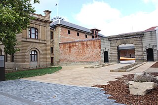
The Tasmanian Museum and Art Gallery (TMAG) is a museum located in Hobart, Tasmania. The museum was established in 1846, by the Royal Society of Tasmania, the oldest Royal Society outside England.
The TMAG receives 400,000 visitors annually.
Soil policy in Victoria refers to the policies of soil governance in the Australian state of Victoria. In a 10-year vision for the environment of Victoria which is spelled out in "Growing Victoria Together", one of the goals is that "the condition of our land will improve as the impact of salinity and soil degradation is reduced". Complementing "Growing Victoria Together" is "Our Environment: Our Future", which is a framework for Victoria's environmental sustainability. This defines a "long term and integrated approach" that seeks to "maximise our future economic growth, maintain our quality of life and protect our unique Victorian environment". This is to be achieved by:
The Inglis River is a river in North West Tasmania, Australia, it extends approximately 61 kilometres (38 mi) from the Campbell Ranges near Takone before discharging into Bass Strait at Wynyard. The Flowerdale River is the largest tributary system on the Inglis River and makes up approximately one-third of the 471-square-kilometre (182 sq mi) Inglis-Flowerdale catchment basin.
The Department of Environment, Parks, Heritage and the Arts (DEPHA) was a government department of the Australian state of Tasmania, that included many of the agencies that manage Tasmania's natural and cultural heritage. As at 1 July 2010 it was amalgamated with the Department of Primary Industries and Water to form the Department of Primary Industries, Parks, Water and Environment (DPIPWE).
Odixia is a genus of Tasmanian flowering plants in the pussy's-toes tribe within the daisy family.
- Odixia achlaena (D.I.Morris) Orchard - Tasmania
- Odixia angusta (N.A.Wakef.) Orchard - Tasmania
Red foxes pose a serious conservation problem in Australia. 2012 estimates indicate that there are more than 7.2 million red fox and growing with a range extending throughout most of the continental mainland. The species became established in Australia through successive introductions by settlers in 1830s. Due to its rapid spread and ecological impact it has classified as one of the most damaging invasive species in Australia.
The Little Swanport River is a perennial river located on the east coast of Tasmania, Australia.

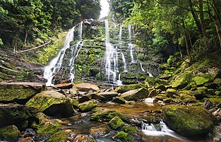
The Detention Falls, a cascade waterfall on the Detention River, is located at Milabena in North West Tasmania, Australia.
