
The geography of France consists of a terrain that is mostly flat plains or gently rolling hills in the north and west and mountainous in the south and the east.

Charcas is a province in the northern parts of the Bolivian Potosí Department. Its capital is San Pedro de Buena Vista.
German submarine U-772 was a Type VIIC U-boat of Nazi Germany's Kriegsmarine during World War II.

Bascuñana is a municipality and town located in the province of Burgos, Castile and León, Spain. According to the 2004 census (INE), the municipality has a population of 61 inhabitants.

Bana is a department or commune of Balé Province in southern Burkina Faso. Its capital lies at the town of Bana. According to the 1996 census the department has a population of 12,299.
Siby is a department or commune of Balé Province in southern Burkina Faso. Its capital lies at the town of Siby. According to the 1996 census the department has a total population of 12,089.

Sanaba is a department or commune of Banwa Province in western Burkina Faso. Its capital lies at the town of Sanaba. According to the 1996 census the department has a total population of 29,525.
Solenzo is a department or commune of Banwa Province in western Burkina Faso. Its capital lies at the town of Solenzo. According to the 1996 census the department has a total population of 115,927.
Tansila is a department or commune of Banwa Province in western Burkina Faso. Its capital lies at the town of Tansila. According to the 1996 census the department has a total population of 27,714.
Bissiga is a department or commune of Boulgou Province in eastern Burkina Faso. Its capital lies at the town of Bissiga. According to the 1996 census the department has a total population of 19,264.

Bittou is a department or commune of Boulgou Province in eastern Burkina Faso. Its capital lies at the town of Bittou. According to the 1996 census the department has a total population of 34,496.
Zonsé is a department or commune of Boulgou Province in eastern Burkina Faso. Its capital lies at the town of Zonsé. According to the 1996 census the department has a total population of 19,916.
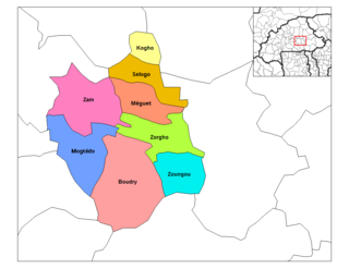
Kogho is a department or commune of Ganzourgou Province in central-eastern Burkina Faso. Its capital lies at the town of Kogho. According to the 1996 census the department has a total population of 15,524.
Méguet is a department or commune of Ganzourgou Province in central-eastern Burkina Faso. Its capital lies at the town of Méguet. According to the 1996 census the department has a total population of 34,668.
Zoungou is a department or commune of Ganzourgou Province in central-eastern Burkina Faso. Its capital lies at the town of Zoungou. According to the 1996 census the department has a total population of 29,753.

Kombori is a department or commune of Kossi Province in western Burkina Faso. Its capital lies at the town of Kombori. According to the 1996 census the department has a total population of 9,610.

Tensobtenga is a department or commune of Kouritenga Province in eastern Burkina Faso. Its capital lies at the town of Tensobtenga. According to the 1996 census the department has a total population of 18,746.

Sourgoubila is a department or commune of Kourwéogo Province in central Burkina Faso. Its capital lies at the town of Sourgoubila. According to the 1996 census the department has a total population of 39,226.
Salogo is a department or commune of Ganzourgou Province in central-eastern Burkina Faso. Its capital lies at the town of Salogo. According to the 2006 census, the department has a total population of 21,405.
Manegsombo is a village in the Kombissiri Department of Bazèga Province in central Burkina Faso. The village has a population of 373.


