Tierp Municipality is a municipality in Uppsala County in east central Sweden. Its seat is located in the town of Tierp.

Hofors Municipality is a municipality in Gävleborg County, east central Sweden. Its seat is in Hofors with 7,400 inhabitants, situated at 60°33′N16°17′E.

Dragsfjärd is a former municipality of Finland. On January 1, 2009, it was consolidated with Kimito and Västanfjärd to form the new municipality of Kimitoön.

The Lagting, or Lagtinget, is the parliament of Åland, an autonomous, demilitarised and unilingually Swedish-speaking territory of Finland. The Lagting has 30 seats.

Iniö is a former municipality of Finland. On 1 January 2009, it was consolidated with Houtskär, Korpo, Nagu and Pargas to form the new town of Väståboland, which name from the beginning of 2012 was changed to Parainen.

European route E 16 is the designation of a main west-east road through Northern Ireland, Scotland, Norway and Sweden, from Derry to Gävle, via Belfast, Glasgow, Edinburgh, previously by ferry to Bergen, Voss, through the Gudvanga Tunnel and the Lærdal Tunnel, Lærdal, over Filefjell to Fagernes, Hønefoss, Gardermoen and Kongsvinger. In Sweden it passes Malung, Falun and ends in Gävle.

Fenno–Skan is the designation of the high voltage direct current transmission between Dannebo in Sweden and Rauma in Finland.

Punavuori is a neighbourhood in Helsinki, the capital of Finland. The name Punavuori refers to red cliffs located between Sepänkatu and Punavuorenkatu. They were still visible in the 19th century, nowadays they are covered with buildings and pavement. Punavuori was traditionally a working-class neighbourhood, today it is known as a bohemian district popular among artists, students and hipsters. It is one of the most densely populated areas in Finland.

The Vyborg Governorate was a Russian Governorate 1744-1812, which was established in territories ceded by the Swedish Empire in the Great Northern War. By the Treaty of Nystad in 1721, Sweden formally ceded control of the parts of the Viborg and Nyslott County and the Kexholm County located on the Karelian Isthmus and Lake Ladoga area to Russia. First these areas were part of the Saint Petersburg Governorate. Vyborg Governorate was established in 1744 when Sweden ceded control of parts of Kymmenegård and Nyslott County by the Treaty of Åbo. In Sweden and Finland the governorate was also known as Old Finland, and between 1802 and 1812 it was named the "Finland Governorate".

Itäkeskus is a quarter in the neighbourhood of Vartiokylä in the eastern part of Helsinki. The district's main attraction is the largest covered-in shopping mall in the Nordic countries, Itis. The district has a station on the Helsinki Metro.

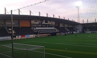
Strömvallen is a football stadium in Gävle, Sweden. It was the home ground of Gefle IF until 2015. The stadium holds 6,703 people and was initially opened in 1903, with a dedicated spectator area built in 1923.

Gavlerinken Arena, formerly known as Läkerol Arena (2006–2014) and Gavlerinken (1967–2006), is an indoor sporting arena located in Gävle, Sweden. The capacity of the arena is 8,585 for ice hockey games and 11,000 for concerts which makes it the 5th largest ice hockey arena in Sweden. The arena is the home arena of the Brynäs IF ice hockey team.

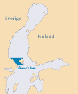
The Sea of Åland is a waterway in the southern Gulf of Bothnia, between the Åland islands and Sweden. It connects the Bothnian Sea with the Baltic Sea proper. The seas are often choppy here. The narrowest part is named South Kvarken. The trench running on the bottom of the Sea of Åland contains the second-deepest spot of the Baltic Sea, at a depth of 301 meters, which is second only to Landsort Deep.

Heikinlaakso (Finnish), Henriksdal (Swedish) is a northeastern neighborhood of Helsinki, Finland.

Suutarila is a subdistrict located next to Keravanjoki in a northeastern major district of Helsinki, Finland, near the border to Vantaa
Itä-Pasila (Finnish), Östra Böle (Swedish) is a neighborhood of Helsinki, Finland.

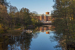
Älvkarleby Hydroelectric Power Plant is a hydroelectric power plant with 5 Francis turbines at Älvkarleby, Sweden. It was built in 1911. From 1988-1991 a new power plant with a single Francis turbine was added, increasing its generation power from 70 MW to 126 MW.

Gavlevallen is an association football stadium in Gävle, Sweden. The project was initiated by Allsvenskan side Gefle IF and Gävle Municipality to build a new 6,500 capacity stadium in the Sätraåsen area of Gävle, Sweden.

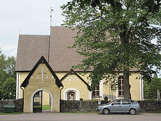
Tierp Church is a Lutheran church in Tierp, Uppsala County, Sweden. It belongs to the Archdiocese of Uppsala. The church is one of the largest countryside churches in Uppland and contains well-preserved medieval frescos.

Stavby Church is a medieval church located north-east of Uppsala in Uppsala County, Sweden. It is part of the Archdiocese of Uppsala.


