
Traffic on roads consists of road users including pedestrians, ridden or herded animals, vehicles, streetcars, buses and other conveyances, either singly or together, while using the public way for purposes of travel. Traffic laws are the laws which govern traffic and regulate vehicles, while rules of the road are both the laws and the informal rules that may have developed over time to facilitate the orderly and timely flow of traffic.

A high-occupancy vehicle lane is a restricted traffic lane reserved for the exclusive use of vehicles with a driver and one or more passengers, including carpools, vanpools, and transit buses. These restrictions may be only imposed during peak travel times or may apply at all times. According to the criteria used there are different types of lanes: temporary or permanent with concrete barriers; two-directional or reversible; and exclusive, concurrent or contraflow lanes working in peak periods. The normal minimum occupancy level is 2 or 3 occupants. Many jurisdictions exempt other vehicles, including motorcycles, charter buses, emergency and law enforcement vehicles, low-emission and other green vehicles, and/or single-occupancy vehicles paying a toll. HOV lanes are normally created to increase average vehicle occupancy and persons traveling with the goal of reducing traffic congestion and air pollution, although their effectiveness is questionable.
Interstate 45 (I-45) is an Interstate Highway located entirely within the U.S. state of Texas. While most Interstate routes ending in "5" are cross-country north-south routes, I-45 is comparatively short, with the entire route located in Texas. It connects the cities of Dallas and Houston, continuing southeast from Houston to Galveston over the Galveston Causeway to the Gulf of Mexico.
Interstate 66 (I-66) is an Interstate Highway in the eastern United States. As indicated by its even route number, it runs in an east–west direction. Its western terminus is near Middletown, Virginia, at an interchange with I-81; its eastern terminus is in Washington, D.C., at an interchange with U.S. Route 29. Because of its terminus in the Shenandoah Valley, the highway was once called the "Shenandoah Freeway." Much of the route parallels U.S. Route 29 or Virginia State Route 55. Interstate 66 has no physical or historical connection to the famous U.S. Route 66 which was in a different region of the United States.
In Downtown Atlanta, the Downtown Connector or I-75/85 is the concurrent section of Interstate 75 and Interstate 85 through the core of the city. Beginning at the I-85/Langford Parkway interchange, the Downtown Connector runs generally due north, meeting the west–east I-20 in the middle. Just north of this is the Grady Curve around Grady Memorial Hospital. Continuing north, the terminus of the Downtown Connector is the Brookwood Interchange or Brookwood Split in the Brookwood area of the city. The overall length of the Downtown Connector is approximately 7.5 miles (12 km). Since the 2000s, it has been officially named James Wendell George Parkway for most of its length, although it is still designated the Connector in the mainstream. It also has unsigned designations State Route 401 (I-75) and State Route 403 (I-85) along its length, due to I-75 and I-85 having a 400-series reference numbers.

State Route 267 is a primary state highway in the US state of Virginia. It consists of two end-to-end toll roads – the Dulles Toll Road and Dulles Greenway – as well as the Dulles Access Road, which lies in the median of Dulles Toll Road and then extends east to Falls Church. The combined roadway provides a toll road for commuting and a free road for access to Washington Dulles International Airport. The three sections are operated and maintained by separate agencies: Dulles Toll Road and Dulles Access Road are maintained by the Metropolitan Washington Airports Authority (MWAA); the Dulles Greenway is owned by TRIPP II, a limited partnership, but is maintained by Macquarie Atlas Roads, an Australian company which owns the majority stake in the partnership. The Dulles Access Road's median hosts the Silver Line of the Washington Metro for much of the length between Reston and Falls Church.

A frontage road is a local road running parallel to a higher-speed, limited-access road. A frontage road is often used to provide access to private driveways, shops, houses, industries or farms. Where parallel high-speed roads are provided as part of a major highway, these are also known as local-express lanes.
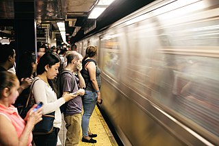
A rush hour or peak hour is a part of the day during which traffic congestion on roads and crowding on public transport is at its highest. Normally, this happens twice every weekday; once in the morning and once in the afternoon or evening, the times during which the most people commute. The term is often used for a period of peak congestion that may last for more than one hour.
Interstate 287 (I-287) is an auxiliary Interstate Highway in the US states of New Jersey and New York. It is a partial beltway around New York City, serving the northern half of New Jersey and the counties of Rockland and Westchester in New York. I-287, which is signed north–south in New Jersey and east–west in New York, follows a roughly horseshoe-shaped route from the New Jersey Turnpike (I-95) in Edison Township, New Jersey, clockwise to the New England Thruway (I-95) in Rye, New York, for 98.72 miles (158.87 km). Through New Jersey, I-287 runs west from its southern terminus in Edison through suburban areas. In Bridgewater Township, the freeway takes a more northeasterly course, paralleled by U.S. Route 202 (US 202). The northernmost part of I-287 in New Jersey passes through mountainous surroundings. After crossing into New York at Suffern, I-287 turns east on the New York State Thruway (I-87) and runs though Rockland County. After crossing the Hudson River on the Tappan Zee Bridge, I-287 splits from I-87 near Tarrytown and continues east through Westchester County on the Cross-Westchester Expressway until it reaches the New England Thruway. Within New Jersey, I-287 is maintained by the New Jersey Department of Transportation (NJDOT), and within New York, it is maintained by the New York State Thruway Authority (NYSTA).
Interstate 295 (I-295) in the U.S. state of Maryland and in Washington, D.C., also known as the Anacostia Freeway, is a 8.05-mile (12.96 km) spur route connecting I-95 / I-495 and Maryland Route 210 near the Potomac River to Interstate 695 & D.C. Route 295 in the Anacostia neighborhood of Washington, D.C.
Interstate 395 (I-395) in Washington, D.C., and Virginia is a 13.39-mile-long (21.55 km) spur route of I-95 that begins at an interchange with I-95 in Springfield and ends at an interchange with U.S. Route 50 in northwest Washington, D.C. It passes underneath the National Mall near the U.S. Capitol and ends at a junction with US 50 at New York Avenue, roughly one mile (1.6 km) north of the 3rd Street Tunnel. Despite its proximity to I-395 in Maryland, the route is unrelated and unconnected.
Interstate 405 (I-405) is a north–south auxiliary Interstate Highway serving the Seattle region of Washington, United States. It bypasses Seattle east of Lake Washington, traveling through the Eastside area of King and Snohomish counties, providing an alternate route to I-5. The 30-mile (48 km) freeway serves the cities of Renton, Bellevue, Kirkland, and Bothell. I-405 terminates at I-5 in Tukwila and Lynnwood, and also intersects several major highways, including SR 167, I-90, SR 520, and SR 522.
The Schuylkill Expressway, locally known as "the Schuylkill", is a two to eight lane freeway through southwestern Montgomery County and the city of Philadelphia, and the easternmost segment of Interstate 76 in the U.S. state of Pennsylvania. It extends from the Valley Forge exit of the Pennsylvania Turnpike in King of Prussia, paralleling its namesake Schuylkill River for most of the route, to the Walt Whitman Bridge in South Philadelphia. It serves as the primary corridor into Philadelphia from points west. Maintenance and planning are administered through Pennsylvania Department of Transportation (PennDOT) District 6. Constructed over a period of ten years from 1949 to 1959, a large portion of the expressway predates the 1956 introduction of Interstate Highway System; many of these portions were not built to contemporary standards. The rugged terrain, limited riverfront space covered by the route and narrow spans of bridges passing over the highway have largely stymied later attempts to upgrade or widen the highway. With the road being highly over capacity, it has become notorious for its chronic congestion. An average of 163,000 vehicles use the road daily in Philadelphia County, and an average of 109,000 use the highway in Montgomery County, making it the busiest road in commonwealth of Pennsylvania. Its narrow lane and left shoulder configuration, left lane entrances and exits, common construction activity and generally congested conditions have led to many accidents, critical injuries and fatalities, leading to the highway's humorous nickname of the "Surekill Expressway" or in further embellishment, the "Surekill Distressway" or the “Surekill Crawlway".

A stack interchange, or colloquially butterfly junction, is a particular, free-flowing type of design for interchanges, meaning grade-separated road junctions. It is referred to as a directional interchange in the American Association of State Highway and Transportation Officials Policy on Geometric Design of Highways and Streets.

The El Monte Busway is an 11-mile (18 km) shared-use express bus corridor (busway) and high occupancy toll lane running west along Interstate 10 from Interstate 605 and El Monte Station in El Monte, California, via busway stations at Cal State LA station and LA County+USC Medical Center station into Downtown Los Angeles and its terminus at Union Station.
The Texas Department of Transportation (TxDOT) is a governmental agency and its purpose is to "provide safe, effective, and efficient movement of people and goods" throughout the state. Though the public face of the agency is generally associated with maintenance of the state's immense highway system, the agency is also responsible for aviation in the state and overseeing public transportation systems.

The Judge Harry Pregerson Interchange is a stack interchange near the Athens and Watts communities of Los Angeles, California, United States. It is the interchange of the following routes:

A high-occupancy toll lane is a type of traffic lane or roadway that is available to high-occupancy vehicles and other exempt vehicles without charge; other vehicles are required to pay a variable fee that is adjusted in response to demand. Unlike toll roads, drivers have an option to use general purpose lanes, on which a fee is not charged. Express toll lanes, which are less common, operate along similar lines, but do not exempt high-occupancy vehicles.

Terminology related to road transport—the transport of passengers or goods on paved routes between places—is diverse, with variation between dialects of English. There may also be regional differences within a single country, and some terms differ based on the side of the road traffic drives on. This glossary is an alphabetical listing of road transport terms.

A managed lane is a type of highway lane that is operated with a management scheme, such as lane use restrictions or variable tolling, to optimize traffic flow, vehicle throughput, or both. Definitions and goals vary among transport agencies, but managed lanes are generally implemented to achieve an improved operational condition on a highway, such as improving traffic speed and throughput, reducing air pollution, and improving safety. Types of managed lanes include High-occupancy vehicle (HOV) lanes, High-occupancy toll lanes, express toll lanes, reversible lanes, and bus lanes. Most managed lane facilities are located in the United States, although HOV and bus lanes can be found in many other countries; outside of the US, many countries use active traffic management that manage all lanes of a highway.
