
Manchester is a city and metropolitan borough of Greater Manchester, England, which had an estimated population of 568,996 in 2022. It contributes to the third-most populous metropolitan area in the United Kingdom as a part of Greater Manchester, which has a population of approximately 2.92 million. It is bordered by the Cheshire Plain to the south, the Pennines to the north and east, and the neighbouring city of Salford to the west. The city borders the boroughs of Trafford, Stockport, Tameside, Oldham, Rochdale, Bury and Salford.

Madchester was a musical and cultural scene that emerged in the English city of Manchester during the late 1980s, closely associated with the indie dance movement. Indie dance blended indie rock with elements of acid house, psychedelia, and 1960s pop.
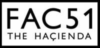
The Haçienda was a nightclub and music venue in Manchester, England, which became famous during the Madchester years of the 1980s and early 1990s. It was run by the record label Factory Records.

Guardian Exchange was an underground telephone exchange built in Manchester from 1954 to 1957. It was built together with the Anchor exchange in Birmingham and the Kingsway exchange in London – all believed to provide hardened communications in the event of nuclear war; as well as linking the UK government in London to the US Government in Washington, D.C. by means of a secure and hardened transatlantic telephone cable making landfall near Oban and running through Glasgow, Manchester and Birmingham. Today, the underground site is used for telephone cabling. Constructed at a depth of below 35 metres (115 ft), the tunnels are about 2 metres (80 in) in diameter. The exchange cost around £4 million, part of which was funded by the United Kingdom's NATO partners.

Rusholme is an area of Manchester, in Greater Manchester, England, two miles south of the city centre. The population of the ward at the 2011 census was 13,643. Rusholme is bounded by Chorlton-on-Medlock to the north, Victoria Park and Longsight to the east, Fallowfield to the south and Moss Side to the west. It has a large student population, with several student halls and many students renting terraced houses, and suburban houses towards Victoria Park.

Irlam is a suburb in the City of Salford, Greater Manchester, England. In 2011, it had a population of 19,933. It lies on flat ground on the south side of the M62 motorway and the north bank of the Manchester Ship Canal, 6.7 miles (10.8 km) southwest of Salford, 7.6 miles (12.2 km) southwest of Manchester and 8.3 miles (13.4 km) northeast of Warrington. Irlam forms a continuous urban area with Cadishead to the southwest, and is divided from Flixton and the Metropolitan Borough of Trafford to the southeast by the Manchester Ship Canal. The main road through Irlam, linking it to Cadishead and Eccles, is the A57. Irlam railway station also serves the district.

Wilmslow Road is a major road in Manchester, England, running from Parrs Wood northwards to Rusholme where it becomes the Oxford Road. The name of the road changes again to Oxford Street when it crosses the River Medlock before reaching Manchester city centre.
Moss Side is an inner-city area of Manchester, in Greater Manchester, England, 1.9 miles (3.1 km) south of the city centre, It had a population of 20,745 at the 2021 census. Moss Side is bounded by Hulme to the north, Chorlton-on-Medlock, Rusholme and Fallowfield to the east, Whalley Range to the south, and Old Trafford to the west.
Didsbury is a suburb of Manchester, in Greater Manchester, England, on the north bank of the River Mersey, 5 miles south of Manchester city centre. The population at the 2011 census was 26,788.

Whalley Range is an area of Manchester, England; it is located about 2 miles (3.2 km) south-west of the city centre. The population at the 2011 census was 15,430. Historically in Lancashire, it was one of the earliest of the city's suburbs, built by local businessman Samuel Brooks.

The Twisted Wheel was a nightclub in Manchester, England, open from 1963 to 1971. It was one of the first clubs to play the music that became known as Northern soul.

Corporation, often referred to as Corp by locals, is an independent live music venue and nightclub located in the city centre of Sheffield, England. In addition to hosting live music from touring bands, Corporation hosts club nights which play a variety of alternative, pop and rock music.
Band on the Wall is a live music venue in the Northern Quarter of Manchester, England.
BBC Radio Manchester is the BBC's local radio station serving Greater Manchester.

The King's Buildings is a campus of the University of Edinburgh in Scotland. Located in the suburb of Blackford, the site contains most of the schools within the College of Science and Engineering, excepting only the School of Informatics and part of the School of Geosciences, which are located at the central George Square campus. The campus lies south of West Mains Road, west of Mayfield Road and east of Blackford Hill, about 2 miles (3.2 km) south of George Square. Scotland's Rural College (SRUC) and Biomathematics and Statistics Scotland (BioSS) also have facilities there.

The Hatchet Inn is a historic pub in the English city of Bristol. It is a Grade II listed building. The name is thought to originate from the axes/hatchets that the local woodsmen used in Clifton Woods.

A nightclub is a club that is open at night, usually for drinking, dancing and other entertainment. Nightclubs often have a bar and discothèque with a dance floor, laser lighting displays, and a stage for live music or a disc jockey (DJ) who mixes recorded music. Nightclubs tend to be smaller than live music venues like theatres and stadiums, with few or no seats for customers.

Greenheys is an inner-city area of south Manchester, England, lying between Hulme to the north and west, Chorlton-on-Medlock to the east and Moss Side to the south.
Commonword (1975–present) is a writing development organisation based in Manchester, North West England, providing opportunities for new and aspiring writers to develop their talent and potential, promoting new writing on national and international levels. The organisation was set up in 1975. It is currently the largest new writing, community writing and publishing organisation in the North West. It is a limited company and registered charity, and is Arts Council funded. Activist and writer Deyika Nzeribe was a former chair.

The Newport music scene, in and around Wales' third city, has been well documented and acclaimed for cultivating bands, singers, and famous music venues. Newport has been traditionally a rock city since the 1970s, but it has evolved over the years to include forms of punk, 1990s alt-rock, and more recently metal and hip-hop.
