The Strategic Defense Initiative (SDI) was a proposed missile defense system intended to protect the United States from attack by ballistic strategic nuclear weapons. The concept was first announced publicly by President Ronald Reagan on 23 March 1983. Reagan was a vocal critic of the doctrine of mutual assured destruction (MAD), which he described as a "suicide pact", and he called upon the scientists and engineers of the United States to develop a system that would render nuclear weapons obsolete.
JTAG is an industry standard for verifying designs and testing printed circuit boards after manufacture.

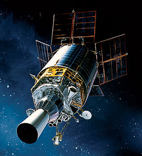
The Space-Based Infrared System (SBIRS) is a consolidated system intended to meet the United States' infrared space surveillance needs through the first two to three decades of the 21st century. The SBIRS program is designed to provide key capabilities in the areas of missile warning, missile defense and battlespace characterization via satellites in geosynchronous earth orbit (GEO), sensors hosted on satellites in highly elliptical orbit (HEO), and ground-based data processing and control. SBIRS ground software integrates infrared sensor programs of the U.S. Air Force (USAF) with new IR sensors.

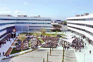
Los Angeles Air Force Base (LAAFB) is a non-flying United States Air Force Base located in El Segundo, California. Los Angeles Air Force Base houses and supports the headquarters of the Air Force Space Command's Space and Missile Systems Center (SMC). The center manages research, development and acquisition of military space systems. The 61st Air Base Wing provides support functions for the base.

Buckley Air Force Base is a United States Air Force base in Aurora, Colorado, that was established by the U.S. Army as an auxiliary field and bombing range in 1938, and activated as a designated installation in 1941. The base was named in honor of World War I Army pilot First Lieutenant John Harold Buckley.

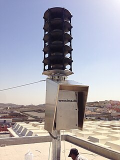
Warning system is any system of biological or technical nature deployed by an individual or group to inform of a future danger. Its purpose is to enable the deployer of the warning system to prepare for the danger and act accordingly to mitigate or avoid it.

The 460th Space Wing is located at Buckley Air Force Base, east of Aurora, Colorado. The 460th delivers global infrared surveillance, provides worldwide missile warning and tracking for homeland defense purposes, and deploys personnel to combatant commanders worldwide.

The Space and Missile Systems Center (SMC) is a part of Air Force Space Command of the United States Air Force, located at Los Angeles Air Force Base in El Segundo, Los Angeles County, California. SMC is the Air Force’s product center for the development and acquisition of space and missile systems.

The 2d Space Warning Squadron Is part of the 460th Space Wing at Buckley Air Force Base, Colorado. It operates the Space-Based Infrared System satellites conducting global monitoring for significant infrared events.

The 11th Space Warning Squadron is a United States Air Force missile warning squadron, located at Buckley Air Force Base, Colorado.
The United States Missile Defense Agency (MDA) is developing a Space Tracking and Surveillance System (STSS) which it will use to research the space-based detection and tracking of ballistic missiles. Data from STSS satellites could allow interceptors to engage incoming missiles earlier in flight than would be possible with other missile detection systems. The STSS program began in 2001, when the "SBIRS Low" program was transferred to MDA from the United States Air Force.

The Joint Polar Satellite System (JPSS) is the latest generation of U.S. polar-orbiting, non-geosynchronous, environmental satellites. JPSS will provide the global environmental data used in numerical weather prediction models for forecasts, and scientific data used for climate monitoring. JPSS will aid in fulfilling the mission of the U.S. National Oceanic and Atmospheric Administration (NOAA), an agency of the Department of Commerce. Data and imagery obtained from the JPSS will increase timeliness and accuracy of public warnings and forecasts of climate and weather events, thus reducing the potential loss of human life and property and advancing the national economy. The JPSS is developed by the National Aeronautics and Space Administration (NASA) for the National Oceanic and Atmospheric Administration (NOAA), who is responsible for operation of JPSS. Three to five satellites are planned for the JPSS constellation of satellites. JPSS satellites will be flown, and the scientific data from JPSS will be processed, by the JPSS - Common Ground System (JPSS-CGS).

USA-230, also known as SBIRS-GEO 1, is an American military satellite and part of the Space-Based Infrared System. It was launched on May 7, 2011 from Cape Canaveral, atop an Atlas V rocket.
USA-241, also known as SBIRS-GEO 2, is an American military satellite and part of the Space-Based Infrared System. It was launched on March 19, 2013 from Cape Canaveral, atop an Atlas V rocket.

USA-273, also known as SBIRS-GEO 3, is an American military satellite and part of the Space-Based Infrared System. It was launched on January 21, 2017 from Cape Canaveral, atop an Atlas V rocket.

JPSS-2, or Joint Polar Satellite System-2, is the second of the United States National Oceanic and Atmospheric Administration's latest generation of U.S. polar-orbiting, non-geosynchronous, environmental satellites called the Joint Polar Satellite System. JPSS-2 is to be launched 2022 and join NOAA-20 and Suomi NPP in the same orbit. Circling the Earth from pole-to-pole, it will cross the equator about 14 times daily, providing full global coverage twice a day.
USA-282, also known as SBIRS-GEO 4, is an American military satellite and part of the Space-Based Infrared System. It was launched on January 20, 2018 from Cape Canaveral, atop an Atlas V rocket.


