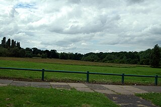
Thimble End is a neighbourhood on the outskirts of Sutton Coldfield, Birmingham, England. It has been developed several times with the construction and expansion of housing estates on the land with the most recent being completed in 2005.
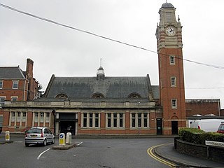
Sutton Coldfield, officially the Royal Town of Sutton Coldfield, is a town and civil parish in Birmingham, West Midlands, England. The town lies about 7 miles northeast of Birmingham City Centre and borders Little Aston, North Warwickshire, Lichfield, Erdington and South Staffordshire. Its 2011 Census population was 95,107 – an increase of 6.7% since the 2001 Census.

Birmingham is the second-most populous city in the United Kingdom, after London, and the most populous city in the English Midlands. With an estimated population of 1,137,100 as of 2017, Birmingham is the cultural, social, financial and commercial centre of the Midlands. It is the main centre of the West Midlands conurbation, which is the third most populated urban area in the United Kingdom, with a population in 2011 of 2,440,986. The wider Birmingham metropolitan area is the second largest in the United Kingdom with a population of over 3.7 million. Birmingham is frequently referred to as the United Kingdom's "second city".

England is a country that is part of the United Kingdom. It shares land borders with Wales to the west and Scotland to the north-northwest. The Irish Sea lies west of England and the Celtic Sea lies to the southwest. England is separated from continental Europe by the North Sea to the east and the English Channel to the south. The country covers five-eighths of the island of Great Britain, which lies in the North Atlantic, and includes over 100 smaller islands, such as the Isles of Scilly and the Isle of Wight.
Situated between Walmley, Minworth and Signal Hayes, the area is small in comparison to Walmley and Minworth and is covered by the Sutton New Hall ward. The area was once farmland used by farmers residing in Walmley and Minworth however the need for extra living space after World War II prompted the construction of a small housing estate on the site. This was further expanded in the 1970s and the final part of the farmland was constructed on by 2005. The newest housing estate was named Thimble End Court. Birmingham City Council also developed land adjacent to the newest estate by constructing a £98,000 children's play area.

Walmley is an area of Sutton Coldfield, England. It is in south Sutton Coldfield, near to Erdington, Minworth, Wylde Green, Pype Hayes and south of Thimble End. It is approximately 11 kilometres (7 mi) northeast of Birmingham City Centre. It is the main focus of the Sutton New Hall Birmingham City Council ward.
Minworth is a village contiguous with Sutton Coldfield on the northeastern outskirts of Birmingham, West Midlands. It is located near Walmley, Wishaw, Curdworth, Erdington, Water Orton, Thimble End, and Castle Vale.

World War II, also known as the Second World War, was a global war that lasted from 1939 to 1945. The vast majority of the world's countries—including all the great powers—eventually formed two opposing military alliances: the Allies and the Axis. A state of total war emerged, directly involving more than 100 million people from over 30 countries. The major participants threw their entire economic, industrial, and scientific capabilities behind the war effort, blurring the distinction between civilian and military resources. World War II was the deadliest conflict in human history, marked by 50 to 85 million fatalities, most of whom were civilians in the Soviet Union and China. It included massacres, the genocide of the Holocaust, strategic bombing, premeditated death from starvation and disease, and the only use of nuclear weapons in war.
The road that forms the eastern boundary of the estate is called Thimble End Road.
This page is based on this
Wikipedia article Text is available under the
CC BY-SA 4.0 license; additional terms may apply.
Images, videos and audio are available under their respective licenses.

Erdington is a suburb and ward of Birmingham that is historically part of Warwickshire. Its postcodes include B23, B24 and B72. It is 5 miles (8 km) northeast of central Birmingham, England and borders Sutton Coldfield. It is also a council constituency, managed by its own district committee. The formal council constituency consists of the ward of Erdington, and Tyburn,, Stockland Green and Kingstanding, although all of Kingstanding and most of both Tyburn and Stockland Green wards lie outside the historical boundaries of Erdington. Stockland Green was formerly part of Aston, Kingstanding part of Perry Barr and Tyburn partially split between Aston and Hodge Hill. Erdington was part of the Sutton Coldfield constituency before 1974.
Castle Vale is a housing estate located between Erdington, Minworth and Castle Bromwich. Currently Castle Vale votes with Tyburn Ward which is part of Erdington constituency, 6 miles (9 km) northeast of Birmingham city centre in England. The area has an approximate population of 10,000 people and has a distinctly modern residential character stemming from its history as a postwar overspill estate.

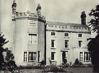
The New Hall Estate is the older of the two major private housing estates named after New Hall Manor in the Royal Town of Sutton Coldfield in the West Midlands in England. The newer being New Hall Manor Estate.

New Hall Valley Country Park is a country park located in New Hall Valley between Walmley and Wylde Green in the Sutton Coldfield area of north Birmingham. It is the first new country park in the UK for over a decade. The park is split into "phases".
Sutton New Hall is one of the 40 electoral wards in Birmingham, England and is named after New Hall, a medieval manor house.
Silverknowes is a district of Edinburgh, Scotland. Silverknowes lies to the northwest of the city. The district contains over 2000 homes, ranging in size from bungalow to semi-detached housing, much of it built during the mid-twentieth century.
Lee Bank is an inner city area of Birmingham, England. It is part of the Edgbaston and Ladywood wards, inside the Middle Ring Road, near to the centre of Birmingham.
Wiggins Hill is a hamlet in the North Warwickshire district of the county of Warwickshire in England.

Maney is an area of Sutton Coldfield, Birmingham, England. It is situated close to the town centre of Sutton Coldfield and is also near Wylde Green and Walmley. The main thoroughfare is Birmingham Road, which runs through Maney.
Falcon Lodge is the area of Sutton Coldfield, Birmingham, West Midlands, England, covered in predominantly council houses forming the Falcon Lodge Estate. It is located between Whitehouse Common and Reddicap Heath. To the west of the estate lies Rectory Park. It forms part of the edge of the Sutton Coldfield conurbation and the English countryside.
Pype Hayes is a modern housing estate area in the east of the Erdington district of Birmingham.It is located within the Tyburn ward. Covering the postcodes of B76 and B24.
Gilbertstone is a residential suburban area straddling the border of Yardley and South Yardley in Birmingham, West Midlands.

Shepway is a suburb to the south-east of Maidstone in Kent, England. It lies to the south of Mote Park, to the east of Loose Road (A229) and Sutton Road (A274) and west of Willington Street. The land was formerly farmland and orchards. The suburb takes its name from Shepway Court a country house located where the road of that name is today.
Plants Brook is a stream in Erdington and Sutton Coldfield, Birmingham, England. It is a tributary of the River Tame, whose waters ultimately flow, via the Humber Estuary, into the North Sea.

Kingswood, occasionally referred to as Kingswood Parks, is a modern housing estate on the northern fringe of Kingston upon Hull, England.
