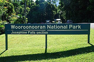
Wooroonooran National Park is a national park in Queensland, Australia, 1,367 km northwest of Brisbane, between Innisfail and Cairns.

The North Coast railway line (NCL) is a 1,681-kilometre (1,045 mi) 1067 mm gauge railway line in Queensland, Australia. It commences at Roma Street station, Brisbane, and largely parallels the Queensland coast to Cairns in Far North Queensland. The line is electrified between Brisbane and Rockhampton. Along the way, the 1680 km railway passes through the numerous towns and cities of eastern Queensland including Nambour, Bundaberg, Gladstone, Rockhampton, Mackay and Townsville. The line though the centre of Rockhampton runs down the middle of Denison Street.
Paerau is a small settlement in inland Central Otago in New Zealand's South Island. It is located in the Strath Taieri, the upper valley of the Taieri River, at the foot of the Rock and Pillar Range. "Paerau" is a Māori-language name meaning "one hundred ridges".
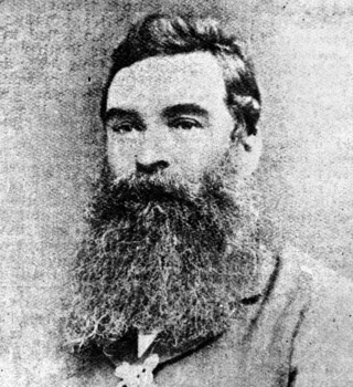
William Hann was a pastoralist and explorer in northern Queensland, Australia. His expedition in 1872 found the first indications of the Palmer River goldfield.

The Palmer River is a river in Far North Queensland, Australia. The area surrounding the river was the site of a gold rush in the late 19th century which started in 1873.
The Herveys Range Heritage Tea Rooms are an historical cafe located at the top of the Hervey Range, approximately 32 kilometres (20 mi) north-west of Townsville in North Queensland, Australia. The tea rooms are famous for being the only cafe in Queensland to include kopi luwak coffee on their menu, hailed as the most expensive coffee in the world.

The Bicentennial National Trail (BNT), originally known as the National Horse Trail, is one of the longest multi-use, non-motorised, self-reliant trails in the world, stretching 5,330 kilometres from Cooktown, Queensland, through New South Wales and the Australian Capital Territory to Healesville, 60 km north-east of Melbourne. This trail runs the length of the rugged Great Dividing Range through national parks, private property and alongside wilderness areas. The BNT follows old coach roads, stock routes, brumby tracks, rivers and fire trails. It was originally intended for horses, but is these days promoted also for cycling and walking, though it is not yet entirely suited to these two activities.

The Bohle River is a river in North Queensland, Australia.
The Hervey Range is a large mountain range about 39 kilometres (24 mi) north of Townsville, in Queensland, Australia. It is one of the highest peaks in the Townsville region and is also the location of the Herveys Range Heritage Tea Rooms. The highest point of the range is Mount Cataract, which is 709 metres (2,326 ft) high.
Hervey Bay railway line, sometimes known as Urangan railway line, is a closed railway line in Queensland, Australia. It was opened in 1896 to Pialba and it was extended to Urangan in 1913. It was extended to the end of the Urangan Pier in 1917, along with the opening of the pier. It was closed in 1993.
The Great Northern Railway is a 1067 mm gauge railway line in Queensland, Australia. The line stretches nearly 1,000 kilometres linking the port city of Townsville, Australia to the mining town of Mount Isa in north-west Queensland. Along with a passenger service called the Inlander, it is a major freight route connecting the Mount Isa Mines to the Port of Townsville. In 2010, the line moved 5.8 million tonnes of cargo, and this is expected to increase significantly in coming years.
Hervey Range is a rural locality split between the City of Townsville and the Charters Towers Region, Queensland, Australia. In the 2016 census Hervey Range had a population of 279 people.

Range Hotel, Burial Ground and Camping Reserve site is a heritage-listed archeological site at Page Road, Hervey Range, City of Townsville, Queensland, Australia. The hotel was built in 1865 to 1866. It was added to the Queensland Heritage Register on 6 March 2009.

West End Hotel is a heritage-listed hotel at 89 Ingham Road, West End, City of Townsville, Queensland, Australia. It was built in 1885 by Peter Dean. It was added to the Queensland Heritage Register on 24 June 1999.

Alley Family Graves is a heritage-listed cemetery at Gillies Highway, Gordonvale, Cairns Region, Queensland, Australia. It was built from 1887 to 1977. It was added to the Queensland Heritage Register on 23 August 1999.

Laura to Maytown Coach Road is a heritage-listed road between the towns of Laura and Maytown, Shire of Cook, Queensland, Australia. It was built from c. 1877 to c. 1895. It was added to the Queensland Heritage Register on 21 October 1992.
Eureka Hotel is a heritage-listed hotel at Hervey Range Road, Hervey Range, Charters Towers Region, Queensland, Australia. It was built c. 1865. It was added to the Queensland Heritage Register on 21 October 1992.

Quartz Hill Coach Change Station Site and Cemetery is a heritage-listed coach station in Mount Surprise, Shire of Etheridge, Queensland, Australia. It was built from 1888 to 1908. It was added to the Queensland Heritage Register on 4 July 2006.
Greenvale railway line was in northern Queensland, Australia. It carried nickel ore from a mine in Greenvale to the Queensland Nickel's refinery in Yabulu, approximately 20 kilometres (12 mi) north of Townsville.
Hervey Range Developmental Road is a continuous 125-kilometre (78 mi) road route in the Townsville and Charters Towers local government areas of Queensland, Australia. It is designated as State Route 72. It is a state-controlled regional road.