
Shoal Harbour is a small community in Newfoundland and Labrador, Canada, linked to and under the same Municipality of Clarenville.

The Bay de Verde Peninsula is the largest peninsula that makes up part of the Avalon Peninsula, of the province of Newfoundland and Labrador, Canada. The peninsula separates both Trinity and Conception Bay.
Trinity Bay is a large bay on the northeastern coast of Newfoundland in the Canadian province of Newfoundland and Labrador. The Bay along with Placentia Bay to the southwest define the isthmus of Avalon from which the Avalon Peninsula lies to the east of the main landmass of Newfoundland Island.

Sandy Cove, previously known as Savage Cove-Sandy Cove, is a town located on the Eastport Peninsula in Newfoundland and Labrador, Canada. It had a population of 132 in the 2011 census
Templeman, Newfoundland is located on the north side of Bonavista Bay just south of Cape Freels and north of Wesleyville. Templeman has a shallow and rocky harbour, therefore its harbour can only accommodate and is only suitable for small boats.
George's Brook is a village located north of Clarenville. The town is unincorporated and is a Local service district with the neighboring community of Milton.. In 1950, when it became a Canada Post Office, the first Postmistress was Mona Pelley. By 1956 it had a population of 197.
Duntara is a town located north west of Catalina, Newfoundland and Labrador. Duntara was an Incorporated Community on October 21, 1961. It had a population of 30 as of 2016.
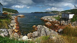
Catalina is a community located on the eastern side of the Bonavista Peninsula, in the province of Newfoundland, Canada. Catalina adjoins the union town of Port Union, the town built for and home to the Fisherman's Union Company established by Sir William Coaker.
Chance Cove is a town in the Canadian province of Newfoundland and Labrador. The town had a population of 310 in the Canada 2006 Census.
Heart's Desire is a town in the Canadian province of Newfoundland and Labrador. The town had a population of 226 in the Canada 2006 Census.
Little Catalina was a town in the Canadian province of Newfoundland and Labrador. The town had a population of 458 in the Canada 2006 Census.

Port Rexton is a small town in the Canadian province of Newfoundland and Labrador. It is located on the East Coast of the island of Newfoundland at the north end of Robinhood Bay, about 10 minutes east of Trinity and 3 hours north of St. John's. The town had a population of 690 in 1940, 449 in 1951, 454 in 1956, 351 in the Canada 2006 Census, 338 in the Canada 2011 Census and most recently 340 in the Canada 2016 Census. The town is part of a group of communities known as the Trinity Bight. The town is home to a few small businesses, including inns and restaurants.
Salvage is a town in the Canadian province of Newfoundland and Labrador. The town had a population of 174 in the Canada 2006 Census.
Sandringham is a town in the Canadian province of Newfoundland and Labrador. It is home to Terra Nova National Park. The town had a population of 255 in the Canada 2006 Census.
St. Brendan's is a town in the Canadian province of Newfoundland and Labrador. The town had a population of 145 in the Canada 2016 Census.
Trinity Bay North is a town in the Canadian province of Newfoundland and Labrador. It is located at the northern tip of Trinity Bay. The town had a population of 1,819 in the Canada 2016 Census.
Gin Cove was a small town located on the north side of Smith Sound on the east coast of Newfoundland and Labrador. The community was first recorded in the 1901 census with a population of 33. There were a variety of industries in Gin cove including fishing, woodcutting and shipbuilding. The population peaked at 45 in 1941 but in the late 1940s people started to move away to find employment, mostly to nearby Clarenville. The community was abandoned in 1960.

Fox Point is a settlement in Newfoundland and Labrador.

Division No. 1, Subdivision G is an unorganized subdivision on the Avalon Peninsula in Newfoundland and Labrador, Canada. It is in Division 1 and contains the unincorporated communities of Baccalieu Island, Besom Cove, Bradley's Cove, Burnt Point, Caplin Cove, Daniel's Cove, Grates Cove, Gull Island, Job's Cove, Kingston, Long Beach, Lower Island Cove, Low Point, Northern Bay, Ochre Pit Cove, Red Head Cove, Riverhead, Smooth Cove and Western Bay.
Division No. 1, Subdivision L is an unorganized subdivision on the Avalon Peninsula in Newfoundland and Labrador, Canada. It is in Division 1 and contains the unincorporated communities of Bareneed, Black Duck Pond, Blow Me Down, Coley's Point South, Hibb's Cove, Pick Eyes, Port de Grave, Ship Cove and The Dock
