
County Tipperary is a county in Ireland. It is located in the province of Munster. The county is named after the town of Tipperary, and was established in the early thirteenth century, shortly after the Norman invasion of Ireland. The population of the county was 159,553 at the 2016 census. The largest towns are Clonmel, Nenagh and Thurles.

Great Marlow is a civil parish within Wycombe district in the English county of Buckinghamshire located north of the town of Marlow and south of High Wycombe. The parish includes the hamlets of Bovingdon Green, Burroughs Grove, Chisbridge Cross and Marlow Common, and Danesfield, a housing estate for predominantly RAF officers, although families of other ranks from the RAF, Royal Navy and British Army also live there. Prior to November 2007 the major settlement in Great Marlow was Marlow Bottom which has now become a civil parish in its own right.

North Tipperary was a county in Ireland. It was part of the Mid-West Region and was also located in the province of Munster. It was named after the town of Tipperary and consisted of 48% of the land area of the traditional county of Tipperary. North Tipperary County Council was the local authority for the county. In 2011, the population of the county was 70,322. It was abolished on 3 June 2014, merged with South Tipperary under a new Tipperary County Council.

Ascot is a small town in East Berkshire, England, 6 miles (9.7 km) south of Windsor, 4 miles (6.4 km) east of Bracknell and 25 miles (40 km) west of London. It is most notable as the location of Ascot Racecourse, home of the Royal Ascot meeting, and is reportedly one of the most valuable towns in England when taking into account the average house price. It is also one of the most expensive towns in Britain to rent a property. The town comprises three areas: Ascot itself, North Ascot and South Ascot. It is in the civil parish of Sunninghill and Ascot.

Baldoyle is a coastal suburb of Dublin's northside. It is located in the southeastern part of the jurisdiction of Fingal, Ireland, developed from a former fishing village.

Two-Mile Borris is a village in County Tipperary, Ireland. The village is located on the L4202 road at the junction with the Ballyduff Road, close to the N75 and 7.5 km (4.7 mi) from Thurles town centre. It is also situated 1.5 km from junction 5 of the M8 motorway. Its population was 502 at the 2006 census. It is situated in the townland of Borris which is part of the civil parish of Twomileborris in the ancient barony of Eliogarty.

West Bletchley is a district and civil parish that covers the western part of Bletchley; a constituent town of Milton Keynes in Buckinghamshire, England. The parish includes part of Bletchley which is south of Standing Way (A421),
west of the West Coast Main Line, and north of Water Eaton Brook..
Plumpton is a village and civil parish in the Lewes District of East Sussex, England. The village is located five miles (8 km) north-west of Lewes. The parish measures 6.5 miles in length on its north-south axis and 1 mile at its widest on the
B2116 Underhill Road. The southern half of the parish lies within the South Downs National Park and the highest point is the crest of Plumpton Plain at 214m (702 feet), which is traversed by the South Downs Way. The parish includes the small village of Plumpton adjacent to the Downs and to the north the larger village of Plumpton Green where most of the community and services are based. Plumpton is probably best known for its race course and, to a lesser extent, Plumpton College, formerly Plumpton Agricultural College.

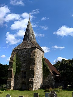
Holycross is a village and civil parish in County Tipperary, Ireland. It is one of 21 civil parishes in the barony of Eliogarty. Unusually, the civil parish straddles two counties and the baronies of Eliogarty and of Middle Third. It is also an ecclesiastical parish in the Roman Catholic Archdiocese of Cashel and Emly.
Rossmore is a small village and townland in County Tipperary in Ireland. It is in the civil parish of Clonoulty, barony of Kilnamanagh Lower. It is located in the District Electoral Division (DED) of Clonoulty West. It is also half of the Clonoulty and Rossmore parish in the Roman Catholic Archdiocese of Cashel and Emly.
Ikerrin is a barony in County Tipperary, Ireland. This geographical unit of land is one of 12 baronies in County Tipperary. Its chief town is Roscrea. The barony lies between Eliogarty to the south and Ormond Upper to the west. As a "peninsula", it is surrounded on three sides by counties Offaly and Laois. The territory is currently administered by Tipperary County Council.
Kilnamanagh Upper is a barony in County Tipperary, Ireland. This geographical unit of land is one of 12 baronies in County Tipperary. Its chief town is Borrisoleigh. The barony lies between Ormond Upper to the north, Kilnamanagh Lower to the south and Eliogarty to the east. It is currently administered by Tipperary County Council.
Kilnamanagh Lower is a barony in County Tipperary, Ireland. This geographical unit of land is one of 12 baronies in County Tipperary. Its chief town is Dundrum. The barony lies between Kilnamanagh Upper to the north, Clanwilliam to the south and Eliogarty to the east. It is currently administered by Tipperary County Council.
Middle Third is a barony in County Tipperary, Ireland. This geographical unit of land is one of 12 baronies in County Tipperary. Its chief town is Cashel. The barony lies between Eliogarty to the north, Iffa and Offa East to the south, Clanwilliam to the west and Slievardagh to the east. It is currently administered by Tipperary County Council.
Slievardagh is a barony in County Tipperary, Ireland. This geographical unit of land is one of 12 baronies in County Tipperary. Its chief town is Mullinahone. The barony lies between Eliogarty to the north, Iffa and Offa East to the south and Middle Third to the west. It is currently administered by Tipperary County Council.
Thurles Racecourse is a horse racing venue in the town of Thurles, County Tipperary, Ireland which stages National Hunt racing. Racing has taken place at Thurles since 1732 when a three-day festival took place at the venue.

Turtulla is a townland in the civil parish of Thurles, County Tipperary. It is a little over 34 acres in extent.
Just across the river, there is another, much larger, townland of the same name which belongs to Fertiana civil parish.


