Tiffany Springs, Kansas City

Last updated

Tiffany Springs is a neighborhood of Kansas City, Missouri, United States. [1]

Kansas City, Missouri City in western Missouri

Kansas City is the largest city in the U.S. state of Missouri. According to the U.S. Census Bureau, the city had an estimated population of 488,943 in 2017, making it the 37th most-populous city in the United States. It is the central city of the Kansas City metropolitan area, which straddles the Kansas–Missouri state line. Kansas City was founded in the 1830s as a Missouri River port at its confluence with the Kansas River coming in from the west. On June 1, 1850 the town of Kansas was incorporated; shortly after came the establishment of the Kansas Territory. Confusion between the two ensued and the name Kansas City was assigned to distinguish them soon after.

Missouri State of the United States of America

Missouri is a state in the Midwestern United States. With over six million residents, it is the 18th-most populous state of the Union. The largest urban areas are St. Louis, Kansas City, Springfield, and Columbia; the capital is Jefferson City. The state is the 21st-most extensive in area. In the South are the Ozarks, a forested highland, providing timber, minerals, and recreation. The Missouri River, after which the state is named, flows through the center of the state into the Mississippi River, which makes up Missouri's eastern border.

United States federal republic in North America

The United States of America (USA), commonly known as the United States or America, is a country composed of 50 states, a federal district, five major self-governing territories, and various possessions. At 3.8 million square miles, the United States is the world's third or fourth largest country by total area and is slightly smaller than the entire continent of Europe's 3.9 million square miles. With a population of over 327 million people, the U.S. is the third most populous country. The capital is Washington, D.C., and the largest city by population is New York City. Forty-eight states and the capital's federal district are contiguous in North America between Canada and Mexico. The State of Alaska is in the northwest corner of North America, bordered by Canada to the east and across the Bering Strait from Russia to the west. The State of Hawaii is an archipelago in the mid-Pacific Ocean. The U.S. territories are scattered about the Pacific Ocean and the Caribbean Sea, stretching across nine official time zones. The extremely diverse geography, climate, and wildlife of the United States make it one of the world's 17 megadiverse countries.

A variant name was "Artesian Springs". [2] A post office called Artesian Springs was established in 1891, and remained in operation until 1895. [3] The present name is after F. B. Tiffany, an original owner of the town site. [4]

The area is home to The Springs Aquatic Center, a water park that opened in May 2006. The facility, located at 9400 North Congress Avenue off Interstate 29, is operated jointly by the city (Kansas City Parks and Recreation) and the county (Platte County Parks). [5] [6] [7]

Water park amusement park that features pools with water play areas

A water park or waterpark is an amusement park that features water play areas such as swimming pools, water slides, splash pads, water playgrounds, and lazy rivers, as well as areas for bathing, swimming, and other barefoot environments. Modern water parks may also be equipped with some type of artificial surfing or bodyboarding environment, such as a wave pool or flowrider.

Interstate 29 (I-29) is a north–south Interstate Highway in the Midwestern United States that begins in Missouri. It travels through the Kansas City and St. Joseph metropolitan areas before exiting the state and entering Iowa. Almost all of I-29 in Missouri lies in an area called the Platte Purchase that was not originally part of Missouri when the state entered the Union in 1821.
Related Research Articles

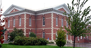
Platte County, Missouri County in the United States

Platte County is a county located in the northwestern portion of the U.S. state of Missouri. As of the 2010 census, the population was 89,322. Its county seat is Platte City. The county was organized December 31, 1838, from the Platte Purchase, named for the Platte River.

Kansas City, Kansas City and County seat in Kansas, United States

Kansas City is the third-largest city in the State of Kansas, the county seat of Wyandotte County, and the third-largest city of the Kansas City metropolitan area. Kansas City, Kansas is abbreviated as "KCK" to differentiate it from Kansas City, Missouri, after which it is named. It is part of a consolidated city-county government known as the "Unified Government". Wyandotte County also includes the independent cities of Bonner Springs and Edwardsville. As of the 2010 census, the city had a population of 145,786 residents. It is situated at Kaw Point, which is the junction of the Missouri and Kansas rivers.

Parkville, Missouri City in Missouri, United States

Parkville is a city in Platte County, Missouri, United States and is a part of the Kansas City Metropolitan Area. The population was 5,554 at the 2010 census. Parkville is known for its antique shops, art galleries, and historic downtown. The city is home to Park University, English Landing Park and National Golf Club of Kansas City and has reservoir named Riss Lake.

Blue Springs, Missouri City in Missouri, United States

Blue Springs is a city located in the U.S. state of Missouri within Jackson County. Blue Springs is located 19 miles (31 km) east of downtown Kansas City and is the eighth largest city in the Kansas City Metropolitan Area. As of the 2010 United States Census the population was 52,575, tying it for 10th largest city in the state of Missouri with St. Peters.

Kansas City metropolitan area Metropolitan area in the United States

The Kansas City metropolitan area is a 14 county metropolitan area anchored by Kansas City, Missouri, and straddling the border between the U.S. states of Missouri and Kansas. With a population of 2,104,509, it ranks as the second largest metropolitan area centered in Missouri. Alongside Kansas City, the area includes a number of other cities and suburbs, the largest being Overland Park, Kansas; Kansas City, Kansas; Olathe, Kansas; and Independence, Missouri; each over 100,000 in population. The Mid-America Regional Council (MARC) serves as the Council of Governments and the Metropolitan Planning Organization for the area.

East Leavenworth is an unincorporated community in Platte County, Missouri, United States. It is located on Route 45, approximately three miles east of Leavenworth, Kansas.

Waldron, Missouri unincorporated community in Missouri

Waldron is an unincorporated community in southwestern Platte County, Missouri, United States. Waldron is not located on a highway, but is approximately two miles southwest of the Interstate 435 and Route 45 interchange. It is about five miles west of the Kansas City city limits.

Faucett is an unincorporated community in southern Buchanan County, Missouri, United States. It is located sixteen miles north of Platte City on Interstate 29 (Missouri)/U.S. Route 71. The community is part of the St. Joseph, MO–KS Metropolitan Statistical Area.

Wallace, Missouri unincorporated community in Missouri

Wallace is an unincorporated community in southern Buchanan County, Missouri, United States. Wallace is located approximately twelve miles northwest of Platte City. Its post office has closed and mail now comes from nearby Dearborn.

Pendleton Heights is a historic neighborhood in Kansas City, Missouri, United States. It is near the downtown loop, between Paseo and Chestnut Trafficway to the west and east, and Independence Boulevard and Cliff Drive to the south and north.

Area Code 816 is the area code for Kansas City, St. Joseph, and all or part of 15 surrounding counties in northwestern Missouri. This area code originally covered most of the northern third of the state, including its borders with Illinois, Iowa, Kansas, and Nebraska, but has been reduced so that it only serves a ribbon bordering Kansas. Within Missouri, 816 borders only area code 660, the latter being a relief code when 816 was nearing exhaustion.

The Park Hill School District encompasses most of southern Platte County, Missouri, in the Northland region of the Kansas City Metropolitan Area. There are eight cities and towns that are partly or entirely within the district boundaries, including Parkville, Riverside, Weatherby Lake, Platte Woods, Lake Waukomis, Houston Lake, Northmoor and Kansas City, Missouri.

New Market is an unincorporated community in northern Platte County, in the U.S. state of Missouri. The community is located on Missouri Route 371 about 1.5 miles south of the Platte-Buchanan county line. Dearborn is two miles to the northeast across U.S. Route 71 and Bee Creek flows past the west side of the community.

Bee Creek is a stream in Buchanan and Platte counties of the U.S. state of Missouri. It is a tributary of the Missouri River.

Edgerton Junction is an unincorporated community in Platte County, in the U.S. state of Missouri.

Kerrville is an unincorporated community in Platte County, in the U.S. state of Missouri.

Linkville is a neighborhood of Kansas City, Missouri, United States.

West Platte is an unincorporated community in Platte County, in the U.S. state of Missouri.

Woodruff is an unincorporated community in Platte County, in the U.S. state of Missouri.

References

  1. "Tiffany Springs (in Platte County, MO) Populated Place Profile". MO HomeTownLocator. Retrieved 10 December 2016.
  2. U.S. Geological Survey Geographic Names Information System: Tiffany Springs, Kansas City
  3. "Post Offices". Jim Forte Postal History. Retrieved 9 December 2016.
  4. "Platte County Place Names, 1928–1945". The State Historical Society of Missouri. Archived from the original on June 24, 2016. Retrieved December 9, 2016.
  5. "The Springs Aquatic Center - About Us".
  6. "The Springs Aquatic Center". Kansas City Parks and Recreation.
  7. "The Springs Aquatic Center". Platte County Parks.

Coordinates: 39°15′41″N94°41′47″W / 39.26139°N 94.69635°W / 39.26139; -94.69635

Geographic coordinate system Coordinate system

A geographic coordinate system is a coordinate system that enables every location on Earth to be specified by a set of numbers, letters or symbols. The coordinates are often chosen such that one of the numbers represents a vertical position and two or three of the numbers represent a horizontal position; alternatively, a geographic position may be expressed in a combined three-dimensional Cartesian vector. A common choice of coordinates is latitude, longitude and elevation. To specify a location on a plane requires a map projection.