| Timbavati River( Tsonga, meaning "Sacred Lion") | |
| River | |
 | |
| Country | South Africa |
|---|---|
| Region | Mpumalanga |
| Source | |
| - location | Acornhoek, Mpumalanga |
| - coordinates | 24°35′45″S31°7′29″E / 24.59583°S 31.12472°E |
| Mouth | |
| - location | Confluence with Olifants River, Mpumalanga |
| - coordinates | 24°3′18″S31°40′39″E / 24.05500°S 31.67750°E Coordinates: 24°3′18″S31°40′39″E / 24.05500°S 31.67750°E |
 | |
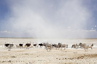
The Timbavati River is a river in Mpumalanga Province of South Africa. It flows mostly through the Kruger National Park after entering the Park adjacent to Maroela Caravan Camp 24°27′20″S31°23′53″E / 24.45556°S 31.39806°E near Orpen Rest Camp. It is a tributary of the Olifants River and the confluence is at 24°3′18″S31°40′49″E / 24.05500°S 31.68028°E .

A river is a natural flowing watercourse, usually freshwater, flowing towards an ocean, sea, lake or another river. In some cases a river flows into the ground and becomes dry at the end of its course without reaching another body of water. Small rivers can be referred to using names such as stream, creek, brook, rivulet, and rill. There are no official definitions for the generic term river as applied to geographic features, although in some countries or communities a stream is defined by its size. Many names for small rivers are specific to geographic location; examples are "run" in some parts of the United States, "burn" in Scotland and northeast England, and "beck" in northern England. Sometimes a river is defined as being larger than a creek, but not always: the language is vague.

Mpumalanga is a province of South Africa. The name means "east", or literally "the place where the sun rises" in the Swazi, Xhosa, Ndebele and Zulu languages. Mpumalanga lies in eastern South Africa, bordering Swaziland and Mozambique. It constitutes 6.5% of South Africa's land area. It shares borders with the South African provinces of Limpopo to the north, Gauteng to the west, the Free State to the southwest, and KwaZulu-Natal to the south. The capital is Mbombela (Nelspruit).

South Africa, officially the Republic of South Africa (RSA), is the southernmost country in Africa. It is bounded to the south by 2,798 kilometres (1,739 mi) of coastline of Southern Africa stretching along the South Atlantic and Indian Oceans; to the north by the neighbouring countries of Namibia, Botswana, and Zimbabwe; and to the east and northeast by Mozambique and Eswatini (Swaziland); and it surrounds the enclaved country of Lesotho. South Africa is the largest country in Southern Africa and the 25th-largest country in the world by land area and, with over 57 million people, is the world's 24th-most populous nation. It is the southernmost country on the mainland of the Old World or the Eastern Hemisphere. About 80 percent of South Africans are of Sub-Saharan African ancestry, divided among a variety of ethnic groups speaking different African languages, nine of which have official status. The remaining population consists of Africa's largest communities of European (White), Asian (Indian), and multiracial (Coloured) ancestry.
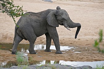 Elephant in the riverbed
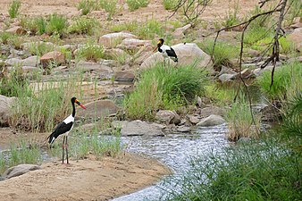 Pair of Saddle-billed storks beside the river


The African bush elephant, also known as the African savanna elephant, is the larger of the two species of African elephants, and the largest living terrestrial animal. These elephants were previously regarded as the same species, but the African forest elephant has been reclassified as L. cyclotis.
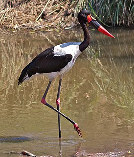
The saddle-billed stork is a large wading bird in the stork family, Ciconiidae. It is a widespread species which is a resident breeder in sub-Saharan Africa from Sudan, Ethiopia and Kenya south to South Africa, and in The Gambia, Senegal, Côte d'Ivoire and Chad in west Africa.