
Wyalkatchem townsite is located in the central agricultural region, 192 kilometres (119 mi) east-north-east of Perth and 35 kilometres (22 mi) east of Dowerin. At the 2006 census, Wyalkatchem had a population of 344.
Salt Pan Creek, an urban watercourse of the Georges River catchment, is located in the Canterbury-Bankstown region of Sydney, in New South Wales, Australia.

The Shire of Dowerin is a local government area in the Wheatbelt region of Western Australia, about 160 kilometres (100 mi) northeast of Perth, the state capital. The Shire covers an area of 1,847 square kilometres (713 sq mi) and its seat of government is the town of Dowerin.
The Mortlock Football League is an Australian rules football competition based around 8 clubs in the south-west region of Western Australia. It is one of a number of football leagues in the wheat-belt region of WA. The eight teams represent the towns of Calingiri, Dalwallinu, Dowerin, Gingin, Goomalling, Toodyay, Wongan-Ballidu. Wyalkatchem played until the end of 2010.

The Shire of Trayning is a local government area in the Wheatbelt region of Western Australia, about 60 kilometres (37 mi) northwest of Merredin and about 240 kilometres (149 mi) east of the state capital, Perth. The Shire covers an area of 1,651 square kilometres (637 sq mi), and its seat of government is the town of Trayning.

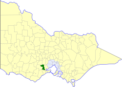
The Shire of Wyalkatchem is a local government area located in the Wheatbelt region of Western Australia. Its seat of government is the town of Wyalkatchem, about 190 kilometres (118 mi) northeast of Perth, the state capital.

Hat Head is a coastal town on the mid-northern coast of New South Wales, 459 kilometres north of Sydney, Australia, and in the Hat Head National Park. At the time of the 2011 census, Hat Head had a population of 326 people.

Ginninderra Creek, a partly perennial stream of the Murrumbidgee catchment within the Murray-Darling basin, is located in the Capital Country region spanning both the Australian Capital Territory and New South Wales, Australia.
The Shire of Bannockburn was a local government area about 85 kilometres (53 mi) west-southwest of Melbourne, the state capital of Victoria, Australia. The shire covered an area of 702.28 square kilometres (271.2 sq mi), and existed from 1862 until 1994.
The Findlay Group is a group of islands in the Canadian Arctic Archipelago in Qikiqtaaluk Region, Nunavut. This Arctic Ocean group consists of Lougheed Island, Stupart Island, Edmund Walker Island, Grosvenor Island and Patterson Island.
The Harding River is a river in the Pilbara of Western Australia. It was named on 31 July 1861 by the surveyor and explorer Francis Gregory while on expedition in the area, after one of the volunteer members of his expedition, John Harding.

Rufus River, a watercourse of the Murray catchment and part of the Murray-Darling basin, is located in the western Riverina region of south western New South Wales, Australia.

The Electoral district of Maryborough was an electorate of the Victorian Legislative Assembly based on an area around Maryborough, Victoria. It was created in the expansion of the Assembly by the Victorian Electoral Act, 1858, which took effect at the election in 1859.

Kununoppin is a small town in the Wheatbelt region of Western Australia. The town is located on the Nungarin–Wyalkatchem Road and in the Shire of Trayning local government area, 257 kilometres (160 mi) north east of the state capital, Perth, Western Australia. At the 2006 census, Kununoppin had a population of 151.
Playford River is a river in the Northern Territory of Australia and has a length of 406 km. The river originates near the base of Mount Morgan then flows in a southerly direction before veering west and eventually dicharging into Lake De Burgh. The Playford has three tributaries: Buchanan Creek, Desert Creek and Eastern Creek—as well as a number of permanent waterholes. These include Tobacco waterhole, Ibis waterhole, Upper and Lower Amazon Lagoon and Xmas megahole.
Tumbarumba Creek, a watercourse of the Murray catchment within the Murray–Darling basin, is located in the region bordering the Riverina and Australian Alps of New South Wales, Australia.
The Pipers Creek, a watercourse that is part of the Hastings River catchment, is located in the Mid North Coast region of New South Wales, Australia.
The Ralfes Creek, a perennial stream that is part of the Hastings River catchment, is located in the Mid North Coast region of New South Wales, Australia.
Pages Creek, a mostly perennial stream of the Hunter River catchment, is located in the Hunter region of New South Wales, Australia.


