
Nesset is a former municipality in Møre og Romsdal county, Norway on the Romsdal Peninsula. The administrative centre was the village of Eidsvåg. Other population centers included Rausand, Boggestranda, Myklebostad, Eresfjord, and Eikesdalen.

Tingvoll is a municipality in Møre og Romsdal county, Norway. It is part of the Nordmøre region. The administrative centre is the village of Tingvollvågen. Other villages include Meisingset, Kvisvik, and Torjulvågen. The municipality covers a peninsula on the mainland as well as a few surrounding islands. Norwegian National Road 70 and European route E39 both run through the municipality.
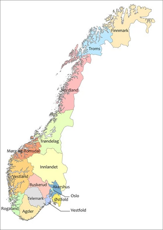
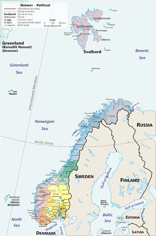
Norway is divided into 15 administrative regions, called counties which until 1918 were known as amter. The counties form the first-level administrative divisions of Norway and are further subdivided into 356 municipalities. The island territories of Svalbard and Jan Mayen are outside the county division and ruled directly at the national level. The capital Oslo is both a county and a municipality.
Norwegian Postal Codes are four-digit codes, known in Norwegian as postnummer. Posten, the Norwegian postal service, makes small modifications to the postal code system each year. In 1999 Posten made considerable changes to the postal codes in Norway.

Torvikbukt is a village in Gjemnes Municipality in Møre og Romsdal county, Norway. The village is located at the junction of the Batnfjorden and Tingvollfjorden and just northwest of the 994-metre (3,261 ft) tall mountain Reinsfjellet. The village of Øre lies about 6 kilometres (3.7 mi) to the southwest and the village of Heggem lies about 9 kilometres (5.6 mi) to the south. The 0.38-square-kilometre (94-acre) village has a population (2018) of 221 and a population density of 582 inhabitants per square kilometre (1,510/sq mi).
Batnfjord or Batnfjorden is a fjord in Gjemnes Municipality in Møre og Romsdal county, Norway. The 10-kilometre (6.2 mi) long fjord begins at the village of Batnfjordsøra, the municipal center of Gjemnes Municipality, and runs to the northeast toward the island of Bergsøya, where it joins the Tingvollfjorden. Other villages on the shores of the fjord include Gjemnes, Torvikbukt, and Øre. The European route E39 highway runs along the northern shore of the fjord. The Batnfjordelva flows into this fjord.
Tingvollfjorden is a small fishing lake in the municipality of Ål in Buskerud county, Norway. The lake is located in the valley of Hallingdal, northwest of Honefoss on the watershed of the Hallingdalselva.
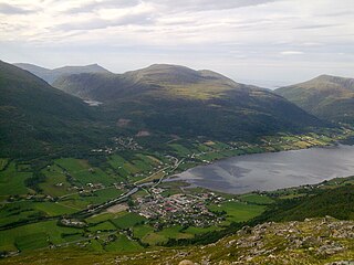
Romsdalshalvøya, sometimes translated as the Romsdal Peninsula, is a 1,560-square-kilometre (600 sq mi) peninsula located in the Romsdal district of Møre og Romsdal county in Norway. The peninsula encompasses the western Norwegian municipalities of Molde, Gjemnes, and Hustadvika.

Sunndalsfjorden is a fjord in Sunndal Municipality in Møre og Romsdal county, Norway. The 17-kilometre (11 mi) long Sunndalsfjorden comprises the southern end of the main Tingvollfjorden. It begins at the Ballsneset peninsula, at the municipal boundary of Sunndal and extends south to the village of Sunndalsøra. Other villages along the fjord include Jordalsgrenda and Øksendalsøra. The main inflow of the fjord is the river Driva which flows into the fjord at Sunndalsøra. Norwegian National Road 70 runs along the northeastern part of the fjord near Sunndalsøra.
Norway is commonly divided into five major geographical regions. These regions are purely geographical, and have no administrative purpose. However, in 2017 the government decided to abolish the current counties of Norway and to replace them with fewer, larger administrative regions. The first of these new areas came into existence on 1 January 2018, when Nord-Trøndelag and Sør-Trøndelag merged to form Trøndelag.

As a member of EFTA, Norway (NO) is not included in the Classification of Territorial Units for Statistics (NUTS), but in a similar classification used for coding statistical regions of countries that are not part of the EU but are candidate countries, potential candidates or EFTA countries. The three levels are:

Bergsøya is an island in Gjemnes Municipality in Møre og Romsdal county, Norway. The island is located near the junctions of the Freifjorden, Kvernesfjorden, and Tingvollfjorden. The highest point on the 8.8-square-kilometre (3.4 sq mi) island is the 284-metre (932 ft) tall mountain Brannhaugen.

Flemma is a village in Gjemnes Municipality in Møre og Romsdal county, Norway. The village lies along the Tingvollfjorden, about 6 kilometres (3.7 mi) north of the village of Angvika. The mountain Reinsfjellet lies about 7 kilometres (4.3 mi) to the west. Across the fjord from Flemma is the village of Gyl in Tingvoll Municipality.

Aspøya is an artificial island in Tingvoll Municipality in Møre og Romsdal county, Norway. It is located between the Freifjorden and the Tingvollfjorden. The European route E39 highway crosses Aspøya and connects it to the nearby island of Bergsøya to the west by the Bergsøysund Bridge–part of the Krifast bridge and tunnel system which connects the town of Kristansund to the mainland. To the east, the E39 highway connects it to the Straumsnes peninsula in Tingvoll.

Tingvollvågen or Tingvoll is the administrative centre of Tingvoll Municipality in Møre og Romsdal county, Norway. The village is located on a small inlet off the Tingvollfjorden, directly across the fjord from the village of Angvika. Tingvollvågen lies about 10 kilometres (6.2 mi) north of the village of Meisingset and about 20 kilometres (12 mi) south of the village of Straumsnes. The historic Tingvoll Church is located in this village. Norwegian National Road 70 runs through the village on its way from Kristiansund to Oppdal.

Øre is a former municipality in Møre og Romsdal county, Norway. The municipality existed from 1838 until its dissolution in 1965 when it was merged into Gjemnes Municipality. The 237-square-kilometre (92 sq mi) municipality was located south and west of the Batnfjorden, to the northeast of the town of Molde. The administrative centre was the village of Øre.
This page is based on this
Wikipedia article Text is available under the
CC BY-SA 4.0 license; additional terms may apply.
Images, videos and audio are available under their respective licenses.