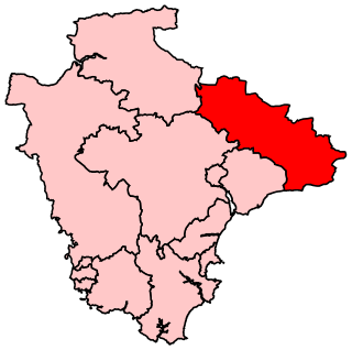
South Hams is a local government district on the south coast of Devon, England. It is administered partly by South Hams District Council, which has its headquarters in the town of Totnes, and partly by Devon County Council in the nearby city of Exeter. The area also contains the towns of Dartmouth, Kingsbridge, Salcombe and Ivybridge, the last of which is the largest, with a population of 11,851.

East Devon is a local government district in Devon, England. Its council has been based in Honiton since February 2019, and the largest town is Exmouth.

North Devon is a local government district in Devon, England. Its council is based in Barnstaple. Other towns and villages in the North Devon District include Braunton, Fremington, Ilfracombe, Instow, South Molton, Lynton and Lynmouth. The district was formed on 1 April 1974 as a merger of the Barnstaple municipal borough, the Ilfracombe and Lynton urban districts, and the Barnstaple and South Molton rural districts.

Torridge is a local government district in North Devon, England. Its council is based in Bideford. Other towns and villages in the district include Holsworthy, Great Torrington, Hartland and Westward Ho!. The island of Lundy is administratively part of the district. To the south of the district bordering Cornwall, near Welcombe, the rugged coastline has a wild untouched beauty, due to its inaccessibility, but the South West Coast Path is well defined. The district is named after the River Torridge.

West Devon is a local government district and borough in Devon, England. Towns in the district include Chagford, Okehampton, Princetown, and Tavistock, where the council is based.

Teignbridge is a local government district in Devon, England. Its council is based in Newton Abbot.

Aveton Gifford is a small rural village in the south of the English county of Devon. It lies at the head of the estuary of the River Avon or Aune, at the point where it is crossed by the A379 road. It receives its name from this river and also from the family of Giffard who held the manor. Walter Giffard came across with William the Conqueror and helped with the Domesday Book.

The Local Government Act 1972 is an Act of the Parliament of the United Kingdom that reformed local government in England and Wales on 1 April 1974.

Totnes is a constituency represented in the House of Commons of the UK Parliament since 2010 by Sarah Wollaston who was elected as a Conservative Party MP, but now sits as a member of The Independent Group.

East Devon is a constituency represented in the House of Commons of the UK Parliament since 2001 by Hugo Swire of the Conservative Party.

Tiverton and Honiton is a constituency in Devon represented in the House of Commons of the UK Parliament since 2010 by Neil Parish, a Conservative.

Alverdiscott is a village, civil parish, former manor and former ecclesiastical parish in the Torridge district of Devon, centred 5.5 miles (9 km) SSW of Barnstaple.

Beaford is a village and civil parish in the Torridge district of Devon, England. The village is about five miles south-east of Great Torrington, on the A3124 road towards Exeter. According to the 2001 census the parish had a population of 393, compared to 428 in 1901. The western boundary of the parish is formed by the River Torridge and it is surrounded, clockwise from the north, by the parishes of St Giles in the Wood, Roborough, Ashreigney, Dolton, Merton and Little Torrington.

Barnstaple Town Football Club is a football club based in Barnstaple, Devon, England. They are currently members of Division One South & West of the Southern League and play at Mill Road.
St. Thomas was a rural district, in the County of Devon, England from 1894 to 1974. The offices were in Southernhay East, inside the City of Exeter, but outside the County of Devon.

Tiverton was a constituency located in Tiverton in east Devon, formerly represented in the House of Commons of the Parliament of the United Kingdom. Enfranchised as a parliamentary borough in 1615 and first represented in 1621, it elected two Members of Parliament (MPs) by the first past the post system of election until 1885. The name was then transferred to a county constituency electing one MP.
Launceston Rural District was a local government division of Cornwall between 1894 and 1974. Established under the Local Government Act 1894, the rural district was enlarged in 1966 by the abolition of Broadwoodwidger Rural District, in Devon, to include the civil parishes of North Petherwin and Werrington.

South Hams District Council is the council administering the non-metropolitan district of the South Hams in Devon, England. It was formed in 1974 and covers a population of around 85,000. The District Council is part of a three-tier government with Devon County Council above and town and parish councils below. It elects 31 councillors every four years and has historically been represented by the Conservative Party.


