The Legislative Assembly is the legislative branch of the government of El Salvador.
Los Trancos Woods is an unincorporated community in San Mateo County, California near the border of Santa Clara County. The US Geological Survey, National Geographic Names Database, show it as a feature type populated place. The area does not have its own unique ZIP code; it is in ZIP code 94028 and area code 650. The community adjoins the City of Palo Alto's Foothills Park. It is on the US Geological Survey's 7.5-minute "Mindego Hill" quadrangle. Coordinates in the National Geographic Names Database are shown as 37°20′58″N122°11′58″W. County documents suggest the community may eventually be annexed by Portola Valley.
La Jalca is a district of the Chachapoyas Province in the Amazonas Region, Peru. Its capital is La Jalca, also known as Jalca, Jalca Grande or La Jalca Grande. It was the first Spanish foundation of the region. The current city of Chachapoyas was established here. Founded in 1538 as San Juan de la Frontera de los Chachapoyas Chachapoyas was later moved to its present location.
Yamón District is one of seven districts of the province Utcubamba in Peru.

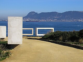
The Bay of Cádiz is a body of water in the province of Cádiz, Spain, adjacent to the southwestern coast of the Iberian Peninsula.

The comarca of the Campiña de Jerez is a comarca in the province of Cádiz, southern Spain.
Mariano Melgar District is one of the twenty-nine districts of the Arequipa Province in Peru.

Ocobamba District is one of the eight districts of the province Chincheros in Peru.
Mollebaya District is one of twenty-nine districts of the province Arequipa in Peru.

Olleros District is one of twelve districts of the province Huaraz in Peru.
Yanama District is one of eight districts of the province Yungay in Peru.
Noceda de Rengos is one of 54 parish councils in Cangas del Narcea, a municipality within the province and autonomous community of Asturias, in northern Spain.
Pinillos is a village in the province and autonomous community of La Rioja, Spain. The municipality covers an area of 11.89 square kilometres (4.59 sq mi) and as of 2011 had a population of 18 people.
Batería de San Melitón de la Calavera is a former defensive stronghold located near the beach of Camposoto at the southern end of the town of San Fernando in the Province of Cádiz, Andalusia, Spain. This battery was used to protect the Isla de Leon during the Siege of Cadiz and was part of the defense line of the Castle of Sancti Petri. It is 2 kilometers from the Batería de Aspiroz.

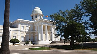
Capitanía General de San Fernando is an institution of the Spanish Armada, located in San Fernando in the Province of Cádiz, Andalusia, Spain. It was moved from Cadiz to San Fernando in 1769, and then relocated to its current location at the end of the Calle Real in the year 1917.

Hospital Militar de San Carlos is a hospital located in San Fernando in the Province of Cádiz, Andalusia, Spain. Construction of the original hospital building took place by the Franciscans in February 1809, during the war of independence, but the current building was completed in 1981. Located next to the Panteón de Marinos Ilustres, it was the tallest building in San Fernando until the Torres de la Casería de Ossio surpassed it by several metres.
The Real Instituto y Observatorio de la Armada is the scientific institute and astronomical observatory of the Spanish Navy (Armada), located in San Fernando in the Province of Cádiz, Andalusia, Spain.
The Parque del Centenario is a park located in Algeciras. It was established in 2007 thanks to the collaboration between the Port Authority of the Bay of Algeciras and City Hall to mark the hundredth anniversary of the Algeciras Conference. The park covers more than 100,000 m2, and lies on the ruins of the old Fuerte de San García, destroyed around 1811 by the British troops on the occasion of the independence war between Spain and France. Surrounding the park are several developments of villas and two beaches, San Garcia and the Chinarral.
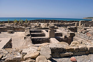
The Roman fish salting factory was a salting factory established on the seafront of Algeciras, southeastern Spain by the Romans. It belonged to the fishing village of San Nicolás, part of what was called Caetaria. A site of archaeological and historical interest, it was declared a Bien de Interés Cultural site on 27 June 2002.
Qosqoccahuarina is a private area of conservation in the Urubamba mountain range in the Andes of Peru. It is located in the Cusco Region, Urubamba Province, Ollantaytambo District. It lies in the community of Rumira Sondormayo at the Patacancha valley near Patacancha. The area of conservation of Qosqoccahuarina is recognized by Resolución Ministerial No. 089-2011-MINAM. The aim is to protect the Polylepis forest and its avifauna, the hydrographical basins of the community and the wild flora and fauna of the Andean highlands.