Toulaman River

Last updated
Map Dominica.png
Map

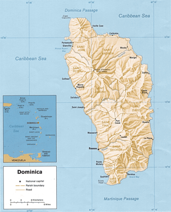
The Toulaman River is a river in Dominica. Its source is in the Morne Diablotins. It empties into the sea on the northeastern coast, north of Marigot.

See also

Related Research Articles

<span class="mw-page-title-main">Portsmouth, Dominica</span> Town in Saint John Parish, Dominica

Portsmouth is the second largest town in Dominica, with 3,630 inhabitants. It is located on the shore of a natural Harbor, Prince Rupert Bay, in Saint John Parish on the north-west coast of Dominica. The area was called Ouyouhao by the Kalinago and Grand Anse by the French. The Indian River is Portsmouth’s southern border and Cabrits National Park is located on a peninsula to the north of town.

<span class="mw-page-title-main">Rosalie, Dominica</span>

Rosalie is a village in Dominica. It is located in Saint David Parish at the northern end of Rosalie Bay, on the central east coast of the island, close to the mouth of the Rosalie River.

<span class="mw-page-title-main">Massacre, Dominica</span>

Massacre is a town in Saint Paul Parish, Dominica, with about 1,200 inhabitants. It is located on the central west coast of the island, to the north of the capital, Roseau, on the Massacre River.

<span class="mw-page-title-main">Roseau River (Dominica)</span> River in Dominica

The Roseau River is one of the major rivers in Dominica. With a total length of 13.6 km (8.5 mi), it has a drainage basin area size of 33 km2 (13 sq mi).

The Melville Hall River is a river in Dominica. It is located in the north of the island, flowing northeast from the slopes of Morne Diablotin and discharging into the Atlantic Ocean between the villages of Wesley and Marigot.

Penville or Pennville is a village in Dominica's Saint Andrew Parish. The community is situated just north of Vieille Case, and has a population of 524.

The Canal River is a river on the Caribbean island of Dominica.

The River Claire is a river on the Caribbean island of Dominica.

The Coulibistrie River is a river on the Caribbean island of Dominica. It flows from the interior westward through a deep valley, and empties into the Caribbean Sea north of Batalie Bay. It is fast-flowing river, with small rapids and numerous bathing pools.

The Eden River is a river in Dominica.

The Fond Figues River is a river on the Caribbean island of Dominica.

The Indian River is a river on the Caribbean island of Dominica. It flows to the Caribbean Sea between the town of Portsmouth and the village of Glanvillia. The Indian is the widest river in Dominica.

The Massacre River is a river on the Caribbean island of Dominica.

The Maréchal River is a river on the Caribbean island of Dominica.

The Lamoins River is a river in Dominica.

The Malabuka River is a river on the Caribbean island of Dominica.

The Trois Pitons River is a river on the Caribbean island of Dominica.

The Woodford Hill River is a river located in the village of Woodford Hill on the Caribbean island of Dominica.

The River Sarisari is a river on the Caribbean island of Dominica.

<span class="mw-page-title-main">Coulibistrie</span> Village in Dominica

Coulibistrie is a village on the west coast of Dominica, in the northwest corner of Saint Joseph Parish. It is between the villages of Colihaut to the north and Morne Rachette to the south. It extends inland from the coast within a deep valley, along both banks of the Coulibistrie River. The village is primarily residential with few businesses. Many of the houses are built directly atop or adjoining the numerous large boulders that litter the valley along its base.

References

15°33′N61°18′W / 15.550°N 61.300°W / 15.550; -61.300