
London International Airport is located 5 nautical miles northeast of the city of London, Ontario, Canada.

Catania–Fontanarossa Airport, also known as Vincenzo Bellini Airport, is an international airport 2.3 NM southwest of Catania, the second largest city on the Italian island of Sicily. It is named after the opera composer Vincenzo Bellini, who was born in Catania.

Royal Air Force Station Folkingham or RAF Folkingham is a former Royal Air Force station located south west of Folkingham, Lincolnshire and about 29 miles (47 km) due south of county town Lincoln and 112 miles (180 km) north of London, England.

Vincenzo Florio Airport Trapani–Birgi, also known simply as Trapani Airport, is a military and public airport serving Trapani, in Sicily, Italy. Located between Trapani and Marsala, it is one of the five civil airports in Sicily, but is also used for military purposes. In 2015, 1,586,992 passengers passed through the airport, making it the third-busiest airport in Sicily. The civil airport is named after the Sicilian industrialist Vincenzo Florio Sr..
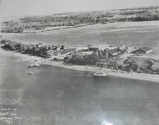
Canadian Forces Base Rockcliffe is a former Canadian Forces Base located in the eastern part of Ottawa, Ontario, now used for Ottawa/Rockcliffe Airport and the Canada Aviation and Space Museum.

Comiso Airport "Pio La Torre", also known as Vincenzo Magliocco Airport, is located in the Sicilian town of Comiso in the Ragusa province. The airport serves Comiso, Ragusa, Vittoria and Gela. It changed from military to civil use during 2005–2008. The airport was opened to commercial and general aviation 30 May 2013.

Ponte Olivo Airfield is an abandoned pre-World War II airport and later wartime military airfield in Sicily, 3 km north of Gela. Its last known use was by the United States Army Air Force Twelfth Air Force in 1944 during the Italian Campaign.

Youks-les-Bains Airfield is an abandoned military airfield in Algeria, located about 20 km northwest of Tebessa. The airfield today consists of several agricultural fields, with the faint remains of its main runway, parts of a taxiway and a few aircraft dispersal hardstands visible in aerial photography.
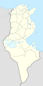
Hergla Airfield is an abandoned military airfield in Tunisia, which was located approximately 12 km north-northwest of Harqalah in al Janubiyah Wilayat province, about 90 km south-southwest of Tunis.

The Foggia Airfield Complex was a series of World War II military airfields located within a 40 km (25 mi) radius of Foggia, in the Province of Foggia, Italy. The airfields were used by the United States Army Air Force Fifteenth Air Force as part of the strategic bombardment campaign against Nazi Germany in 1944 and 1945, as well as by Twelfth Air Force and the Royal Air Force during the Italian Campaign (1943–1945).
Lecce Airfield is an abandoned World War II military airfield in Italy, which is located approximately 5 km east of Lecce in the Salentine Peninsula. Built in 1943 by United States Army Engineers, the airfield was primarily a Fifteenth Air Force B-24 Liberator heavy bomber base used in the strategic bombing of Germany. Lecce was also used by tactical aircraft of Twelfth Air Force in the Italian Campaign.

Dole–Jura Airport, also known as Franche-Comté Regional Airport, is an airport serving Dole, a commune in the Jura department in the Bourgogne-Franche-Comté region in eastern France. The airport is located 7 km (4 NM) southwest of Dole, and southeast of Tavaux. It was formerly known as Dole–Tavaux Airport. The airport is used for general aviation, and for a few commercial airline services.
Borizzo Airfield is an abandoned World War II military airfield in Italy, which was located in the vicinity of Trapani on Sicily.

Giebelstadt Army Airfield was a closed military airfield located in Germany southwest of Giebelstadt (Bavaria); approximately 250 miles southwest of Berlin. It was turned over to the German government on 23 June 2006 and is now a general aviation airport.

Fort Sumner Municipal Airport is a village owned, public use airport located two nautical miles (4 km) northeast of the central business district of Fort Sumner, a village in De Baca County, New Mexico, United States. It is included in the National Plan of Integrated Airport Systems for 2011–2015, which categorized it as a general aviation airport.

Sicily Airport may refer to one of the airports listed below.

Ganzhou Huangjin Airport (former) was the old airport serving the city of Ganzhou in Jiangxi Province, China. The airport was located in Shuinan New Area in Zhanggong District. It was named after the nearby village of Huangjin. Originally built in 1936, it was one of the first civil airports in China, but was closed in March 2008 when all services were transferred to the new airport, also named Ganzhou Huangjin Airport.

Matagorda Peninsula Army Airfield is a closed military airfield, located on Matagorda Island, Texas. It was used during World War II as a training airfield by the 77th Flying Training Wing, Army Air Forces Central Flying Training Command.


