Tropical cyclone effects in Europe

Last updated
Tracks of all cyclones affecting Europe between 1851 and 2014 Europe Tropical Cyclone Tracks.png
Tracks of all cyclones affecting Europe between 1851 and 2014

The effects of tropical cyclones in Europe and their extratropical remnants include strong winds, heavy rainfall, and in rare instances, tornadoes or snowfall. Only two modern cyclones officially are being regarded as directly impacting mainland Europe while still fully tropical or subtropical: Hurricane Vince in 2005, which struck southwestern Spain as a tropical depression; and Subtropical Storm Alpha in 2020, which made landfall in northern Portugal at peak intensity. It is possible that Hurricane Debbie in 1961, may have been tropical still, when it made landfall in northwestern Ireland, but this is disputed. [nb 1] It is believed that a hurricane struck Europe in 1842.

Contents

Atlantic hurricanes generally do not form east of the 30th meridian west, and those that do typically continue to the west. Storms can move around the Bermuda high and turn to the northeast and affect Europe. Several extratropical cyclones have struck Europe, and they were called colloquially "hurricanes". Some of these European windstorms had hurricane-force winds of greater than 119 km/h (74 mph). Those storms are not included in this list. [1]

Climatology and predictions

Advanced meteorological observation stations and ship reports allowed Atlantic hurricanes to be tracked for extended durations, including to the European mainland in some cases, beginning in the 1860s. Most storms that affected Europe have done so from August to October, which is the climatological peak of the Atlantic hurricane season. In a survey of such European tropical cyclones from 1961 to 2010, Dr. Kieran Hickey observed that the storms generally formed west of Africa and recurved to the northeast, or formed off the east coast of the United States and proceeded eastward. Ireland and the United Kingdom experience the most effects, due to their positions far to the west of the rest of Europe. Countries that are as far to the east as Estonia [2] and Russia [3] have experienced tropical cyclone impacts.

Tropical-like systems, referred to as "medicanes," [4] are occasionally observed over the Mediterranean. Several of these storms have developed eye-like features and hurricane-force winds; however, their nature is contrary to that of a tropical cyclone. The majority of these storm originate from deep, cold-core lows which they do not fully disassociate from. Additionally, unlike tropical systems, sea surface temperatures above 26 °C (79 °F) are not required for their development. [5]

The Royal Netherlands Meteorological Institute predicted that by the year 2100, global warming would increase greatly the threat of hurricane-force winds to western Europe from former tropical cyclones and hybrid storms, the latter similar to Hurricane Sandy in 2012, in a paper published in April 2013. [6] One model predicted an increase from 2 to 13 in the number of cyclones with hurricane-force winds in the waters offshore western Europe. The study suggested that conditions favorable for tropical cyclones would expand 1,100 km (680 mi) to the east. A separate study based out of University of Castilla–La Mancha predicted that hurricanes would develop in the Mediterranean Sea in Septembers by the year 2100, which would threaten countries in southern Europe. [7]

Storms

Pre-1900

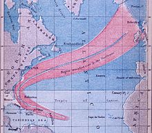
Track of a hurricane in 1848 that extended from the United States to Europe Augsep1848hurricanetrack.jpg
Track of a hurricane in 1848 that extended from the United States to Europe

1900–1980s

Surface weather analysis of the extratropical remnants of Hurricane Faith over northwestern Europe on September 6, 1966. Hurricane Faith surface analysis September 6, 1966.png
Surface weather analysis of the extratropical remnants of Hurricane Faith over northwestern Europe on September 6, 1966.

1990s

Remnants of Hurricane Charley in 1986 moving over Ireland and the United Kingdom as an extratropical storm Hurricane Charley as viewed from the NOAA 9 Satellite, 26 August 1986.png
Remnants of Hurricane Charley in 1986 moving over Ireland and the United Kingdom as an extratropical storm

2000s

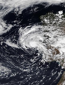
Hurricane Vince on October 9, 2005, northwest of the Madeira Islands Hurricane Vince on 2005-10-09, 1200.jpg
Hurricane Vince on October 9, 2005, northwest of the Madeira Islands
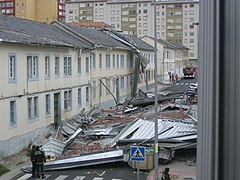
Wind damage from the remnants of Hurricane Gordon in Ferrol, Spain 21-S.JPG
Wind damage from the remnants of Hurricane Gordon in Ferrol, Spain

2010s

Extratropical cyclone formed from the remnants of Hurricane Bertha over Europe Bertha 2014-08-11 VIIRS.jpg
Extratropical cyclone formed from the remnants of Hurricane Bertha over Europe

2020s

Subtropical Storm Alpha shortly after designation on September 18, 2020 Alpha 2020-09-18 1305Z.jpg
Subtropical Storm Alpha shortly after designation on September 18, 2020

See also

Notes

  1. For the purposes of the article, mainland Europe is defined as the continent of Europe, including the British Isles and Iceland, but excluding the outermost regions of the European Union, such as the offshore archipelagos of the Azores and the Canary Islands.

Related Research Articles

<span class="mw-page-title-main">1958 Atlantic hurricane season</span> Hurricane season in the Atlantic Ocean

The 1958 Atlantic hurricane season included every tropical cyclone either affecting or threatening land. There were ten named storms as well as one pre-season tropical storm. Seven of the storms became hurricanes, including five that were major hurricanes, or the equivalent of a Category 3 on the Saffir-Simpson scale. The strongest storm was Hurricane Helene, which became a strong Category 4 hurricane with 150 mph (240 km/h) winds and a barometric pressure of 930 mbar while just offshore the southeastern United States.
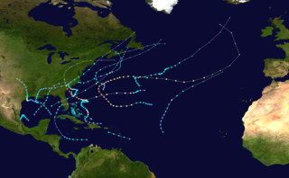
<span class="mw-page-title-main">1959 Atlantic hurricane season</span> Hurricane season in the Atlantic Ocean

The 1959 Atlantic hurricane season had a then record-tying number of tropical cyclones – five – develop before August 1. The season was officially to begin on June 15, 1959 and last until November 15, 1959, the period of each year when most tropical cyclones form in the Atlantic basin, however in actuality the season began early when Tropical Storm Arlene formed on May 28. Tropical Storm Arlene struck Louisiana and brought minor flooding to the Gulf Coast of the United States. The next storm, Beulah, formed in the western Gulf of Mexico and brought negligible impact to Mexico and Texas. Later in June, an unnamed hurricane, nicknamed the Escuminac disaster, caused minor damage in Florida and devastated coastal Nova Scotia and New Brunswick, after becoming extratropical. Hurricane Cindy brought minor impact to The Carolinas. In late July, Hurricane Debra produced flooding in the state of Texas. Tropical Storm Edith in August and Hurricane Flora in September caused negligible impact on land.

<span class="mw-page-title-main">1961 Atlantic hurricane season</span> Hurricane season in the Atlantic Ocean

The 1961 Atlantic hurricane season was a hyperactive Atlantic hurricane season, with an accumulated cyclone energy (ACE) total of 189. The season, however, was an average one in terms of named storms. The season featured eight hurricanes and a well above average number of five major hurricanes. It was previously thought that the season had a record-tying seven major hurricanes, before the Atlantic hurricane reanalysis project downgraded two storms in 2019. Two Category 5 hurricanes were seen in 1961, making it one of only seven Atlantic hurricane seasons to feature multiple Category 5 hurricanes in one season. The season started on June 15, and ended on November 15. These dates conventionally delimit the period of each year when most tropical cyclones form in the Atlantic basin. The first system, an operationally unclassified tropical depression, formed offshore east Central Florida on June 10, but dissipated a few days later. Next, Hurricane Anna developed in the eastern Caribbean Sea near the Windward Islands on July 20. It brought minor damage to the islands, as well as wind and flood impacts to Central America after striking Belize as a hurricane. Anna caused one death and about $300,000 (1961 USD) in damage. Activity went dormant for nearly a month and a half, until Hurricane Betsy developed on September 2. Betsy peaked as a Category 4 hurricane, but remained at sea and caused no impact.

<span class="mw-page-title-main">1962 Atlantic hurricane season</span> Hurricane season in the Atlantic Ocean

The 1962 Atlantic hurricane season featured Hurricanes Daisy and Ella – two tropical cyclones that showed the latest dates for the fourth and fifth named storms on record since tropical cyclones were first named in the North Atlantic ocean, starting in 1950, when they both formed on September 29 and October 14. On the same hand, it was the least active since 1939, with only five named storms. Although the season officially began on June 15, the first named storm did not form until August 26, the third-latest date. Hurricane Alma brushed the Outer Banks before becoming extratropical southeast of New England, destroying hundreds of boats and producing beneficial rainfall. In late August, Tropical Storm Becky developed unusually far east in the Atlantic Ocean, becoming the easternmost storm on record to recurve to the northeast. Celia followed in the September, forming east of the Lesser Antilles and executing a loop near Bermuda before dissipating. Hurricane Daisy, the latest fourth named storm, was the costliest of the season, leaving about $1.1 million in damage in New England (1962 USD). The storm dropped the highest rainfall total on record in Maine, and its precipitation caused 22 traffic fatalities. The final hurricane – Ella – the latest fifth named storm – was also the strongest, remaining offshore of the eastern United States but causing two deaths.

<span class="mw-page-title-main">1966 Atlantic hurricane season</span> Hurricane season in the Atlantic Ocean

The 1966 Atlantic hurricane season saw the Weather Bureau office in Miami, Florida, be designated as the National Hurricane Center (NHC) and assume responsibility of tropical cyclone forecasting in the basin. The season officially began on June 1, and lasted until November 30. These dates conventionally delimit the period of each year when most tropical cyclones form in the Atlantic basin. It was an above-average season in terms of tropical storms, with a total of 15. The first system, Hurricane Alma, developed over eastern Nicaragua on June 4 and became the most recent major hurricane in the month of June. Alma brought severe flooding to Honduras and later to Cuba, but caused relatively minor impact in the Southeastern United States. Alma resulted in 91 deaths and about $210.1 million (1966 USD) in damage.
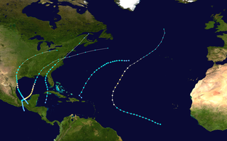
<span class="mw-page-title-main">1902 Atlantic hurricane season</span> Hurricane season in the Atlantic Ocean

The 1902 Atlantic hurricane season featured five known tropical cyclones, three of which made landfall in the United States. The first system was initially observed in the northwestern Caribbean on June 12. The last system dissipated on November 6 while located well southeast of Newfoundland. These dates fall within the period with the most tropical cyclone activity in the Atlantic. None of the systems existed simultaneously.

<span class="mw-page-title-main">Hurricane Lili (1996)</span> Category 3 Atlantic hurricane in 1996

Hurricane Lili was a relatively long-lived hurricane of the 1996 Atlantic hurricane season that affected countries from Central America to the United Kingdom. Lili formed on October 14 from a tropical wave, which emerged from the coast of west Africa on October 4. After the storm formed, further strengthening of Lili was gradual, first to tropical storm status on October 16 and then to hurricane status on October 17. The next day, Lili struck Cuba and moved across the central portion of the island, the first hurricane to hit the country since Hurricane Kate in 1985. After emerging into the Atlantic Ocean, the hurricane accelerated northeastward, briefly peaking as a category 3 hurricane on the Saffir-Simpson Hurricane Scale near the Bahamas. For almost an entire week, Hurricane Lili oscillated in intensity while fluctuating several times in forward speed. About two weeks passed before Lili transitioned into an extratropical storm north of the Azores on October 27, which subsequently moved across Ireland and Great Britain.

<span class="mw-page-title-main">Hurricane Charley (1986)</span> Category 1 Atlantic hurricane

Hurricane Charley was the second hurricane to threaten the East Coast of the United States within a year's timeframe, after Hurricane Gloria of 1985. The third tropical storm and second hurricane of the season, Charley formed as a subtropical low on August 13 along the Florida panhandle. After moving off the coast of South Carolina, the system transitioned into a tropical cyclone and intensified into a tropical storm on August 15. Charley later attained hurricane status before moving across eastern North Carolina. It gradually weakened over the north Atlantic Ocean before transitioning into an extratropical cyclone on August 20. Charley's remnants remained identifiable for over a week, until after crossing Ireland and Great Britain they dissipated on August 30.

<span class="mw-page-title-main">Tropical Storm Josephine (1996)</span> Atlantic tropical storm in 1996

Tropical Storm Josephine was an unusual Atlantic tropical storm that moved from west to east across the Gulf of Mexico in October 1996. It formed on October 4 as a tropical depression from the remnants of a cold front. Early in its duration, the system interacted with a ridge over the central United States, which produced strong winds and high tides along the Texas coast. The outer rainbands caused flooding rainfall in southern Texas, and in Louisiana, high tides flooded roads and stranded residents on Grand Isle. Moving generally to the east due to a trough, the depression intensified into a tropical storm on October 6, and the next day reached peak winds of 70 mph (110 km/h) while approaching the west coast of Florida. Josephine made landfall in Taylor County near peak intensity early on October 8, and soon after became extratropical. While moving ashore, the storm produced a high storm surge reaching 9.3 ft (2.8 m) in Suwannee. High tides flooded about 3,600 houses along the west coast. Josephine also produced heavy rainfall, which flooded hundreds of homes, and high winds, which left 400,000 people without power. The storm also spawned at least 16 tornadoes, one of which damaged 130 homes.

<span class="mw-page-title-main">Tropical Storm Alberto (2006)</span> Atlantic tropical cyclone

Tropical Storm Alberto was the first tropical storm of the 2006 Atlantic hurricane season. Forming on June 10 in the northwestern Caribbean, the storm moved generally to the north, reaching a maximum intensity of 70 mph (110 km/h) before weakening and moving ashore in the Big Bend area of Florida on June 13. Alberto then moved through eastern Georgia, North Carolina, and Virginia as a tropical depression before becoming extratropical on June 14.
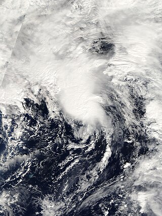
<span class="mw-page-title-main">Subtropical Storm Nicole</span> Atlantic subtropical storm in 2004

Subtropical Storm Nicole was the first subtropical storm to receive a name using the standard hurricane name list that did not become a tropical cyclone. The fifteenth tropical or subtropical cyclone and fourteenth named storm of the 2004 Atlantic hurricane season, Nicole developed on October 10 near Bermuda from a broad surface low that developed as a result of the interaction between an upper level trough and a decaying cold front. The storm turned to the northeast, passing close to Bermuda as it intensified to reach peak winds of 50 mph on October 11. Deep convection developed near the center of the system as it attempted to become a fully tropical cyclone. However, it failed to do so and was absorbed by an extratropical cyclone late on October 11.

<span class="mw-page-title-main">Hurricane Gordon (2006)</span> Category 3 Atlantic hurricane

Hurricane Gordon was the first tropical cyclone since 1992 to affect the Azores while retaining tropical characteristics. The eighth tropical storm, third hurricane, and first major hurricane of the 2006 Atlantic hurricane season, Gordon formed on September 10 in the tropical Atlantic Ocean. It gradually matured into a hurricane as it tracked northward, reaching its peak intensity with winds of 195 km/h (121 mph) early on September 14 while located about 925 km (575 mi) southeast of Bermuda. After becoming nearly stationary, Gordon weakened to minimal hurricane status, although it re-intensified after accelerating to the east. It weakened again after moving over cooler waters, and passed through the Azores on September 20. Shortly thereafter, it became an extratropical cyclone and subsequently affected Spain, Ireland, and the United Kingdom.

<span class="mw-page-title-main">Tropical Storm Grace (2009)</span> Atlantic tropical storm in 2009

Tropical Storm Grace holds the record for being the farthest northeast forming tropical cyclone in the Atlantic basin. The seventh named storm of the slightly below average 2009 Atlantic hurricane season, Grace formed from an extratropical cyclone over the Azores on 4 October. It strengthened to attain peak sustained winds of 65 mph (100 km/h) and developed an eye-like feature, although cold sea surface temperatures inhibited the development of thunderstorm activity near the center. The storm lost its tropical characteristics on 6 October, and the storm's remnants merged with a separate system near the British Isles on 7 October.

<span class="mw-page-title-main">2014 Atlantic hurricane season</span> Hurricane season in the Atlantic Ocean

The 2014 Atlantic hurricane season was a below-average hurricane season in terms of named storms and major hurricanes, though average in terms of number of hurricanes overall. It produced nine tropical cyclones, eight of which became named storms; six storms became hurricanes and two intensified further into major hurricanes. The season officially began on June 1, and ended on November 30. These dates historically describe the period each year when most tropical cyclones form in the Atlantic basin. The first storm of the season, Arthur, developed on July 1, while the final storm, Hanna, dissipated on October 28, about a month prior to the end of the season. 2014 is the most recent year with an average or below average number of named Atlantic storms.

<span class="mw-page-title-main">Hurricane Rafael</span> Category 1 Atlantic hurricane in 2012

Hurricane Rafael produced minor damage in the northeastern Caribbean Sea in mid-October 2012. The seventeenth named storm and ninth hurricane of the 2012 hurricane season, Rafael originated from a tropical wave roughly 230 mi (370 km) south-southeast of Saint Croix on October 12; because the system already contained tropical storm-force winds, it skipped tropical depression status. Though initially disorganized due to moderate wind shear, a subsequent decrease allowed for shower and thunderstorm activity to develop in earnest by October 14. While moving north-northwestward the following morning, Rafael intensified into a Category 1 hurricane. A cold front off the East Coast of the United States caused the system to turn northward and eventually northeastward by October 16, at which time Rafael attained its peak intensity with maximum sustained winds of 90 mph (150 km/h). As the cyclone entered a more stable atmosphere and tracked across increasingly cooler sea surface temperatures, it began extratropical transition, a process the system completed by the following afternoon. However, Rafael's extratropical remnant persisted for another nine days, with the storm looping around a larger extratropical low over the north-central Atlantic, before turning southeastward and then eastward. Rafael's remnant later made landfall on Portugal on October 26, before dissipating later that day.

<span class="mw-page-title-main">Tropical cyclones in the Mascarene Islands</span>

Since 1656, at least 300 tropical cyclones have affected the Mascarene Islands in the southern Indian Ocean. The archipelago consists of several islands, including Mauritius, Réunion, and Rodrigues. Mauritius claims responsibility for several Outer Islands, including St. Brandon and Agaléga, and has disputed territorial claims of Tromelin Island and the Chagos Archipelago. The deadliest tropical cyclone to affect the region was one that struck Mauritius in 1892, which killed 1,200 people, left 50,000 people homeless, and destroyed one-third of the capital Port Louis.

References

  1. 1 2 3 4 5 6 7 David Longshore (1998). Encyclopedia of Hurricanes, Typhoons, and Cyclones, New Edition. New York: Facts on File. p. 110. ISBN   9781438118796 . Retrieved 2013-06-19.
  2. 1 2 Ingrid Teesalu (September 14, 2011). "Gales Leave 900 Households Blacked Out". err.ee. Retrieved September 9, 2020.
  3. 1 2 Ослабевший ураган "Катя" добрался до Санкт-Петербурга (in Russian). KM Онлайн. September 15, 2011. Retrieved September 9, 2020.
  4. M. Tous & R. Romero (2011-12-13). "Meteorological environments associated with medicane development". International Journal of Climatology. 33 (1): 1–14. Bibcode:2013IJCli..33....1T. doi:10.1002/joc.3428. S2CID   129155891 . Retrieved 2013-06-29.
  5. L. Fita; R. Romero; A. Luque; Kerry Emmanuel & R. Ramis (2007-01-15). "Analysis of the environments of seven Mediterranean tropical-like storms using an axisymmetric, nonhydrostatic, cloud resolving model" (PDF). Natural Hazards and Earth System Sciences. 7 (1): 41–56. Bibcode:2007NHESS...7...41F. doi: 10.5194/nhess-7-41-2007 .
  6. Haarsma, R J (2013-03-18). "More hurricanes to hit western Europe due to global warming". Geophysical Research Letters. 40 (9): 1783–1788. Bibcode:2013GeoRL..40.1783H. doi:10.1002/grl.50360. S2CID   9084384.
  7. Masters, Jeff (2013-04-08). "Europe expected to see a large increase in Hurricane Sandy-like hybrid storms". Weather Underground. Retrieved 2020-09-03.
  8. Wheeler, D.; García-Herrera, R.; Vaquero, J. M.; Chenoweth, M.; Mock, C. J. (2009). "Reconstructing The Trajectory of The August 1680 Hurricane From Contemporary Records". Bulletin of the American Meteorological Society. 90 (7): 971–978. Bibcode:2009BAMS...90..971W. doi: 10.1175/2009BAMS2649.1 .
  9. Liberato, Margarida L.R. (2014). "The 19 January 2013 windstorm over the north Atlantic: Large-scale dynamics and impacts on Iberia". Weather and Climate Extremes. 5–6: 16–28. doi: 10.1016/j.wace.2014.06.002 .
  10. Domínguez-Castro, F.; Trigo, R. M.; Vaquero, J. M. (21 November 2012). "The first meteorological measurements in the Iberian Peninsula: evaluating the storm of November 1724". Climatic Change. 118 (2): 443–455. doi:10.1007/s10584-012-0628-9. hdl: 10.1007/s10584-012-0628-9 . S2CID   56398071.
  11. J.Vaquero M.García-Herrera, R.; Wheeler, D.; Chenoweth, M.; Mock, C. J. (2008-02-01). "A Historical Analog of 2005 Hurricane Vince". Bulletin of the American Meteorological Society. 89 (2): 191–201. Bibcode:2008BAMS...89..191V. doi: 10.1175/BAMS-89-2-191 .
  12. "Hurricane of August and September 1848". National Oceanic & Atmospheric Administration. Retrieved 2013-06-14.
  13. José Fernández Partagás (2003). Year 1883 (PDF) (Report). National Oceanic and Atmospheric Administration. Retrieved 2013-06-14.
  14. José Fernández Partagás (2003). Year 1884 (PDF) (Report). National Oceanic and Atmospheric Administration. Retrieved 2013-06-14.
  15. José Fernández Partagás (2003). Year 1887 a (PDF) (Report). National Oceanic and Atmospheric Administration. Retrieved 2013-06-14.
  16. José Fernández Partagás (2003). Year 1887 b (PDF) (Report). National Oceanic and Atmospheric Administration. Retrieved 2013-06-14.
  17. José Fernández Partagás (2003). Year 1906 (PDF) (Report). National Oceanic and Atmospheric Administration. Retrieved 2013-06-14.
  18. "Storm Three 1917 Metadata". National Hurricane Center. National Oceanic and Atmospheric Administration. 2008. Retrieved 2013-06-12.
  19. "Storm Two 1922 Metadata". National Hurricane Center. National Oceanic and Atmospheric Administration. 2009. Retrieved 2013-06-12.
  20. "Storm One 1927 Metadata". National Hurricane Center. National Oceanic and Atmospheric Administration. 2009. Retrieved 2013-06-12.
  21. Mitchell, Charles L. (September 1932). "The Tropical Storm of August 30 – September 15, 1932" (PDF). Monthly Weather Review. 60 (9): 177–178. Bibcode:1932MWRv...60..177.. doi: 10.1175/1520-0493(1932)60<177:TTSOAI>2.0.CO;2 . Retrieved 2013-06-12.
  22. "Storm Four 1932 Metadata". National Hurricane Center. National Oceanic and Atmospheric Administration. 2013. Retrieved 2013-06-12.
  23. "Storm Four 1932 Raw Data" (.XLS). National Hurricane Center. National Oceanic and Atmospheric Administration. 2013. Retrieved 2013-06-12.
  24. "Storm Nine 1944 Metadata". National Hurricane Center. National Oceanic and Atmospheric Administration. 2013. Retrieved 2013-06-19.
  25. "Storm Twelve 1944 Metadata". National Hurricane Center. National Oceanic and Atmospheric Administration. 2013. Retrieved 2013-06-19.
  26. 1 2 3 4 5 6 7 8 9 10 11 12 13 "Atlantic hurricane best track (HURDAT version 2)" (Database). United States National Hurricane Center. September 19, 2022. Retrieved December 9, 2022.
  27. Moore, Paul L. (1957-12-01). "The Hurricane Season of 1957" (PDF). Monthly Weather Review. 85 (12): 401–408. Bibcode:1957MWRv...85..401M. doi:10.1175/1520-0493(1957)085<0401:THSO>2.0.CO;2 . Retrieved 2013-06-12.
  28. "World Briefs". The Owosso Argus-Press. London, United Kingdom. Associated Press. 1957-09-25. p. 21. Retrieved 2013-06-12.
  29. Hurricane Debbie — September 7–15, 1961 Preliminary Report (PDF). National Weather Bureau (Report). National Oceanic and Atmospheric Administration. 1961. Retrieved 2013-01-01.
  30. "Gale Killed Fifteen". Irish Independent. September 18, 1961. p. 3.  via Irish Newspaper Archives (subscription required)
  31. "Man Hurt In Storm Dies". Irish Press. October 2, 1961. p. 7.  via Irish Newspaper Archives (subscription required)
  32. "Ferry Boat Captain Credits Luck". Edmonton Journal. Associated Press. 1966-09-08. p. 41. Retrieved 2013-06-21.
  33. Lars Andreas Roald (2008). Rainfall Floods and Weather Patterns (PDF) (Report). Norwegian Water Resources and Energy Directorate. pp. 31 and 34. Archived from the original (PDF) on 2013-10-05. Retrieved 2013-02-14.
  34. Arnold L. Sugg (March 1967). The Hurricane Season of 1966 (PDF) (Report). National Hurricane Center. pp. 137 and 138. Retrieved 2013-02-27.
  35. Arnold L. Sugg & Joseph M. Pelissier (April 1968). "The Hurricane Season of 1967" (PDF). Monthly Weather Review. 96 (4): 248. Bibcode:1968MWRv...96..242S. doi:10.1175/1520-0493(1968)096<0242:THSO>2.0.CO;2 . Retrieved 2013-06-21.
  36. "MV Fiete Schulze (+1967)". Wreck Site. Retrieved August 26, 2013.
  37. John R. Hope (1973). "Hurricane Fran (Bravo) Preliminary Report". National Hurricane Center. p. 3. Retrieved 2013-06-21.
  38. Hurricane Irene Preliminary Report (GIF) (Report). National Hurricane Center. 1981-10-20. Retrieved 2013-06-21.
  39. Miles B. Lawrence (1985-11-03). Hurricane Gloria Preliminary Report (GIF) (Report). National Hurricane Center. p. 2. Retrieved 2013-08-11.
  40. Irish Meteorological Service (1986). "August 1986 Monthly Weather Bulletin". Archived from the original on 2011-06-17. Retrieved 2008-10-25.
  41. Mary C. Bourke (1990). "The effect of Hurricane Charley on the Cloghoge River, Ireland". Planetary Science Institute. Archived from the original on 2007-02-22. Retrieved 2008-10-26.
  42. National Meteorology Library and Archive (1986). "Charley comes to Wales: 25 August 1986". Government of the United Kingdom.
  43. Staff Writer (1986-08-26). "Tail End of Hurricane Charley Kills At Least 11 in Britain and Ireland". Associated Press.  via LexisNexis (subscription required)
  44. Harold P. Gerrish (1987-10-16). "Hurricane Arlene Preliminary Report: Page Two". National Hurricane Center. Retrieved 2011-06-12.
  45. J.G. Pinto, M. Klawa, U. Ulbrich, R.Rudari and P. Speth (October 2001). "Extreme Precipitation Events Over Northwest Italy" (PDF). Centro di Ricerca Interuniversitario in Monitoraggio Ambientale. Archived from the original (PDF) on 2011-10-05. Retrieved 2013-06-12.{{cite web}}: CS1 maint: multiple names: authors list (link)
  46. Ian Murray (1993-09-14). "Nimrod rescues plane hit by lightning in mid-Atlantic". The Times.  via LexisNexis (subscription required)
  47. Barbara Mcmahon & David Taylor (1993-09-14). "Mountain Rescue for Cadets as Storms Rage". Evening Standard. p. 1.  via LexisNexis (subscription required)
  48. Chris Thorncrof; Sarah C. Jones (April 2000). "The Extratropical Transitions of Hurricanes Felix and Iris in 1995". Monthly Weather Review . 128 (4): 947–972. Bibcode:2000MWRv..128..947T. doi: 10.1175/1520-0493(2000)128<0947:TETOHF>2.0.CO;2 . ISSN   1520-0493.
  49. Chris Court & Andrew Woodcock (1995-09-07). "Hurricane Iris Blows Into Britain". Press Association.  via LexisNexis (subscription required)
  50. Richard Pasch (1997-02-21). Tropical Storm Josephine Preliminary Report (Report). National Hurricane Center. Retrieved 2013-06-21.
  51. Miles B. Lawrence (1996-11-18). Hurricane Lili Preliminary Report (Report). National Hurricane Center. Retrieved 2013-06-17.
  52. Richard Pasch (1999-01-19). Hurricane Danielle Preliminary Report (Report). National Hurricane Center. Retrieved 2013-06-17.
  53. Andy Gales (1998-09-29). "Hurricane is set to storm into Britain". The Evening Chronicle. Newcastle, United Kingdom. (accessed via Lexis Nexis on 2013-06-10)
  54. Richard J. Pasch (1999-02-08). Hurricane Jeanne Tropical Cyclone Report (Report). National Hurricane Center. Retrieved 2013-06-17.
  55. Lynne Kelleher (1998-11-10). "Hurricane Mitch leaves 30,000 homes in dark out after night of chaos". The Mirror. London. Retrieved 2013-06-10.
  56. Kettle, Anthony J. (23 December 2021). "Storm Anatol over Europe in December 1999: impacts on societal and energy infrastructure". Advances in Geosciences. 56: 141–153. Bibcode:2021AdG....56..141K. doi:10.5194/adgeo-56-141-2021. S2CID   245454598.
  57. 1 2 Ulbrich, U.; Fink, A. H.; Klawa, M.; Pinto, J. G. (March 2001). "Three extreme storms over Europe in December 1999" (PDF). Weather. 56 (3): 70–80. Bibcode:2001Wthr...56...70U. doi:10.1002/j.1477-8696.2001.tb06540.x. S2CID   45202242.
  58. Jack Beven (2000-12-08). Hurricane Alberto Tropical Cyclone Report (Report). National Hurricane Center . Retrieved 2013-06-09.
  59. Richard J. Pasch (2000-12-18). Hurricane Isaac Tropical Cyclone Report (Report). National Hurricane Center. Retrieved 2013-06-09.
  60. Chuck Kruger (2000). "Tail-end of Hurricane Sets A Record On Cape". Surfbirds.com. Archived from the original on January 7, 2009. Retrieved 2011-05-26.
  61. James Franklin; Daniel Brown (2000-11-05). Tropical Storm Leslie Tropical Cyclone Report (Subtropical Depression One) (Report). National Hurricane Center. Retrieved 2013-06-09.
  62. Brett Israel (2011-09-12). "Article: How Often Does Britain Get Hit by Hurricanes?". LiveScience.com. Retrieved 2013-06-09.
  63. Kevin Boyle; Gary Padgett (2002). "October 2002 Worldwide Tropical Summary". Australian Severe Weather. Retrieved 2013-06-09.
  64. Gary Padgett (2003). "April 2003 Global Tropical Cyclone Summary" . Retrieved 2013-06-09.
  65. Kevin Boyle (2003). "Monthly Global Tropical Cyclone Summary September 2003". Gary Padgett. Retrieved 2013-06-11.
  66. 1 2 3 August 2004 Weather Summary (Report). United Kingdom Met Office. 2013-02-27. Retrieved 2013-06-14.
  67. Jack Beven (2004-12-17). Hurricane Karl Tropical Cyclone Report (Report). National Hurricane Center. Retrieved 2013-06-09.
  68. October 2004 Weather Summary (Report). United Kingdom Met Office. 2013-02-27. Retrieved 2013-06-14.
  69. Richard J. Pasch; Eric S. Blake (2006-02-08). Hurricane Maria Tropical Cyclone Report (PDF) (Report). National Hurricane Center. Retrieved 2013-06-14.
  70. A. Stohl; C. Forster; H. Sodemann (2008). "Remote sources of water vapor forming precipitation on the Norwegian west coast at 60ºN–a tale of hurricanes and an atmospheric river" (PDF). Journal of Geophysical Research. 113 (D5): n/a. Bibcode:2008JGRD..113.5102S. doi:10.1029/2007jd009006.
  71. 1 2 "Weakened Hurricane Maria Leaves One Dead In Norway". Terra Daily. Agence France-Presse. 2005-09-14. Retrieved 2013-06-14.
  72. 1 2 Ove Langeland; Per Medby; Bjørg Langset (2011-05-31). Climate Change and Territorial Effects on Regions and Local Economies (PDF) (Report). European Observation Network. Archived from the original (PDF) on 2014-01-09. Retrieved 2013-06-14.
  73. "Norske ekstremvær får navn" (in Norwegian). Norwegian Meteorological Institute. Retrieved 9 January 2014.
  74. James L. Franklin (2006-02-22). Hurricane Vince Tropical Cyclone Report (PDF) (Report). National Hurricane Center. Retrieved 2013-06-10.
  75. "Problemas en varias carreteras de la provincia". Diario Córdoba (in Spanish). 2005-10-13. Archived from the original on 2008-09-16. Retrieved 2013-06-10.
  76. Lixion Avila; Daniel Brown (2006-08-11). Tropical Storm Alberto Tropical Cyclone Report (PDF) (Report). National Hurricane Center. Retrieved 2013-06-14.
  77. June 2006 Weather Summary (Report). United Kingdom Met Office. 2013-02-27. Retrieved 2013-06-14.
  78. 1 2 Eric Blake (2006-11-14). Hurricane Gordon Tropical Cyclone Report (PDF) (Report). National Hurricane Center. Retrieved 2011-05-03.
  79. Agencia Estatal de Meteorología. "Las Consecuencias de Gordon en Espana" (PDF) (in Spanish). Government of Spain. Archived from the original on October 4, 2006. Retrieved 2011-05-09.{{cite web}}: CS1 maint: unfit URL (link)
  80. Lewis Smith & Paul Simons (2006-09-22). "Gordon keeps the forecasters guessing". The Sunday Times. Retrieved 2011-05-10.
  81. Daniel P. Brown (2006-11-15). Hurricane Helene Tropical Cyclone Report (PDF) (Report). National Hurricane Center. Retrieved 2013-06-14.
  82. Richard J. Pasch (2009-02-04). Tropical Storm Laura Tropical Cyclone Report (PDF) (Report). National Hurricane Center. Retrieved 2013-06-10.
  83. "Tropical storm brings floods". The Westmorland Gazette. 2008-10-04. Retrieved 2013-06-11.
  84. Laura Harding (2009-08-27). "More rain expected in parts of UK". The Independent. Retrieved 2013-06-10.
  85. Robbie Berg (2009-11-28). Tropical Storm Grace Tropical Cyclone Report (PDF) (Report). National Hurricane Center. Retrieved 2013-06-10.
  86. October 2009 Weather Summary (Report). United Kingdom Met Office. 2013-02-27. Retrieved 2013-06-14.
  87. 1 2 3 4 Stacy Stewart (2012-01-16). Hurricane Katia Tropical Cyclone Report (PDF) (Report). National Hurricane Center. Retrieved 2013-06-10.
  88. 1 2 Post-tropical storm Katia – September 2011 (Report). United Kingdom Met Office. 2011-11-15. Retrieved 2013-06-10.
  89. "Snow and high winds forecast as hurricane and Arctic air combine to blast Scotland". The Daily Record. 2011-10-06. Retrieved 2013-06-10.
  90. Fred Campagna (2012-09-12). "Remnants of Leslie follow freak snow storm in Iceland". Right Weather. Retrieved 2013-06-11.
  91. "Worked to become 3 am". Mbl.is. 2012-09-11. Retrieved 2013-06-14.
  92. Daniel P. Brown (2013-01-08). Hurricane Nadine Tropical Cyclone Report (PDF) (Report). National Hurricane Center. Retrieved 2013-06-11.
  93. "Tropical Storm Nadine finally breaks up". BBC. 2012-10-05. Retrieved 2013-06-11.
  94. October 2012 Weather Summary (Report). United Kingdom Met Office. 2013-02-27. Retrieved 2013-06-14.
  95. Lixion Avila (2013-01-14). Hurricane Rafael Tropical Cyclone Report (PDF) (Report). National Hurricane Center. Retrieved 2013-06-10.
  96. "European Severe Weather Database". European Severe Storms Laboratory. 2013. Retrieved 2013-06-22.
  97. "UK weather still affected by ex-hurricane Bertha". BBC News. 11 August 2014. Retrieved 11 August 2014.
  98. "Coup de vent en Manche". Météo-France/CMS. 10 August 2014. Retrieved 11 August 2014.
  99. "Impacts of ex-hurricane Bertha". Met Office. 12 August 2014. Retrieved 26 August 2014.
  100. "Iceland in the eye of the storm (Translated from Icelandic)". Visir.
  101. BBC editorial staff (October 21, 2014). "Hurricane Gonzalo: Woman hit by tree in London dies". The British Broadcasting Corporation. Retrieved October 21, 2014.
  102. "Hurricane Gonzalo live: two dead as winds batter Britain". Telegraph.co.uk. 21 October 2014. Archived from the original on 21 October 2014. Retrieved 21 October 2014.
  103. "Wetter-News für Deutschland, Europa und weltweit – Wetter24.de". Wetter24.de. Archived from the original on 24 October 2014. Retrieved 16 October 2018.
  104. Greece Flooding, Caused By Slow-Moving Remnants of Hurricane Gonzalo, Covers Athens Streets Archived 2014-11-15 at the Wayback Machine
  105. "A mini heatwave is on its way to the UK". Independent.co.uk . 26 June 2015. Retrieved 16 October 2018.
  106. "TD 9 Forms in Central Atlantic".
  107. "More severe weather forecast for southern and eastern Europe but calmer conditions here in the UK". 11 October 2015. Retrieved 16 October 2018.
  108. Maier‐Gerber, Michael; Pantillon, Florian; Muzio, Enrico Di; Riemer, Michael; Fink, Andreas H.; Knippertz, Peter (1 August 2017). "Birth of the Biscane". Weather. 72 (8): 236–241. Bibcode:2017Wthr...72..236M. doi: 10.1002/wea.2995 .
  109. "Three killed as storm sweeps into Ireland". BBC News. 17 October 2017. Retrieved 16 October 2018.
  110. "Clear-up after Ophelia wind damage". BBC News. 17 October 2017. Retrieved 16 October 2018.
  111. "Rina to bring rain and wind to Ireland and UK into early Saturday".
  112. "Tropical storm Ernesto looks set to reach Ireland on Saturday night". Newsweek . 18 August 2018. Retrieved 16 October 2018.
  113. Laud, Georgina (17 August 2018). "Storm Ernesto path update: Where is Storm Ernesto now? When will it hit UK?". Express.co.uk. Retrieved 2 October 2018. According to the NHC: "Ernesto is moving quickly toward the northeast near 25 mph (41 km/h), and an even faster motion toward the northeast or east-northeast is expected during the next day or two."
  114. Godlewski, Nina (18 August 2018). "Tropical storm Ernesto looks set to reach Ireland on Saturday night". Newsweek. Retrieved 2 October 2018. But the storm was still set to bring heavy rains and some wind gusts to the islands off the coast of Ireland and the country itself by Saturday night and continuing into Sunday. Heavy rain was expected in some areas and was expected to lighten through the day Sunday to a drizzle, according to the Met Service. The storm could even bring rain to Scotland, Northern Ireland and other parts of the United Kingdom after passing over Ireland.
  115. Godlewski, Nina (18 August 2018). "Tropical storm Ernesto looks set to reach Ireland on Saturday night". Newsweek. Retrieved 2 October 2018. About an inch of rain was expected to fall in most places as the storm traveled across the U.K. though some areas could see higher rainfall totals, AccuWeather reported. Areas where more rain falls could potentially cause flash flooding.
  116. Godlewski, Nina (18 August 2018). "Tropical storm Ernesto looks set to reach Ireland on Saturday night". Newsweek. Retrieved 2 October 2018. The strongest gusts of winds were expected to be between 30 and 40 mph
  117. "Storm Ernesto on course for the UK and Ireland this weekend". Sky News. Retrieved 2 October 2018. Western Ireland will also see "thicker cloud, stronger winds and persistent rain", according to Sky News weather presenter Jo Edwards.
  118. "Storm Ernesto on course for the UK and Ireland this weekend". Sky News. Retrieved 2 October 2018. Ernesto will leave behind a legacy of overcast and muggy conditions when it eventually clears into the North Sea late on Sunday.
  119. Avila, Lixion. Post-Tropical Cyclone Leslie Tropical Cyclone Update. National Hurricane Center (Report). National Oceanic and Atmospheric Administration. Retrieved 13 October 2018.
  120. "A tempestade Leslie entrou pela Figueira da Foz e fustigou o Centro" (in Portuguese). Diário de Notícias. October 14, 2018. Retrieved October 14, 2018.
  121. "UK weather forecast: Storm Sebastian strikes with heavy rain and high winds as Met Office issues yellow warnings". INews UK. November 27, 2019.
  122. Daniel P. Brown (January 28, 2021). Subtropical Storm Alpha Tropical Cyclone Report (PDF) (Report). Miami, Florida: National Hurricane Center. p. 3. Retrieved July 1, 2021.
  123. "Hurricane Zeta path: How UK weather will be affected by US tropical storm – and latest Met Office forecast". 29 October 2020.
  124. "Tropical Storm THETA".
  125. http://www.met.fu-berlin.de/de/wetter/maps/Analyse_20211008.gif [ bare URL image file ]
  126. http://www.met.fu-berlin.de/de/wetter/maps/Analyse_20211009.gif [ bare URL image file ]
  127. . 2022-06-12 https://web.archive.org/web/20220612015125/https://www.orkneyharbours.com/documents/forecast?nc=1636000681. Archived from the original on 2022-06-12. Retrieved 2022-06-12.{{cite web}}: Missing or empty |title= (help)