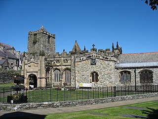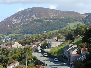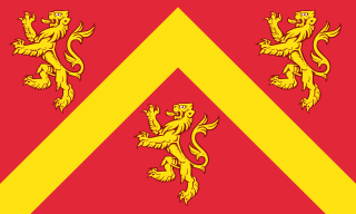
Holyhead is a town in Wales and a major Irish Sea port serving Ireland. It is also a community and the largest town in the Isle of Anglesey county, with a population of 13,659 at the 2011 census. Holyhead is on Holy Island, which is separated from Anglesey by the Cymyran Strait and was originally connected to Anglesey via the Four Mile Bridge and now by the Stanley Embankment.

Cemaes is a village on the north coast of Anglesey in Wales, sited on Cemaes Bay, an Area of Outstanding Natural Beauty which is partly owned by the National Trust. It is the most northerly village in Wales. The name Cemaes derives from the Welsh word cemais, meaning "bend or loop in a river, inlet of sea, bay". In 2011 the population of Cemaes in Llanbadrig community was 1,357.

Penmaenmawr is a town and community in Conwy County Borough, Wales, which was formerly in the parish of Dwygyfylchi. It is on the North Wales coast between Conwy and Llanfairfechan and was an important quarrying town, though quarrying is no longer a major employer. The population of the community was 4,353 in 2011, including Dwygyfylchi and Capelulo. The town itself having a population of 2,868 (2011).

The North Wales Coast Line, also known as the North Wales Main Line, is the railway line from Crewe to Holyhead. Virgin Trains consider their services along it to be a spur of the West Coast Main Line.

Wylfa Nuclear Power Station is a former Magnox power station situated west of Cemaes Bay on the island of Anglesey, North Wales. Construction of the two 490 MW nuclear reactors, known as "Reactor 1" and "Reactor 2", began in 1963. They became operational in 1971. Wylfa was located on the coast because seawater was used as a coolant.

Cemlyn Bay is a bay on the northwest coast of Anglesey, North Wales, approximately 2.5 km west of Wylfa nuclear power station, within the community of Cylch-y-Garn.

Valley railway station is a railway station that serves the village of Valley in Anglesey, Wales. It is the last station before the western terminus of the North Wales Coast Line at Holyhead. It also serves the nearby RAF base and Anglesey Airport.

A generation II reactor is a design classification for a nuclear reactor, and refers to the class of commercial reactors built up to the end of the 1990s. Prototypical generation II reactors include the PWR, CANDU, BWR, AGR, VVER and RBMK.

Cemaes Bay F.C. is a football team playing in the Anglesey Football League. Between 1995 and 1998 the club played in the League of Wales.
Cestyll Garden is a secluded garden with picturesque sea views near Cemaes on the north west coast of the island of Anglesey in North Wales, United Kingdom.

The A5025 is an 'A' road that runs from Llanfairpwllgwyngyll to Valley in Anglesey, Wales. A major road around the north coast of the isle, it runs up the east, north and finally north-west side of the island via several places including Benllech and Amlwch. In all the road is 33.1 miles (53.3 km) long.

Horizon Nuclear Power is a British energy company that is expected to build new nuclear power stations in the United Kingdom. It was established in 2009, with its head office in Gloucester, and is now owned by Hitachi.

Dwygyfylchi is a village in Conwy County Borough, Wales. The community contains the nearby settlement of Penmaenmawr and has a population of 4,353. The electoral ward of Capelulo which includes Dwygyfylchi had a population of 1,485 in 2011.

Many parts of Wales are protected areas, according to a number of designations. They include three national parks, and five Areas of Outstanding Natural Beauty.

The Kattang Nature Reserve is a protected nature reserve that is located in the Mid North Coast region of New South Wales, on the eastern coast of Australia. The 68-hectare (170-acre) reserve is situated 7 kilometres (4.3 mi) from Laurieton, 47 kilometres (29 mi) south of Port Macquarie and 10 kilometres (6.2 mi) east of the Pacific Highway, near Kew.

The Brunswick Heads Nature Reserve is a protected nature reserve located in the Northern Rivers region of New South Wales, Australia. The 221-hectare (550-acre) reserve is situated near Brunswick Heads and contains an intact segment of littoral rainforest.
Wamberal Lagoon, an intermittently closed intermediate saline coastal lagoon, is located on the Central Coast region of New South Wales, Australia. Wamberal Lagoon is located between the beachside settlements of Forresters Beach and Wamberal, and adjacent to the east coast, about 87 kilometres (54 mi) north of Sydney.
Tregele is a small village located Mechell Community, in north Anglesey, Wales. Located about a mile south-west of the larger coastal village of Cemaes, it is also close to the Wylfa Nuclear Power Station on Wylfa Head. Despite its small size Tregele has a petrol station and used to have a pub. One kilometre south of the village is a cromlech named Llanfechell Cromlech.

Ngambaa Nature Reserve, including Red Cedar Park is a protected area of 10,560 hectares, situated in the Mid North Coast region of New South Wales. The nearest large town is Macksville. The reserve endeavours to protect a large number of rare and threatened flora and fauna species, such as rainforest and four species of ironbark trees. An interesting local species is the small bolwarra, one of the most primitive of flowering plants. The landscapes are of significance to the local Aboriginal communities, and contain relics of historical use by non-Aboriginal people.


