Tweedsmuir Park may refer to:
| This disambiguation page lists articles about distinct geographical locations with the same name. If an internal link led you here, you may wish to change the link to point directly to the intended article. |
Tweedsmuir Park may refer to:
| This disambiguation page lists articles about distinct geographical locations with the same name. If an internal link led you here, you may wish to change the link to point directly to the intended article. |
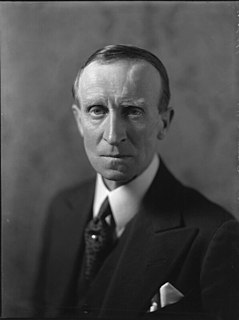
John Buchan, 1st Baron Tweedsmuir, was a Scottish novelist, historian, and Unionist politician who served as Governor General of Canada, the 15th since Canadian Confederation.
Thomas Dufferin ("Duff") Pattullo was the 22nd Premier of British Columbia, Canada from 1933 to 1941. The Pattullo Bridge is named in his honour as well as Prince Rupert's Pattullo Park, Mount Pattullo, and the Pattullo Range in North Tweedsmuir Provincial Park, and the Pattullo Glaciers in that range.
The Chilcotin region of British Columbia is usually known simply as "the Chilcotin", and also in speech commonly as "the Chilcotin Country" or simply Chilcotin. It is a plateau and mountain region in British Columbia on the inland lee of the Coast Mountains on the west side of the Fraser River. Chilcotin is also the name of the river draining that region. In the language of the Chilcotin people their name and the name of the river means "people of the red ochre river"

The Pacific Ranges are the southernmost subdivision of the Coast Mountains portion of the Pacific Cordillera. Located entirely within British Columbia, Canada, they run northwest from the lower stretches of the Fraser River to Bella Coola and Burke Channel, north of which are the Kitimat Ranges. The Coast Mountains lie between the Interior Plateau and the Coast of British Columbia.

The Kitimat Ranges are one of the three main subdivisions of the Coast Mountains in British Columbia, Canada, the others being the Pacific Ranges to the south and the Boundary Ranges to the north.

The Rainbow Range, formerly known as the Rainbow Mountains, is a mountain range in British Columbia, Canada, located 40 kilometres (25 mi) northwest of Anahim Lake. Located on the western edge of the Chilcotin Plateau, the range adjoins the Coast Mountains Pacific Ranges to the south, and the Kitimat Ranges to the north. In some classification systems it is considered part of the Coast Mountains. It lies north of the Bella Coola and Atnarko Rivers and south and west of the Dean River, which curves around its north flank, and is relatively drier in climate and easier of terrain than more mountainous areas immediately west.

Monarch Mountain is one of the principal summits of the Pacific Ranges subdivision of the Coast Mountains in southern British Columbia. It stands just east of a pass between the Klinaklini River and the south branch of the Atnarko River, which is a tributary of the Bella Coola River. Surrounding Monarch Mountain is the Monarch Icefield, the northernmost of the major icefields of the Pacific Ranges, and just south of it is the Ha-Iltzuk Icefield, which is the largest. Monarch is in the southern end of Tweedsmuir South Provincial Park.
Entiako Provincial Park and Protected Area is a provincial park in British Columbia, Canada, located on the south flank of the Nechako River watercourse. It was formerly part of Tweedsmuir Provincial Park until that park was broken up; its sibling parks from that change are Tweedsmuir North Provincial Park and Protected Area and Tweedsmuir South Provincial Park.

Tweedsmuir North Provincial Park and Protected Area is a provincial park in British Columbia, Canada, which along with Tweedsmuir South Provincial Park and Entiako Provincial Park and Protected Area were once part of Tweedsmuir Provincial Park, then B. C.'s largest park, 9,810 square kilometres (3,790 sq mi) located in the Coast Range. Tweedsmuir gained park status in 1938 and Wells Gray Provincial Park in 1939, the earliest large parks established in the provincial parks system. Tweedsmuir North Provincial Park and Protected Area was re-designated a park and protected area as the latter classification allows resource extraction and other economic activities not permitted in full park designations. Entiako Provincial Park and Protected Area is located on the south flank of the Nechako River watercourse.

Tweedsmuir South Provincial Park is a provincial park located in the central west of British Columbia, Canada. Formerly part of Tweedsmuir Provincial Park which was originally 981,000 hectares in size. It was formed from the southern portion of that park, the northern portion being re-designated Tweedsmuir North Provincial Park and Protected Area in order to allow resource extraction in the park.

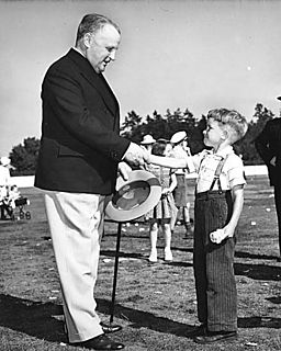
Lord Tweedsmuir Secondary is a public high school in the Vancouver suburb of Surrey, British Columbia, Canada and is part of School District 36 Surrey. In September 1993, staff and students from Cloverdale Junior Secondary and Lord Tweedsmuir Senior Secondary joined together to form Lord Tweedsmuir Secondary, and moved into the new building. Lord Tweedsmuir's name has been attached to a school in the Cloverdale area since 1940 when Canada's Governor General, John Buchan, Lord Tweedsmuir of Elsfield died.
Strathcona-Tweedsmuir School is a private university prep school in Okotoks, Alberta, Canada. It has students in Grades K to 12. Its Grade 12 provincial exam scores are consistently some of the most highly ranked in the province. Strathcona-Tweedsmuir is Southern Alberta's first full IB World School, and Alberta's only independent school authorized to deliver IB Programmes in Grades 1 through 12. Strathcona-Tweedsmuir School ranks well in the annual Fraser Institute surveys. Strathcona is also an active participator in the CESI program, and often volunteers teachers for inter-school evaluatory interaction. STS is also a member of Round Square and CAIS.

The Alexander MacKenzie Heritage Trail is a 420 km (260 mi) long historical overland route between Quesnel and Bella Coola, British Columbia, Canada. Of the many grease trails connecting the Coast with the Interior, it is the most notable and often is referred to as the Grease Trail.
Tsitsutl Peak is the highest volcanic peak of the Rainbow Range in British Columbia, Canada, located within Tweedsmuir South Provincial Park, 43 km (27 mi) northwest of Anahim Lake and 44 km (27 mi) northeast of Thunder Mountain.

The Interior Mountains, also called the Northern Interior Mountains and Interior Ranges, are the semi-official names for a huge area that comprises much of the northern two thirds of the Canadian province of British Columbia and a large area of southern Yukon.
Tweedsmuir may refer to:
The Pattullo Range is a subrange of the Hazelton Mountains, located south of Tesla Lake and northeast of Bella Coola in northern British Columbia, Canada. Its highest summit is Tsaydaychuz Peak, 2758 m.
The Quanchus Range is a subrange of the Nechako Plateau in the Interior of British Columbia, Canada, located on the north end of Tweedsmuir North Provincial Park and Protected Area. It is almost completely an island after the creation of the Nechako Reservoir. Its two main summits are Michel Peak (2260m) and Tweedsmuir Peak (2194m).
The Edwards Range is a small mountain range near the northern end of the Pacific Ranges of the Coast Mountains of British Columbia, Canada, located north of Gellenspetz Creek and southeast of the town of Bella Coola. It has an area of 179 km2.

The Kitlope Heritage Conservancy or Huchsduwachsdu Nuyem Jees in the Haisla language, is a provincial park located on the Pacific coast of the province of British Columbia, Canada. It preserves the largest continuous tract of coastal temperate rainforest in the world. Beginning at the head of Gardner Canal, the park stretches inland along the Kitlope River to the border of Tweedsmuir Provincial Park.