
Limpopo is the northernmost province of South Africa. It is named after the Limpopo River, which forms the province's western and northern borders. The capital and largest city in the province is Polokwane, while the provincial legislature is situated in Lebowakgomo.

Tzaneen is a large tropical garden town situated in the Mopani District Municipality of the Limpopo province in South Africa. It is situated in a high rainfall fertile region with tropical and subtropical agriculture taking place in a 20,000 square kilometres (7,700 sq mi) region. It is Limpopo's second largest town after Polokwane.

The Olifants River,Lepelle, iBhalule or Obalule is a river in South Africa and Mozambique, a tributary of the Limpopo River. It falls into the Drainage Area B of the Drainage basins of South Africa. The historical area of the Pedi people, Sekhukhuneland, is located between the Olifants River and one of its largest tributaries, the Steelpoort River.

The R36 is a provincial route in South Africa that connects the N1 at Bandelierkop with Ermelo, via Tzaneen and Lydenburg. It is co-signed with the N4 for 8 kilometres between Machadodorp and Patattanek, with a tollgate on this section. It used to extend further south past Ermelo to Amersfoort, but that section is now designated as part of the N11.

The R71 is a provincial route in Limpopo, South Africa that connects Polokwane with the Kruger National Park via Tzaneen and Phalaborwa.

Gazankulu was a bantustan in South Africa, intended by the apartheid government to be a semi-independent homeland for the Tsonga people. It was located in both the Northern Transvaal, now Limpopo province and Eastern Transvaal, now Mpumalanga province.
Limpopo Tourism and Parks Board is a governmental organisation established in 2001 and responsible for maintaining wilderness areas and public nature reserves in Limpopo Province, South Africa.
Luvubu and Letaba Water Management Area in South Africa includes major South African rivers. The area is also known as "Levubu and Letaba Water Management Area " and "Luvuvhu and Groot Letaba WMA". The WMA includes the following rivers: Mutale River, Luvuvhu River and Letaba River, and covers these dams:
Ebenezer Dam is an earth-fill type dam on the Groot Letaba River, near Tzaneen, Limpopo, South Africa. The Broederstroom also flows into the dam. It was established in 1959 and its primary purpose is for municipal and industrial usage. The dam's hazard potential has been ranked to be high.
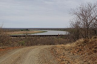
Middle Letaba Dam is an earth-fill type dam located on the Middle Letaba River, 40 km east of Elim and 40 km west of Giyani, Limpopo, South Africa. The source of the Middle Letaba river rises high in the tropical mountains of Magoebaskloof near Tzaneen, where rainfall is abundant during the summer months. The river passes numerous villages and its flow becomes quite strong when it reaches the village of Magoro.

The Levubu River or Levuvhu is located in the northern Limpopo province of South Africa. Some of its tributaries, such as the Mutshindudi River and Mutale River rise in the Soutpansberg Mountains.
The Groot Letaba River headwater streams originate in the Drakensberg Escarpment, descending in long runs with an occasional riffle or pool, mostly in the Limpopo province of South Africa.
Klein Letaba River is a tributary of the Letaba River, situated in Limpopo, South Africa. After its confluence with the Groot Letaba River on the western boundary of the Kruger National Park, it forms the Letaba River flowing through the whole width of the park.
The Middle Letaba River is a tributary of the Klein Letaba River, situated in Limpopo, South Africa.
The Ga-Selati River or Selati River is a river in Limpopo, South Africa.

The Letaba River, also known as Leţaba, Lehlaba or Ritavi, is a river located in eastern Limpopo Province, South Africa. It is one of the most important tributaries of the Olifants River.
Muyexe is a village and rural township in the Mopani District, Limpopo Province, South Africa. It is located in the eastern side of Giyani township, about 35km away and closer to the Kruger National in Shingwedzi Camp. It is under the chief Ndabezitha Muyexe of Maluleke clan.
The Nwanedi River is a watercourse in Limpopo Province, South Africa. It is a tributary of the Limpopo River flowing east of the Nzhelele, joining the right bank of the Limpopo 58 km east of Musina at the South Africa/Zimbabwe border.
Engelhard Dam is a dam on the Letaba River, between the Letaba and Olifants Rest camps in the Kruger National Park, Limpopo, South Africa. Its main function is to regulate water flow down the Letaba in the direction of Mozambique.
The R529 is a Regional Route in Limpopo, South Africa that connects Giyani with Lenyenye via Letsitele.
