
Interstate 15 (I-15) is a major Interstate Highway in the western United States. I-15 begins near the Mexico–US border in San Diego County and stretches north to Alberta, Canada, passing through the states of California, Nevada, Arizona, Utah, Idaho, and Montana. The interstate serves the cities of San Diego, Las Vegas, St. George, Provo, Salt Lake City, Ogden, Pocatello, Idaho Falls, Butte, Helena, and Great Falls. It also passes close to the urban areas of Orange County, California and Los Angeles County, California. The stretches of I-15 in Idaho, Utah, and Arizona have been designated as the "Veterans Memorial Highway". The southern end is at a junction with I-8 and State Route 15 in San Diego, and the northern end is at a connection with Alberta Highway 4 at the Sweetgrass–Coutts Border Crossing.
U.S. Route 491 (US 491) is a north–south U.S. Highway serving the Four Corners region of the United States. One of the newest designations in the U.S. Highway System, it was created in 2003 as a renumbering of U.S. Route 666 (US 666). With the 666 designation, this road was nicknamed the "Devil's Highway" because of the significance of number 666 to many Christian denominations, which is believed by some that 666 is the Number of the Beast. This Satanic connotation, combined with a high fatality rate along the New Mexico portion, convinced some people the highway was cursed. The problem was compounded by persistent sign theft. These factors led to two efforts to renumber the highway, first by officials in Arizona, later in New Mexico. There have been safety improvement projects in recent years, and fatality rates have subsequently decreased.
U.S. Route 91 (US 91) is a north–south United States highway. The highway currently serves as a connection between the Cache Valley area of Utah and Idaho to the Salt Lake City and Idaho Falls population centers. Prior to the mid-1970s, US 91 was an international commerce route from Long Beach, California to the Canada–US border north of Sweetgrass, Montana. US 91 was routed on the main streets of most of the communities it served, including Las Vegas Boulevard in Las Vegas and State Street in Salt Lake City. From Los Angeles to Salt Lake, the route was built along the corridor of the Arrowhead Trail. US 91 has been largely replaced by Interstate 15. A portion of the highway's former route in California is currently State Route 91.
U.S. Route 163 is a 64-mile (103 km) U.S. Highway that runs from US 160 northward to US 191 in the U.S. states of Arizona and Utah. The southernmost 44 miles (71 km) of its length are within the Navajo Nation. The highway forms part of the Trail of the Ancients, a National Scenic Byway. The highway cuts through the heart of Monument Valley and has been featured in numerous movies and commercials.
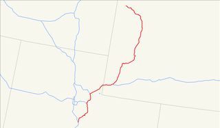
U.S. Route 189 is a spur of U.S. Route 89. It currently runs for 322 miles (518 km) from Provo, Utah at Interstate 15 to Jackson, Wyoming. The highway was not part of the original 1926 U.S. Highway system. The highway was created in the 1930s, absorbing former U.S. Route 530 and a portion of U.S. Route 30S. The portion through Provo Canyon has been designated the Provo Canyon Scenic Byway by the state of Utah.

U.S. Route 89 is a north–south United States Highway with two sections, and one former section. The southern section runs for 848 miles from Flagstaff, Arizona, to the southern entrance of Yellowstone National Park. The northern section runs for 404 miles from the northern entrance of Yellowstone National Park in Montana, ending at the Canada–US border. Unnumbered roads through Yellowstone connect the two sections. Before 1992, U.S. Highway 89 was a Canada to Mexico, border-to-border, highway that ended at Nogales, Arizona, on its southern end.

U.S. Route 191 is a spur of U.S. Route 91 that has two branches. The southern branch runs for 1,465 miles (2,358 km) from Douglas, Arizona on the Mexican border to the southern part of Yellowstone National Park. The northern branch runs for 440 miles (710 km) from the northern part of Yellowstone National Park to Loring, Montana, at the Canada–US border. Unnumbered roads within Yellowstone National Park connect the two branches. The highway passes through the states of Arizona, Utah, Wyoming, and Montana.

U.S. Route 89A is a north–south auxiliary U.S. highway, though its actual direction of travel is more east–west. The highway is an old routing of U.S. Route 89 from Bitter Springs, Arizona to Kanab, Utah. The state of Arizona has designated this highway the Fredonia-Vermilion Cliffs Scenic Road. The highway is used to access Grand Canyon National Park and is known for the Navajo Bridge. Until 2008, the Utah portion was signed State Route 11.
U.S. Route 50 (US 50) is a transcontinental highway in the United States, stretching from West Sacramento, California, in the west to Ocean City, Maryland, on the east coast. The Nevada portion crosses the center of the state and was named The Loneliest Road in America by Life magazine in July 1986. The name was intended as a pejorative, but Nevada officials seized it as a marketing slogan. The name originates from large desolate areas traversed by the route, with few or no signs of civilization. The highway crosses several large desert valleys separated by numerous mountain ranges towering over the valley floors, in what is known as the Basin and Range province of the Great Basin.

U.S. Route 50 (US-50) in Utah crosses the center of the state. The highway serves no major population centers in Utah, with the largest city along its path being Delta. Most of the route passes through desolate, remote areas. Through the eastern half of the state the route is concurrent with Interstate 70 (I-70). US-50 both enters and exits Utah concurrent with US-6, however the two routes are separate through the center of the state.
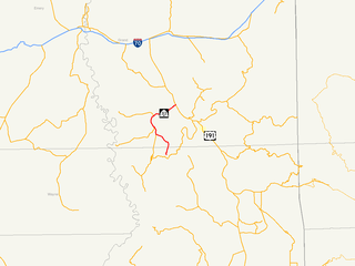
State Route 313 (SR-313) is a Utah state highway in San Juan and Grand Counties. The highway has been designated the Dead Horse Point Mesa Scenic Byway. The highway is an access road for both the Island in the Sky district of Canyonlands National Park and Dead Horse Point State Park. The highway is a toll road in Dead Horse Point State Park. Westbound traffic is charged a state park entrance fee at the park boundary.
Interstate 80 Business (BL-80) is an unofficial business loop of Interstate 80 (I-80) that is 2.26 miles (3.64 km) long and serves as the main street for the US cities of West Wendover, Nevada, and Wendover, Utah, along a roadway named Wendover Boulevard. Wendover Boulevard was originally part of U.S. Route 40 (US 40), which connected California to New Jersey via Nevada and Utah. A portion of the Nevada segment is concurrent with U.S. Route 93 Alternate (US 93 Alt.), and the entire portion in Utah is coterminous with Utah State Route 58 (SR-58). The Nevada Department of Transportation applied for the business loop designation in the early 1980s but the designation has never been approved; nevertheless, signs are posted in both states. Between July 1976 and 1993, BL-80 was concurrent with State Route 224 (SR 224) in Nevada.

The west end of U.S. Route 40 (US-40) is in the U.S. state of Utah at Silver Creek Junction in Silver Summit with Interstate 80. From there it heads southeast through Heber City and east into Colorado on its way to the Mid-Atlantic.
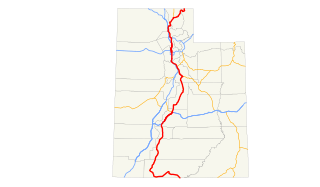
In the U.S. state of Utah, U.S. Route 89 (US-89) is a long north–south state highway spanning more than 502 miles (807.891 km) through the central part of the state. Between Provo and Brigham City, US-89 serves as a local road, paralleling Interstate 15, but the portions from Arizona north to Provo and Brigham City northeast to Wyoming serve separate corridors. The former provides access to several national parks and Arizona, and the latter connects I-15 with Logan, the state's only Metropolitan Statistical Area not on the Interstate.

U.S. Route 191 (US-191) is a major north–south state highway through the eastern part of the U.S. state of Utah. The present alignment of US-191, which stretches from Mexico to Canada, was created in 1981 through Utah. Previously the route had entered northern Utah, ending at US-91 in Brigham City, but with the completion of I-15 it was truncated to Yellowstone National Park and re-extended on a completely different alignment. In addition to a large portion of US-163, this extension absorbed several state routes: SR-33, most of SR-44, and SR-260.
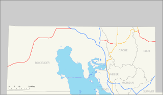
State Route 30 (SR-30) is a state highway in the U.S. state of Utah. It is the only highway signed as a Utah state route to traverse the entire width of the state. Legislatively the highway exists as 3 separate segments. With implied connections via Interstate 84 and U.S. Route 89, the highway is drivable as a continuous route from Nevada to Wyoming. The western segment is a historic corridor paralleling the pre-Lucin Cutoff routing of the First Transcontinental Railroad. A portion of the eastern segment has been designated the Bear Lake Scenic Byway as part of the Utah Scenic Byways program. The route was created in 1966 by combining several state highways into a single designation.
State Route 10 (SR-10) is a State Highway in the U.S. state of Utah. The highway follows a long valley in Eastern Utah between the Wasatch Plateau on the west and the San Rafael Swell on the east.
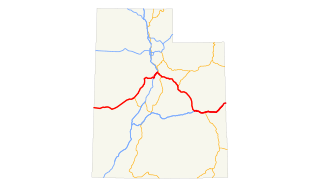
U.S. Route 6 (US-6) is a major east–west state highway through the central part of the U.S. state of Utah. Although it is about 40 miles (64 km) longer than US-50, it serves more populated areas, and in fact follows what had been US-50's routing until it was moved to follow Interstate 70 (I-70) in 1976. In 2009, the Utah State Legislature named part of the route the Mike Dmitrich Highway, which generated controversy, as the state of Utah had previously joined with all the other states through which US-6 passes in naming all of US-6 the Grand Army of the Republic highway.
