Point Arena Air Force Station is a closed United States Air Force General Surveillance Radar station. It is located 3.7 miles (6.0 km) east of Point Arena, California. It was closed in 1998 by the Air Force, and turned over to the Federal Aviation Administration (FAA).
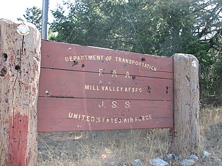
Ground Equipment Facility J-33 is a Federal Aviation Administration (FAA) radar station of the Joint Surveillance System's Western Air Defense Sector (WADS) with an Air Route Surveillance Radar (ARSR-4). The facility was previously a USAF general surveillance radar station during the Cold War.

Finley Air Force Station is a closed United States Air Force General Surveillance Radar station. It is located 1.5 miles (2.4 km) west-northwest of Finley, North Dakota. It was closed in 1979 by the Air Force, and turned over to the Federal Aviation Administration (FAA).

North Truro Air Force Station (AFS) is a closed United States Air Force General Surveillance Radar station. It is located 2.2 mi (3.5 km) east of North Truro, Massachusetts.
Gibbsboro Air Force Station is a closed United States Air Force General Surveillance Radar station. It is located 1.1 miles (1.8 km) south-southeast of Gibbsboro, in Camden County, New Jersey, United States. It was closed in 1994 by the Air Force, and turned over to the Federal Aviation Administration (FAA).
The SAGE radar stations of Air Defense Command were the military installations operated by USAF squadrons using the 1st automated air defense environment and networked by the SAGE System, a computer network. Most of the radar stations used the Burroughs AN/FST-2 Coordinate Data Transmitting Set (CDTS) to automate the operator environment and provide radar tracks to sector command posts at SAGE Direction Centers (DCs), e.g., the Malmstrom Z-124 radar station was co-located with DC-20. The sector/division radar stations were networked by DCs and Manual Control Centers to provide command, control, and coordination for ground-controlled interception of enemy aircraft by interceptors such as the F-106 developed to work with the SAGE System.

The Joint Surveillance System (JSS) is a joint United States Air Force and Federal Aviation Administration system for the atmospheric air defense of North America. It replaced the Semi Automatic Ground Environment (SAGE) system in 1983.
Bedford Air Force Station is a closed United States Air Force General Surveillance Radar station. It is located 12.7 miles (20.4 km) north of Bedford, Virginia. It was closed in 1975.

Kirksville Air Force Station is a closed United States Air Force General Surveillance Radar station. It is located 7.1 miles (11.4 km) north of Kirksville, Missouri. It was closed by the Air Force in 1968. Today the radar site is used by the Federal Aviation Administration (FAA) as a Joint Surveillance System (JSS) site.
Dauphin Island Air Force Station is a closed United States Air Force General Surveillance Radar station. It is located 1.9 miles (3.1 km) east of Dauphin Island, Alabama, near historic Fort Gaines (Alabama). It was closed in 1980.
Port Austin Air Force Station is a closed United States Air Force General Surveillance Radar station. It is located 1.2 miles (1.9 km) south-southwest Port Austin, Michigan. It was closed in 1988 by the Air Force.
West Mesa Air Force Station is a closed United States Air Force General Surveillance Radar station. It is located 9.5 miles (15.3 km) west of Albuquerque, New Mexico. It was closed by the Air Force in 1968 and turned over to the Federal Aviation Administration (FAA). The site is now data-tied into the Joint Surveillance System (JSS).

Ajo Air Force Station is a closed United States Air Force General Surveillance Radar station. It is located 6.4 miles (10.3 km) northwest of Ajo, Arizona. It was closed in 1969 by the Air Force, and the radar site turned over to the Federal Aviation Administration (FAA).
Ground Equipment Facility J-31 is a Joint Surveillance System radar site of the Western Air Defense Sector (WADS) and the Federal Aviation Administration's air traffic control radar network for the Los Angeles Air Route Traffic Control Center. The facility's Air Route Surveillance Radar Model 1E with an ATCBI-6 beacon interrogator system are operated by the FAA and provide sector data to North American Aerospace Defense Command. The site provided Semi-Automatic Ground Environment data to the 1959-66 Norton AFB Direction Center for the USAF Los Angeles Air Defense Sector. The site also provided Project Nike data to the 1960-74 Fort MacArthur Direction Center ~3 mi (4.8 km) away for the smaller US Army Los Angeles Defense Area—as well as gap-filler radar coverage for the 1963-74 Integrated Fire Control area of Malibu Nike battery LA-78 on San Vicente Mountain.

Keno Air Force Station is a closed United States Air Force General Surveillance Radar station. It is located 4.6 miles (7.4 km) south-southwest of Keno, Oregon. It was closed in 1979 by the Air Force, and turned over to the Federal Aviation Administration (FAA).
Mica Peak Air Force Station is a closed United States Air Force General Surveillance Radar station. It is located atop Mica Peak, 6.3 miles (10.1 km) east-northeast of Mica, Washington. It was closed in 1975 by the Air Force, and turned over to the Federal Aviation Administration (FAA).
Makah Air Force Station is a closed United States Air Force General Surveillance Radar station. It is located 2.4 miles (3.9 km) south of Neah Bay, Washington. It was closed in 1988 by the Air Force, and turned over to the Federal Aviation Administration (FAA).
Fort Lawton Air Force Station is a closed United States Air Force General Surveillance Radar station. It is located on Fort Lawton in the Magnolia neighborhood of northwest Seattle, Washington. The Air Force inactivated its unit in 1963; while the site remained under Army control until 1974. Today the Federal Aviation Administration (FAA) operates the site as part of the Joint Surveillance System (JSS).
Backup Interceptor Control was the Electronic Systems Division 416M System to backup the SAGE 416L System in the United States and Canada. BUIC deployed Cold War command, control, and coordination systems to SAGE radar stations to create dispersed NORAD Control Centers.
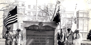
Continental Air Defense Command (CONAD) was a Unified Combatant Command of the United States Department of Defense, tasked with air defense for the Continental United States. It comprised Army, Air Force, and Navy components. It included Army Project Nike missiles anti-aircraft defenses and USAF interceptors. The primary purpose of continental air defense during the CONAD period was to provide sufficient attack warning of a Soviet bomber air raid to ensure Strategic Air Command could launch a counterattack without being destroyed. CONAD controlled nuclear air defense weapons such as the 10 kiloton W-40 nuclear warhead on the CIM-10B BOMARC. The command was disestablished in 1975, and Aerospace Defense Command became the major U.S. component of North American Air Defense Command (NORAD).