United States v. Navajo Nation may refer to the following legal cases:
- United States v. Navajo Nation (2003), 537 U.S. 488 (2003)
- United States v. Navajo Nation (2009), 556 U.S. 287 (2009)
United States v. Navajo Nation may refer to the following legal cases:

The Four Corners Monument marks the quadripoint in the Southwestern United States where the states of Arizona, Colorado, New Mexico, and Utah meet. It is the only point in the United States shared by four states, leading to the area being named the Four Corners region. The monument also marks the boundary between two semi-autonomous Native American governments, the Navajo Nation, which maintains the monument as a tourist attraction, and the Ute Mountain Ute Tribe Reservation.

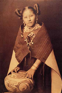
The Hopi are a Native American tribe who primarily live on the Hopi Reservation in northeastern Arizona, United States. As of the 2010 census, there are 19,338 Hopi in the country. The Hopi Tribe is a sovereign nation within the United States and has government-to-government relations with the United States federal government. Particular villages retain autonomy under the Hopi Constitution and Bylaws. The Hopi language is one of 30 in the Uto-Aztecan language family. The majority of Hopi people are enrolled in the Hopi Tribe of Arizona but some are enrolled in the Colorado River Indian Tribes. The Hopi Reservation covers a land area of 2,531.773 sq mi (6,557.26 km2).

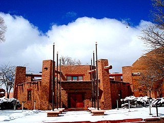
Window Rock is a census-designated place that serves as the seat of government and capital of the Navajo Nation, the largest territory in North America of a sovereign Native American nation. The capital lies within the boundaries of the St. Michaels Chapter, adjacent to the Arizona and New Mexico state line. Window Rock is the site of the Navajo Nation governmental campus, which contains the Navajo Nation Council, Navajo Nation Supreme Court, the offices of the Navajo Nation President and Vice President, and many Navajo government buildings.

Tuba City is an unincorporated town in Coconino County, Arizona, on the Navajo Nation, United States. It is the second-largest community in Coconino County. The population of the census-designated place (CDP) was 8,611 at the 2010 census.

Kayenta is a U.S. town which is part of the Navajo Nation and is in Navajo County, Arizona, United States. Established November 13, 1986, the Kayenta Township is the only "township" existing under the laws of the Navajo Nation, making it unique in this way.

The Navajo Nation, also known as Navajoland, is a Native American reservation in the United States. It occupies portions of northeastern Arizona, northwestern New Mexico, and southeastern Utah; at roughly 17,544,500 acres, the Navajo Nation is the largest land area held by a Native American tribe in the U.S., exceeding ten U.S. states. In 2010, the reservation was home to 173,667 out of 332,129 Navajo tribal members; the remaining 158,462 tribal members lived outside the reservation, in urban areas, border towns, and elsewhere in the U.S.. The seat of government is located in Window Rock, Arizona.

The Four Corners is a region of the Southwestern United States consisting of the southwestern corner of Colorado, southeastern corner of Utah, northeastern corner of Arizona, and northwestern corner of New Mexico. The Four Corners area is named after the quadripoint at the intersection of approximately 37° north latitude with 109° 03' west longitude, where the boundaries of the four states meet, and are marked by the Four Corners Monument. It is the only location in the United States where four states meet. Most of the Four Corners region belongs to semi-autonomous Native American nations, the largest of which is the Navajo Nation, followed by Hopi, Ute, and Zuni tribal reserves and nations. The Four Corners region is part of a larger region known as the Colorado Plateau and is mostly rural, rugged, and arid. In addition to the monument, commonly visited areas within Four Corners include Monument Valley, Mesa Verde National Park, Chaco Canyon, Canyons of the Ancients National Monument and Canyon de Chelly National Monument. The most populous city in the Four Corners region is Farmington, New Mexico, followed by Durango, Colorado.

Tribal sovereignty in the United States is the concept of the inherent authority of indigenous tribes to govern themselves within the borders of the United States. Originally, the U.S. federal government recognized American Indian tribes as independent nations, and came to policy agreements with them via treaties. As the U.S. accelerated its westward expansion, internal political pressure grew for "Indian removal", but the pace of treaty-making grew nevertheless. The Civil War forged the U.S. into a more centralized and nationalistic country, fueling a "full bore assault on tribal culture and institutions", and pressure for Native Americans to assimilate. In the Indian Appropriations Act of 1871, Congress prohibited any future treaties. This move was steadfastly opposed by Native Americans. Currently, the U.S. recognizes tribal nations as "domestic dependent nations" and uses its own legal system to define the relationship between the federal, state, and tribal governments.

U.S. Route 491 (US 491) is a north–south U.S. Highway serving the Four Corners region of the United States. It was created in 2003 as a renumbering of U.S. Route 666 (US 666). With the US 666 designation, the road was nicknamed the "Devil's Highway" because of the significance of the number 666 to many Christian denominations as the Number of the Beast. This Satanic connotation, combined with a high fatality rate along the New Mexico portion, convinced some people the highway was cursed. The problem was compounded by persistent sign theft. These factors led to two efforts to renumber the highway, first by officials in Arizona, then by those in New Mexico. There have been safety improvement projects in recent years, and fatality rates have subsequently decreased.

An Indian reservation is an area of land held and governed by a federally recognized Native American tribal nation whose government is accountable to the U.S. Bureau of Indian Affairs and not to the state government in which it is located. Some of the country's 574 federally recognized tribes govern more than one of the 326 Indian reservations in the United States, while some share reservations, and others have no reservation at all. Historical piecemeal land allocations under the Dawes Act facilitated sales to non–Native Americans, resulting in some reservations becoming severely fragmented, with pieces of tribal and privately held land being treated as separate enclaves. This jumble of private and public real estate creates significant administrative, political and legal difficulties.
Chapter or Chapters may refer to:

Navajo Mountain is a peak in San Juan County, Utah, with its southern flank extending into Coconino County, Arizona, in the United States. It holds an important place in the traditions of three local Native American tribes. The summit is the highest point on the Navajo Nation.
The Navajo meridian, established in 1869, is one of the two principal meridians for Arizona, the other being the Gila and Salt River meridian. Its initial point was stated as latitude 35° 45' north, longitude 108° 32' 45" west from Greenwich, but has been revised as 35°44′56″N108°31′59″W The Navajo meridian and baseline were used to set townships and ranges in a special survey for the original Navajo Reservation, and was set at the eastern boundary of that reservation. The Arizona lands surveyed using the Navajo meridian and baseline were ranges six west to ten west and townships one north to fourteen north, and included Canyon de Chelly National Monument.
United States v. Navajo Nation, 556 U.S. 287 (2009) was a United States Supreme Court case in which the Navajo Nation initiated proceedings in the Court of Federal Claims alleging that when they sought the assistance of the United States Secretary of the Interior to renegotiate their original leasing agreement with the Peabody Coal Company in 1984, a procedural process defined by the 1964 Indian Mineral Leasing Act (IMLA) of 1938, the United States Secretary of the Interior had been improperly influenced by the coal company, and as a result, had breached his fiduciary duty to the Nation when he approved the 1987 lease amendments.

The Church Rock uranium mill spill occurred in the U.S. state of New Mexico on July 16, 1979, when United Nuclear Corporation's tailings disposal pond at its uranium mill in Church Rock breached its dam. The accident remains the largest release of radioactive material in U.S. history, having released more radioactivity than the Three Mile Island accident four months earlier.

In the 1950s, the Navajo Nation was situated directly in the uranium mining belt that experienced a boom in production, and many residents found work in the mines. Prior to 1962, the risks of lung cancer due to uranium mining were unknown to the workers, and the lack of a word for radiation in the Navajo language left the miners unaware of the associated health hazards. The cultural significance of water for the Navajo people and the environmental damage to both the land and livestock inhibits the ability of the Navajo people to practice their culture.

On March 17, 2020, the COVID-19 pandemic was reported to have reached the United States Navajo Nation. The virus then spread rapidly through the Navajo Nation to the point that the Navajo have a higher per capita rate of infection than any state of the United States. The population according to the 2010 United States census was 173,667. As of September 13, 2022, the number of confirmed cases was 31,571 with 1,893 deaths.
United States v. Navajo Nation, 537 U.S. 488 (2003) was a United States Supreme Court case in which the Navajo Nation initiated proceedings alleging that the Secretary of the Interior had breached their fiduciary duty to the Tribe by not acting in the Tribe's best interests.

Sunshine Suzanne Sykes is an American lawyer serving as a United States district judge of the United States District Court for the Central District of California. She previously served as a judge of the California Superior Court for Riverside County.