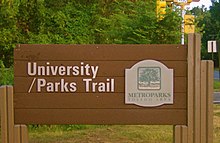
| University/Parks Trail | |
|---|---|
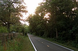 Section of the Trail between Holland-Sylvania Road and McCord Road | |
| Length | 6.3 mi (10.1 km) |
| Location | Lucas County, Ohio, USA |
| Trailheads | University of Toledo to Sylvania, Ohio |
| Use | Multi-use |
| Difficulty | |
| Season | Year-round |
| Sights | Wildwood Preserve Metropark |
| Right of way | Toledo, Angola and Western Railroad [2] [3] |
The University/Parks Trail is a rail trail in metropolitan area of Toledo, Ohio, United States. The trail is open to walkers, bikers, joggers and in-line skaters.