Calderbank is a village outside the town of Airdrie, North Lanarkshire, Scotland. It lies west of the M73, on the west bank of the North Calder Water. The village lies 13 miles east of Glasgow city centre and around 34 miles west of Edinburgh. Other nearby towns include: Airdrie, Coatbridge, Bellshill and Motherwell. It has a population of about 1,610.
Zestoa is a town located in the province of Gipuzkoa, in the autonomous community of the Basque Country, northern Spain.

Al Maktoum Stadium is a multi-purpose stadium in Dubai, United Arab Emirates. It is currently used mostly for football matches and is the home ground of Al Nasr SC. The stadium holds roughly 15,000 people.
The Sadie Seymour Botanical Gardens are nonprofit botanical gardens located on the grounds of the Kona Educational Foundation Center at 76-6280 Kuakini Highway, Kailua-Kona, Hawaiʻi island, Hawaiʻi. Coordinates are 19°36′49.5″N155°58′6″W. They are open daily; admission is free, but donations accepted.
Westfield is a suburb of Edinburgh, the capital of Scotland. It is north of A71.

Weir River Farm is a nature reserve located in Hingham, Massachusetts. The property is owned by The Trustees of Reservations.

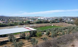
Mengíbar is a city located in the province of Jaén, Spain. According to the 2006 census (INE), the city has a population of 9102 inhabitants.
Braehead is the name of three villages and hamlets in South Lanarkshire, Scotland.

Həsənlər is a village in the Kalbajar Rayon of Azerbaijan.

Bogota is an unincorporated community in Smallwood Township, Jasper County, Illinois, United States.
Boża Wólka is a village in the administrative district of Gmina Mrągowo, within Mrągowo County, Warmian-Masurian Voivodeship, in northern Poland.
El Ghaire is a town and commune in Mauritania.

Aetna is a hamlet in southern Alberta, Canada within Cardston County, located 2 kilometres (1.2 mi) east of Highway 2, approximately 70 kilometres (43 mi) southwest of Lethbridge.
Oakfield, New York is a hamlet in the town of Grand Island in Erie County, New York, United States.
Hartland, New York is a hamlet in the town of Hartland in Niagara County, New York, United States.

Saddle Lake is a settlement in central Alberta. It is located on Saddle Lake Indian Reserve 125 and is governed by the Saddle Lake Cree Nation.

Amieur is a town and commune in Tlemcen Province in northwestern Algeria.
Angola is an unincorporated community in Cumberland County, in the U.S. state of Virginia. Angola is located at 37°24′06″N78°14′24″W.
Berea is an unincorporated community in Giles County, in the U.S. state of Tennessee.
Richardsville is an unincorporated community in Jefferson County, in the U.S. state of Pennsylvania.


