Washington County is a county in the U.S. state of New York. As of the 2020 census, the population was 61,302. The county seat is Fort Edward. The county was named for U.S. President George Washington. The county is part of the Capital District region of the state.

Warren County is a county in the U.S. state of New York. As of the 2020 census, the population was 65,737. The county seat is Queensbury. The county was established in 1813 and is named in honor of General Joseph Warren, an American Revolutionary War hero of the Battle of Bunker Hill. The county is part of the Capital District region of the state.

Saratoga County is a county in the U.S. state of New York, and is the fastest-growing county in Upstate New York. As of the 2020 U.S. census, the county's population was enumerated at 235,509, its highest decennial count ever and a 7.2% increase from the 219,607 recorded at the 2010 census, representing one of the fastest growth rates in New York. The county seat is Ballston Spa. The county is part of the Capital District region of the state.

North Hudson is a town in Essex County, New York, United States. The population was 240 at the 2010 census. The town derives its name by being near the northern end of the Hudson River.

Schroon is a town in the Adirondack Park, in Essex County, New York, United States. The population was 1,880 at the 2020 census. The largest community in the town is the hamlet of Schroon Lake, located at the northern end of the lake of the same name.

Hadley is a town in Saratoga County, New York, United States. The population was 1,971 at the 2000 census. The town was named after Hadley, Massachusetts.

Glens Falls is a city in Warren County, New York, United States and is the central city of the Glens Falls Metropolitan Statistical Area. The population was 14,830 at the 2020 census. The name was given by Colonel Johannes Glen, the falls referring to a large waterfall in the Hudson River at the southern end of the city.

Corinth is a town in Saratoga County, New York, United States. The population was 6,500 at the 2020 census. The town contains a village also named Corinth. The town is on the northeastern border of the county, north of Saratoga Springs. The town is noted as "the snowshoe capital of the world" and is home to Palmer Falls where the Hudson River passes through the Palmertown Range.

The Mohawk Valley region of the U.S. state of New York is the area surrounding the Mohawk River, sandwiched between the Adirondack Mountains and Catskill Mountains, northwest of the Capital District. As of the 2010 United States Census, the region's counties have a combined population of 622,133 people. In addition to the Mohawk River valley, the region contains portions of other major watersheds such as the Susquehanna River.

The Ausable River, also known as AuSable River and originally written as "Au Sable", runs in the U.S. state of New York, from the Adirondack Mountains and past the village of Lake Placid and Au Sable Forks to empty into Lake Champlain. It has an East and West branch that join at Au Sable Forks. The river forms a partial boundary between Clinton County and Essex County. The Ausable River is known for its gorge, Ausable Chasm, located a few miles east of Keeseville.

The Champlain Valley is a region of the United States around Lake Champlain in Vermont and New York extending north slightly into Quebec, Canada. It is part of the St. Lawrence River drainage basin, drained northward by the Richelieu River into the St. Lawrence at Sorel-Tracy, Quebec. The Richelieu valley is not generally referred to as part of the Champlain Valley.

Area codes 518 and 838 are telephone area codes in the North American Numbering Plan for eastern Upstate New York in the United States. 518 is one of the 86 original North American area codes created in 1947. Area code 838 was added to the 518 numbering plan area in 2017. The two area codes serve 24 counties and 1,200 ZIP Code areas in a numbering plan area (NPA) that extends from the eastern Mohawk Valley to the Vermont border, and from the Canada–US border to south of Albany. The bulk of the population is in the Capital District, the vicinity of the cities Albany, Schenectady, and Troy. Other cities in the NPA are Glens Falls, Plattsburgh, and Saratoga Springs. It includes the Upper Hudson Valley counties, Greene and Columbia counties, and some northern parts of Dutchess County.

The North Country of Upstate New York is the northernmost region of the U.S. state of New York. It is bordered by Lake Champlain to the east and further east to the adjacent state of Vermont and the New England region; the Adirondack Mountains / Adirondack Park and the Upper Capital District with the state capital of Albany to the south; the Mohawk Valley region of New York to the southwest; the Canadian-American international border to the north; and Lake Ontario, and the Saint Lawrence River / Saint Lawrence Seaway, and beyond the waters again to Ontario / Canada to the west. A mostly rural forested area, the North Country includes seven counties of the 62 in New York state. Fort Drum, a United States Army base, is also located in the North Country region in Jefferson County, near Watertown, as is the adjacent Adirondack Park of 6.1 million acres, established 1892 as the oldest state park in the nation, and preserved / operated by the Adirondack Park Agency and the New York State Department of Environmental Conservation. As of 2024, the population of the region was 420,311.

New York State Route 9N (NY 9N) is a north–south state highway in northeastern New York in the United States. It extends from an intersection with U.S. Route 9 (US 9), NY 29, and NY 50 in the city of Saratoga Springs to a junction with US 9 and NY 22 in the Clinton County hamlet of Keeseville. At 143.49 miles (230.92 km) in total length, NY 9N is the longest letter-suffixed route in the state. It is concurrent with its parent route for 1 mile (1.6 km) in the village of Lake George and for three blocks in the hamlet of Elizabethtown.
The Northern Forest Canoe Trail (NFCT) is a 740-mile (1,190 km) marked canoeing trail in the northeastern United States and Canada, extending from Old Forge in the Adirondacks of New York to Fort Kent, Maine. Along the way, the trail also passes through the states and provinces of Vermont, Quebec, and New Hampshire. The trail was opened on June 3, 2006.

The Schroon River is a 67.7-mile-long (109.0 km) tributary of the Hudson River in the southern Adirondack Mountains of New York, beginning at the confluence of Crowfoot Brook and New Pond Brook near Underwood, and terminating at the Hudson in Warrensburg. Its watershed is entirely within the Adirondack Park. The river runs through the towns of North Hudson, Schroon, Chester, Bolton, and Warrensburg.

Fort Edward is a town and the county seat of Washington County, New York, United States. The population was 5,991 at the 2020 census. The municipal center complex is on U.S. Route 4 between the villages of Hudson Falls and Fort Edward. When construction of the complex was completed in 1994, most of the administrative offices were moved from the original county seat of Hudson Falls to this location. The town of Fort Edward is part of the Glens Falls Metropolitan Statistical Area.

The Saratoga and North Creek Railway was a heritage railway that began operation in July 2011. Passenger operations ceased on April 7, 2018, and the final revenue freight train to remove stored tank cars operated in May 2018. The railroad ran in the upper Hudson River region of the Adirondack Mountains, in the U.S. state of New York.

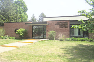
The Southern Adirondack System (SALS) is a consortium of thirty-four libraries in Saratoga, Warren, Washington, and Hamilton counties in New York.

The Spier Falls Dam is a hydroelectric dam on the Hudson River between the towns of Moreau and Lake Luzerne, New York.


