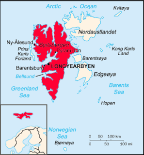
Van Mijenfjorden is the third-longest fjord in Norway's Svalbard archipelago. It lies in the southern portion of Spitsbergen island, south of Nordenskiöld Land and north of Nathorst Land. The fjord is 83 km (52 mi) long, being separated from Bellsund further out by Akseløya and Mariaholmen. The settlement of Sveagruva lies on the fjord's north bank.

Storfjorden is the body of water separating Spitsbergen in the west from Barentsøya and Edgeøya to the east. Its southern limits are Kikutodden in Sørkapp Land east to Håøya, Tiholmane, Brækmoholmane, and Menkeøyane in Thousand Islands and northeast to Negerpynten—the southeastern promontory of Edgeøya. Its limits on its eastern side are Sundneset on the northern side of Freemansundet south to Palibinramten on the northwest coast of Edgeøya. The northern part is called Ginevra Bay, which lies between Olav V Land and Barentsøya. It ends at Heleysundet.
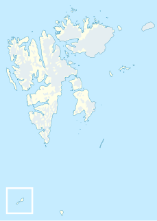
Akseløya is a long, narrow island at the mouth of Van Mijenfjorden, separating Van Mijenfjorden from Bellsund. It is separated from the mainland by Akselsundet to the north, and another narrow strait to the south. The islands are named after the schooner Aksel Thordsen, which was chartered by Adolf Erik Nordenskiöld for an expedition to Svalbard in 1864.
Van Keulenfjorden is a 30 km long fjord on the west coast of Spitsbergen separating Nathorst Land to the north and Wedel Jarlsberg Land to the south. Van Keulenfjorden is separated from Bellsund by Forsbladodden in the north and Richardodden to the south.
Eholmen is a 1.5 km long island in the divide between Bellsund and Van Keulenfjorden, on the west coast of Spitsbergen. It is the southwesternmost point of Nathorst Land.
Wedel Jarlsberg Land is the land area between Van Keulenfjorden and Hornsund on the southwestern part of Spitsbergen, Svalbard. The area is largely covered with glaciers, and is completely within the Sør-Spitsbergen National Park.
Nathorst Land is the land area between Van Keulenfjorden and Van Mijenfjorden on Spitsbergen, Svalbard.
Torell Land is a land area at the southeast part of Spitsbergen, Svalbard. It is named after Otto Martin Torell. Two glaciers, Hornbreen and Hambergbreen, divide Torell Land from Sørkapp Land.
Kolfjellet is a mountain in Nordenskiöld Land at Spitsbergen, Svalbard. The mountain is located north of Van Mijenfjorden and east of Berzeliusdalen, and is separated from Hesselbergaksla and Iskollen by the valley Kolfjelldalen and the glacier Kolfjellbreen. The name Kolfjellet stems from coal deposits in the mountain. The first registered ascent was accomplished in 1912. The mountain is included in the Nordenskiöld Land National Park.
Berzeliusdalen is a valley in Nordenskiöld Land at Spitsbergen, Svalbard. It has a length of about 16 kilometers, stretching from the mountain pass Skardalspasset down to the northern side of Van Mijenfjorden. The valley is named after Swedish chemist Jöns Jacob Berzelius. The river Berzeliuselva flows through the valley.
Fridtjovhamna is a bay at the northern side of Van Mijenfjorden in Nordenskiöld Land at Spitsbergen, Svalbard. It has a length of about 2.5 kilometers, and is formed by the glacier Fridtjovbreen. It is named after a hunting vessel which was used during Torell's expedition to Spitsbergen. Fridtjovhamna is included in the Nordenskiöld Land National Park.

Fridtjovbreen is a glacier in Nordenskiöld Land at Spitsbergen, Svalbard. It has a length of about 14 kilometers, and debouches into the bay Fridtjovhamna at the northern side of Van Mijenfjorden. The name stems from a hunting vessel used during the Torell expedition to Spitsbergen. The lower part of the glacier is included in the Nordenskiöld Land National Park.
Berzeliustinden is a mountain in Wedel Jarlsberg Land in Spitsbergen, Svalbard. It has a height of 1,211 m.a.s.l. It is located south of Van Keulenfjorden, and is included in the Sør-Spitsbergen National Park.

Mariaholmen is an islet in Nathorst Land at the mouth of Van Mijenfjorden at Spitsbergen, Svalbard. It is located south of Akseløya, between Akseløya and Måseneset. While Akselsundet north of Akseløya is regarded as the main entrance to Van Mijenfjorden, Mariasundet between Mariaholmen and Måseneset is also navigable.
Birkelandodden is the northern point of the island Akseløya between Van Mijenfjorden and Bellsund at Spitsbergen, Svalbard. The point is named after Kristian Birkeland. A light has been set up to help navigation through Akselsundet, the main entrance to Van Mijenfjorden.
Bravaisberget is a mountain in Nathorst Land on the island of Spitsbergen in the Norwegian archipelago of Svalbard. It reaches a height of 775 m.a.s.l., and is located at the mouth of Van Keulenfjorden. The mountain is named after French physicist Auguste Bravais, member of the 1838 Spitsbergen expedition with La Recherche.
Erdmannbreen is a glacier in Nordenskiöld Land at Spitsbergen, Svalbard. It is named after Swedish geologist Axel Joachim Erdmann. The glacier has a length of about six kilometers, and is surrounded by the mountains of Malmberget, Ytterdalsgubben and Kosterfjellet. The river of Ytterdalselva originates from Erdmannbreen and flows through the valley of Ytterdalen to the bay of Van Muydenbukta.
Langlifjellet is a mountain in Nathorst Land at Spitsbergen, Svalbard. It has peaks with heights of 1,011, 973 and 885 m.a.s.l. respectively. The mountain is surrounded by the mountains of Sven Nilssonfjellet, Bassøefjellet, and Steindolptoppen, and the glaciers of Løyndbreen, Lundbreen and Langlibreen. The valley of Langlidalen separates Langlifjellet and Sven Nilssonfjellet from the mountain of Rånekampen.
Lundgrenfjellet is a mountain in Nathorst Land at Spitsbergen, Svalbard. It has a height of 1,054 m.a.s.l., and is named after Swedish geologist Sven Anders Bernhard Lundgren. The mountain is located south of Van Mijenfjorden, north of the glaciers of Vengebreen and Rånebreen, west of the valley of Danzigdalen.