The Arctic Archipelago, also known as the Canadian Arctic Archipelago, is an archipelago lying to the north of the Canadian continental mainland, excluding Greenland and Iceland.
Tucker Glacier is a major valley glacier of Victoria Land, Antarctica, about 90 nautical miles long, flowing southeast between the Admiralty Mountains and the Victory Mountains to the Ross Sea. There is a snow saddle at the glacier's head, just west of Homerun Range, from which the Ebbe Glacier flows northwestward.
Borchgrevink Glacier is a large glacier in the Victory Mountains, Victoria Land, Antarctica. It drains south between Malta Plateau and Daniell Peninsula, and thence projects into Glacier Strait, Ross Sea, as a floating glacier tongue.

The Ford Ranges are a collection of mountain groups and ranges standing east of Sulzberger Ice Shelf and Block Bay in the northwest part of Marie Byrd Land, Antarctica.

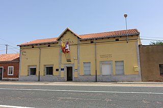
Pozuelo del Páramo is a municipality located in the province of León, Castile and León, Spain. According to the 2004 census (INE), the municipality has a population of 559 inhabitants.

Pomar de Valdivia is a municipality located in the province of Palencia, Castile and León, Spain. According to the 2004 census (INE), the municipality has a population of 531 inhabitants.

San Pablo de la Moraleja is a municipality located in the province of Valladolid, Castile and León, Spain. According to the 2004 census (INE), the municipality has a population of 167 inhabitants.

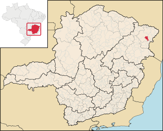
Felisburgo is a Brazilian municipality located in the northeast of the state of Minas Gerais.
The Mariner Glacier is a major glacier over 60 nautical miles long, descending southeast from the plateau of Victoria Land, Antarctica, between Mountaineer Range and Malta Plateau, and terminating at Lady Newnes Bay, Ross Sea, where it forms the floating Mariner Glacier Tongue.
Quiabaya is the capital of the Quiabaya Municipality. It is located in the La Paz Department, Bolivia. As of 2012, it had a population of 378.

Guaraciaba do Norte is a municipality in the state of Ceará in the Northeast region of Brazil.

The borders of the oceans are the limits of Earth's oceanic waters. The definition and number of oceans can vary depending on the adopted criteria. The principal divisions of the five oceans are the Pacific Ocean, Atlantic Ocean, Indian Ocean, Southern (Antarctic) Ocean, and Arctic Ocean. Smaller regions of the oceans are called seas, gulfs, bays, straits, and other terms. Geologically, an ocean is an area of oceanic crust covered by water.
Bowman Inlet is an ice-filled inlet between Kay Nunatak and Platt Point on the Hollick-Kenyon Peninsula, on the east coast of the Antarctic Peninsula.
Jennings Reef is a reef, mostly submerged, extending between Avian Island and the Rocca Islands, off the south end of Adelaide Island, Antarctica. It was named by the UK Antarctic Place-Names Committee for Leading Seaman Ronald A.J. Jennings, the coxswain of the survey motorboat Quest, used by the Royal Navy Hydrographic Survey Unit which charted the feature in 1963.
The Glover Rocks are a group of rocks lying northwest of Avian Island, off the south end of Adelaide Island, Antarctica. They were named by the UK Antarctic Place-Names Committee for John F. Glover, 3rd Engineer of RRS John Biscoe (1962–63), the ship assisting the Royal Navy Hydrographic Survey Unit which charted the feature in 1963.
Mount Riddolls is a very prominent mountain, 3,295 metres (10,810 ft) high, situated directly at the head of Rudolph Glacier in the Victory Mountains of Victoria Land, Antarctica.
Rocca Islands is a group of small islands and rocks 3 nautical miles (6 km) east of Avian Island, off the south end of Adelaide Island. Discovered in 1909 by the French Antarctic Expedition and named by Charcot for Monsieur Rocca, an acquaintance in Punta Arenas. Remapped by the British Royal Navy Hydrographic Survey Unit in 1963.
Launch Rock is a submerged rock lying southwest of the Glover Rocks, off the south end of Adelaide Island, Antarctica. It was named by the UK Antarctic Place-Names Committee to commemorate the unnamed launch from RRS John Biscoe that was used by the Hydrographic Survey Unit which charted this area in 1963.
Awei is a small uninhabited island in Malampa Province of Vanuatu in the Pacific Ocean. It is a part of the Maskelyne Islands archipelago.


