This article needs additional citations for verification .(October 2016) |
Villeret | |
|---|---|
Hamlet | |
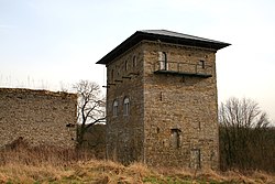 Le donjon de Villeret (the dungeon of Villeret) | |
 Villeret | |
| Coordinates: 50°30′25.39″N4.°39′11.45″E / 50.5070528°N 4.6531806°E | |
| Country | |
| Region | |
| Province | |
| Municipality | |
| Elevation | 119 m (390 ft) |
| Time zone | UTC+1 (CET) |
Villeret is a hamlet of Wallonia in the district of Saint-Martin and the municipality of Jemeppe-sur-Sambre, located in the province of Namur), Belgium.
Contents
Villeret is located at the confluence of the east flowing Ligny and another stream flowing down from the north (through Bothey). [1] The Ligny then continues eastwards into the Orneau.