Related Research Articles
The Southland Plains is a general name given to several areas of low-lying land in the South Island of New Zealand, separated by the rise of the Hokonui Hills in the north. It forms a sizeable area of Southland region and encompasses its two principal settlements the city of Invercargill and the town of Gore. The Southland Plains include some of New Zealand's most fertile farmland.

The Clarence River is a major river which flows through the Kaikōura Ranges in the northeast of New Zealand's South Island. At roughly 209 kilometres (130 mi) long, it is the longest river in Canterbury and the eighth longest in New Zealand.

Te Urewera is an area of mostly forested, sparsely populated rugged hill country in the North Island of New Zealand, a large part of which is within a protected area designated in 2014, that was formerly Te Urewera National Park.

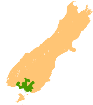
The Waiau River is the largest river in the Southland region of New Zealand. 'Waiau' translates to 'River of Swirling Currents'. It is the outflow of Lake Te Anau, flowing from it into Lake Manapouri 10 kilometres (6 mi) to the south, and from there flows south for 70 kilometres (43 mi) before reaching the Foveaux Strait 8 kilometres (5 mi) south of Tuatapere. It also takes water from Lake Monowai.

Waiau Uwha River, previously known as the Waiau River, is a river in north Canterbury in the South Island of New Zealand. The Waiau Uwha River rises in the Spenser Mountains and flows eastward to the Pacific Ocean. The Waiau Uwha River has the second largest catchment—3,310 square kilometres (1,280 sq mi)—of North Canterbury's rivers.

The Wairoa River of the Hawke's Bay region in New Zealand runs south for 65 kilometres from the inland east coast region of the North Island, west of Gisborne, before flowing into northern Hawke Bay at the town of Wairoa.
The Moerangi River or Moerangi Stream is a small river located in New Zealand's Whirinaki Te Pua-a-Tāne Conservation Park. It is one of the main tributaries of the Waiau River, Hawke's Bay. This river is mostly used by trampers (hikers), fishermen, and hunters.
Waiau River is a river in the Gisborne Region of New Zealand. It has its headwaters in the same area of hill country to the east of the Raukumara Range as the Mata River, flowing firstly north, then east to become a tributary of the Hikuwai River.

The Mararoa River is one of the braided rivers of the Southland Region of the South Island of New Zealand.

State Highway 38 is a road in the North Island of New Zealand that starts from SH 5 near Waiotapu, and ends at Wairoa, where it connects to SH 2. It is the shortest connection from the central North Island (Rotorua) to the East Coast (Gisborne), but it is not often used as such. Large parts of the road are narrow and winding, and about 74 kilometres (46 mi) of the road is unsealed. Travel on this highway takes roughly four hours.
The Empson River is a stream in the Canterbury Region of New Zealand. It arises near Grey Hill in the Hanmer Range and flows south into the Waiau Uwha River. The name is not official.

The Hanmer River is a river in the Hurunui District of New Zealand. It originates in the Hossack Saddle between the Hanmer Range and the Amuri Range, and flows south-west into the Waiau Uwha River about 8 kilometres (5.0 mi) south-west of Hanmer Springs.
The Manganuiohou River is a river of the northeast of New Zealand's North Island. It flows southwards from its source in Te Urewera National Park immediately to the northwest of Lake Waikaremoana, and joins with the Waiau River at the park's southwestern boundary.

The Mason River is a river of the north Canterbury region of New Zealand's South Island. It flows south from the Amuri Range, at the foot of the Mason Hills before turning southwest to reach the Waiau River just to the west of the township of Waiau.
The Stanton River is a river of the Canterbury region of New Zealand's South Island. IUt flows southeast through the Hundalee Hills, turning southwest to reach the Waiau Uwha River 7 kilometres (4 mi) east of Waiau.
The Waihua River is a river of the northern Hawke's Bay region of New Zealand's North Island. Its course roughly parallels that of its northern neighbour, the Waiau River. The Waihua rises in rough hill country north of Raupunga, flowing initially east before turning southeast to reach Hawke Bay 15 kilometres west of Wairoa.

The Waikaretāheke River is a river of the Hawke's Bay region of New Zealand's North Island. It serves as the outflow of Lake Waikaremoana, flowing southeast from the lake's southeastern shore to reach the Waiau River 20 kilometres (12 mi) northwest of Wairoa. State Highway 38 follows the river's course for much of its length.

The Hope River, in Canterbury, New Zealand, is a tributary of the Waiau Uwha River. It is one of three rivers by that name in the South Island.
The Edwards River is a river located in the north of New Zealand's Canterbury region. It is the northern of the two rivers in New Zealand of this name.

The Tutaekuri River, in the Wairoa District of New Zealand's Hawke's Bay, rises below Gaddum Road, in the Tutaekuri Conservation Area and flows about 24 km (15 mi) east before joining the Waiau River near Raumotu Bridge, about 3 km (1.9 mi) from its confluence with the Wairoa River at Frasertown.
References
- ↑ "Place name detail: Waiau River". New Zealand Gazetteer. New Zealand Geographic Board . Retrieved 30 June 2010.
38°57′57″S177°23′46″E / 38.965739°S 177.396219°E