Economy
Agriculture is the backbone of the economy of Wainamah village. Though the name 'Wainamah' means 'tobacco market', it is a bit difficult to find tobacco in the area. This is because of the decline in the price of the tobacco years back, new farms and modern methods of cultivation by the companies that used to buy the local tobacco from these villagers, thus, the new generation here does not find it worthy to cultivate the tobacco since it is mainly for export, consumed by a very few aged people. The abandonment of tobacco cultivation led to peasant agriculture with main crops like maize, beans, cassava, palm wine tapping and cattle rearing. Wainamah has the second largest cattle market in Bui Division with a slaughter slap provided by the state. The villagers of Wainamah take advantage of the long rainy season which ensures continuous availability of grass and legumes for animals to rear a good number of cattle, goats and sheep.
The cold temperatures slow down agricultural activities as crops such as maize which is one of the main crops cultivated here take up to 7–8 months to mature. This forces the villagers to take up farms in the neighboring villages like Kwanso or Babessi town.
There also exist a few shops in the village. Here, bars or drinking spots of either mix of industrially brewed drinks and palm wine or exclusive palm wine spots which outnumber the industrially brewed drinks spots.
The Centre Region occupies 69,000 km2 of the central plains of the Republic of Cameroon. It is bordered to the north by the Adamawa Region, to the south by the South Region, to the east by the East Region, and to the West by the Littoral and West Regions. It is the second largest of Cameroon's regions in land area. Major ethnic groups include the Bassa, Ewondo, and Vute.

Oku is a subdivision in North West Region,, Cameroon. The term Oku also refers to the people who live in this region ruled by a Paramount Monarch [HRM King Ngum IV. Ngum Ernest Merlin Shang] and the primary language that they speak. Oku is a rural area containing about 36 villages with the population of about 180,000 inhabitants. The nearest really large city is Bamenda, but Kumbo, which is closer, is large enough to have telephone lines and a Baptist-run hospital. Oku also has a Sub-divisional hospital. However, three mobile telephone networks are available in Oku. As such, mobile internet facilities are available.
The West Region is 14,000 km2 of territory located in the central-western portion of the Republic of Cameroon. It borders the Northwest Region to the northwest, the Adamawa Region to the northeast, the Centre Region to the southeast, the Littoral Region to the southwest, and the Southwest Region to the west. The West Region is the smallest of Cameroon's ten regions in area, yet it has the highest population density.
Mbengwi is the headquarters of Momo Department in the Northwest Region of Cameroon, located some 22 km from Bamenda.
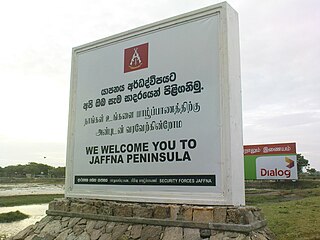
Jaffna Peninsula or is an area in Northern Province, Sri Lanka. It is home to the capital city of the province, Jaffna, and comprises much of the former land mass of the medieval Jaffna kingdom.

Namal is one of the 51 union councils of Abbottabad district in the Khyber Pakhtunkhwa province of Pakistan.
Nicaragua produces coffee, cotton, bananas, sugar and beef cattle.
Chomba is a village under the Bamenda municipality in Cameroon. The village is located six kilometers outside of Bamenda town. Before the 1960s, no motorable road linked the village to Bamenda town. The main road that links the village to the town was constructed manually by the villagers themselves. It was until the late 1970s/early 1980s that motor vehicles could reach the village. Today, the village is linked to the Bamenda town, by a half-paved/half-unpaved road.

Angola is a potentially rich agricultural country, with fertile soils, a favourable climate, and about 57.4 million ha of agricultural land, including more than 5.0 million ha of arable land. Before independence from Portugal in 1975, Angola had a flourishing tradition of family-based farming and was self-sufficient in all major food crops except wheat. The country exported coffee and maize, as well as crops such as sisal, bananas, tobacco and cassava. By the 1990s Angola produced less than 1% the volume of coffee it had produced in the early 1970s, while production of cotton, tobacco and sugar cane had ceased almost entirely. Poor global market prices and lack of investment have severely limited the sector since independence.
Uganda's favorable soil conditions and climate have contributed to the country's agricultural success. Most areas of Uganda have usually received plenty of rain. In some years, small areas of the southeast and southwest have averaged more than 150 millimeters per month. In the north, there is often a short dry season in December and January. Temperatures vary only a few degrees above or below 20 °C but are moderated by differences in altitude.

Ndian is a department of Southwest Region in Cameroon. It is located in the humid tropical rainforest zone about 650 km (400 mi) southeast of Yaoundé, the capital.

Agriculture in Qatar Till quite recently, it was thought that Qatar's environment was not at all favourable for plantation and organic farming due to its harsh temperature during the summer months, desalinated chlorine water, poor annual rainfall and arid soil that all add up to quite the challenge of turning a desert area into a green oasis is inherently limited in scope due to the harsh climate and lack of arable land. In spite of this, small-scale farming, nomadic herding, pearling, and fishing were the predominant means of subsistence in the region until the commencement of oil drilling in 1939.

Batibo is a name that refers to a town and a subdivision in Cameroon, Africa. It is located along the Trans-African Highway, 27 miles west of Bamenda and about 100 miles east of Nigeria. Batibo is the economic, social, political and cultural heartbeat of the Moghamo speaking people as well as the Greater Widikum tribe. Batibo, formerly referred to as Aghwi, is home to a people including farmers, traders, and craftsmen.
Wabane is a town and council/commune in Cameroon. It is the headquarters of Wabane sub-division in Lebialem division Southwest Region of Cameroon.
Santchou is a town and commune in Cameroon.
Ndu is a town and commune in Donga-Mantung, a division in the Northwest Region of Cameroon. It lies at the northeast edge of the Bamenda Grassfields, on the eastern arc of the Ring Road. It is the highest elevation town in Cameroon.

Khamdang Gewog is a gewog of Trashiyangtse District, Bhutan.

Central African cuisine includes the cuisines, cooking traditions, practices, ingredients and foods of the Central African Republic (CAR). Indigenous agriculture in the country includes millet, sorgum, banana, yam, okra, yellow onion, garlic, spinach, rice and palm oil. Imported crops of American origin include maize, manioc (cassava), peanuts, chili peppers, sweet potato and tomato. Additional foods include onions, garlic, chiles and peanuts.
Takhatgadh is a village 25 kilometers away from taluka headquarters Prantij, and 15 kilometers away from District headquarters Himatnagar in Sabarkantha district, Gujarat, India. Takhatgadh Kampa village current president Shree Nishant Patel. In Takhatgadhkampa village Primary, Secondary and Higher- Secondary schools available for village children also near all village's. Takhatgadhkampa is biggest Kachchi Patel village in Sabarkantha.
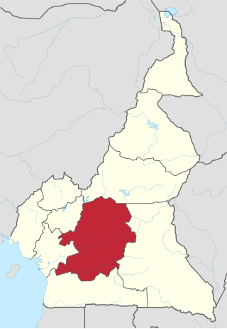
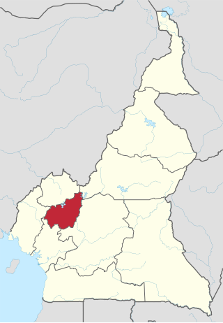
Baba I village (Papiakum) is one of the four villages that make up Babessi subdivision and one of the thirteen villages of Ngoketunjia division of the North West region of Cameroon. Baba I village is located along the ring road from Bamenda some 50 km away from Bamenda town on the Bamenda-Nkambe stretch of the ring road just before one reaches Bamunka.