Wormwood Scrubs, known locally as The Scrubs, is an open space located in the north-eastern corner of the London Borough of Hammersmith and Fulham in west London. It is the largest open space in the Borough, at 80 ha, and one of the largest areas of common in London. The eastern part, known as Little Wormwood Scrubs, is cut off by Scrubs Lane and the West London Line railway. It has been an open public space since the Wormwood Scrubs Act of 1879.

Stalybridge is a town in Tameside, Greater Manchester, England, with a population of 23,731 at the 2011 Census. Historically part of Cheshire, it is 8 miles (12.9 km) east of Manchester city centre and 6 miles (9.7 km) north-west of Glossop.
Mottram in Longdendale is an unparished village within the Metropolitan Borough of Tameside, in Greater Manchester, England. The 2011 Census for the ward of Longdendale which includes Mottram and the surrounding area was 9,950.
Denton is a town in the Metropolitan Borough of Tameside, Manchester, England, five miles (8 km) east of Manchester city centre. Historically part of Lancashire, it had a population of 36,591 at the 2011 Census.

Stockport is a large town in Greater Manchester, England, 7 miles (11 km) south-east of Manchester city centre, where the River Goyt and Tame merge to create the River Mersey, and the largest in the metropolitan borough of the same name.

Ashton-under-Lyne is a market town in Tameside, Greater Manchester, England. The population was 45,198 at the 2011 census. Historically in Lancashire, it is on the north bank of the River Tame, in the foothills of the Pennines, 6.2 miles (10.0 km) east of Manchester.

Dukinfield is a town in Tameside, Greater Manchester, England, on the south bank of the River Tame opposite Ashton-under-Lyne, 6.3 miles (10.1 km) east of Manchester. At the 2011 Census, it had a population of 19,306.

Audenshaw is a town in Tameside, Greater Manchester, England, on the River Tame 1.8 miles (2.9 km) south-west of Ashton-under-Lyne and 4.9 miles (7.9 km) east of Manchester. Historically part of Lancashire, in 2011 it had a population of 11,419.
Mossley (/ˈmɒzli/) is a small town and a civil parish in Greater Manchester, England, in the upper Tame Valley and the foothills of the Pennines, 3 miles (4.8 km) southeast of Oldham and 8.9 miles (14.3 km) east of Manchester.
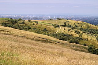
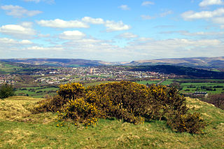
Werneth Low is a hill in Greater Manchester, England, and a part of the Pennines. It is located on the borders of Stockport and Tameside and rises to a height of 279 metres (915 ft). The villages of Woodley, Greave, Gee Cross, Mottram and Romiley lie on the sides of the low.

Worcester Park is a suburb in south west London, covering both the extreme north-west of the London Borough of Sutton in Greater London and the northernmost part of the Borough of Epsom and Ewell in Surrey. The area is 10.2 miles (16.4 km) south-west of Charing Cross. The suburb's population was 16,031 at the time of the 2001 census. The suburb comprises the Worcester Park ward, an electoral area of the London Borough of Sutton with a population in 2011 of 11,655, as well as the Cuddington ward, an electoral area of Epsom and Ewell, which had a population of 5,791 at the time of the 2001 census.

An urban park or metropolitan park, also known as a municipal park or a public park, public open space, or municipal gardens (UK), is a park in cities and other incorporated places to offer recreation and green space to residents of, and visitors to, the municipality. The design, operation and maintenance is usually done by government agencies, typically on the local level, but may occasionally be contracted out to a park conservancy, friends of group, or private sector company.
The City of Westminster, a central London borough, has 116 parks and open spaces; these include small gardens as well as larger areas of land. The open spaces are managed by Westminster City Council and private resident and business associations. Westminster is also home to four of the Royal Parks. The Royal Parks are managed by Royal Parks.

Freemantle is a suburb and electoral ward in Southampton, England.
Medlar-with-Wesham is civil parish and an electoral ward on the Fylde in Lancashire, England. It lies within the Borough of Fylde, and had a population of 3,245 in 1,294 households recorded in the 2001 census. rising to 3,584 at the 2011 Census.
Newton is an area of Hyde, Greater Manchester, England, which occupies a narrow strip of land from the River Tame near Newton Hall to Matley, between Hyde and Dukinfield.

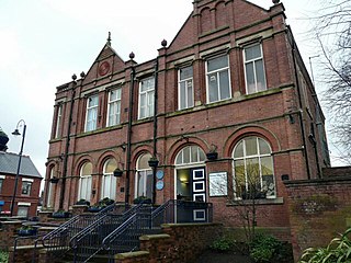
Clarendon Square Shopping Centre is a Shopping Centre in Hyde, Greater Manchester. It is surrounded by other shopping streets with other retailers and provides a host of well-known chain stores and independents, along with containing the towns indoor Market Hall and outside the main frontage the outdoor market. It was originally opened in 1963, but has since been redeveloped and renamed. It consists of a main mall, and accesses to the Market Hall, along with additional sections of mall at the eastern end. It is next to the other major shopping areas of the town centre, such as Market Place and Market Street, and it is also close to the towns 2 major supermarkets, Asda and Morrisons.

The Thuggee and Dacoity Suppression Acts, 1836–48 in British India under East India Company rule were a series of legal acts that outlawed thugee—a practice in North and Central India involving robbery and ritualized murder and mutilation on highways—and dacoity, a form of banditry prevalent in the same region, and prescribed punishment for the same.