Related Research Articles
Monongahela or Mon Valley may refer to:

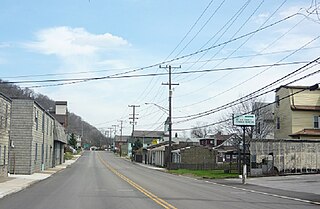
Elizabeth is a borough in Allegheny County, Pennsylvania, United States, on the east bank of the Monongahela River, where Pennsylvania Route 51 crosses, 15 miles (24 km) upstream (south) of Pittsburgh and close to the county line. The population was 1,398 at the 2020 census. The borough of Elizabeth is entirely contained within the 15037 USPS ZIP code. The local school district is the Elizabeth Forward School District. The borough is home to neighborhoods Walker Heights and Town Hill. Elizabeth Borough is the birthplace of Town Hill Hockey established in 1978.

West Elizabeth is a borough in Allegheny County, Pennsylvania, United States. The population was 403 at the 2020 census.

The South Side Flats is a neighborhood in Pittsburgh, Pennsylvania's South Side area. It is located just south of the Monongahela River. The neighborhood has one of the City of Pittsburgh's largest concentrations of 19th-century homes, which has prompted outsiders to call the neighborhood the City's Georgetown. It includes many bars and restaurants as well as residences. The main throughway in the South Side Flats is East Carson Street. The street is home to a significant portion of Pittsburgh's nightlife.

Knoxville is a neighborhood in southern Pittsburgh, Pennsylvania, United States. It is part of zip code 15210, and has representation on Pittsburgh City Council by the council member for District 3.

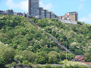
The Monongahela Incline is a funicular on the South Side in Pittsburgh, Pennsylvania, United States, near the Smithfield Street Bridge. Designed and built by Prussian-born engineer John Endres in 1870, it is the oldest continuously operating funicular in the U.S.

A large metropolitan area that is surrounded by rivers and hills, Pittsburgh has an infrastructure system that has been built out over the years to include roads, tunnels, bridges, railroads, inclines, bike paths, and stairways; however, the hills and rivers still form many barriers to transportation within the city.

Cincinnati Street Railway (CSR) was the public transit operator in Cincinnati, Ohio, from 1859 to 1952. The company ceased streetcar operations and was renamed Cincinnati Transit Company.
The Whitehall Branch was a rail line owned and operated by the Pennsylvania Railroad in the U.S. state of Pennsylvania. The line ran from Monongahela Branch near the 30th Street yard to a connection with the Pittsburgh and Lake Erie Railroad and the Allegheny and South Side Railway at the 21st Street Yard in the South Side of Pittsburgh. The line was abandoned by Conrail and has been removed.
The Keeling Coal Company (1861–1878) was a 19th-century coal mining company in Allegheny County, Pennsylvania. Its mines were located in the Pittsburgh Coalfield of western Pennsylvania.
The Pittsburgh and Castle Shannon Railroad was a 3 ft 4 in narrow-gauge railroad in Allegheny County, Pennsylvania. Originally built in 1871, it may have been the first American common-carrier narrow-gauge railroad. It purchased a rail line called the Coal Hill Coal Railroad from the Pittsburgh Coal Company, and used a coal mine under Mt. Washington as a tunnel to transport coal from Castle Shannon, Pennsylvania to Pittsburgh. Passenger traffic was added soon afterwards, and the train carried passengers during the day and coal at night. The original plan was to extend the line to Finleyville, Pennsylvania, but the original narrow-gauge line ran only as far as Castle Shannon. The right of way continued as the Pittsburgh, Castle Shannon and Washington Railroad, later to become part of the Pittsburgh Southern Railroad.

The Castle Shannon Incline was a funicular railroad in Pittsburgh, Pennsylvania that was part of the Pittsburgh and Castle Shannon Railroad. It ran down the southern slope of Mount Washington, as part of the route to the suburb of Castle Shannon, 6 miles south of the incline's location. It replaced an earlier incline dating to 1825 that brought coal down from a mine in Mount Washington.
The Pittsburgh, Virginia and Charleston Railway was a predecessor of the Pennsylvania Railroad in the U.S. state of Pennsylvania. By 1905, when it was merged into the Pennsylvania, it owned a main line along the left (west) side of the Monongahela River, to Pittsburgh's South Side from West Brownsville. Branches connected to the South-West Pennsylvania Railway in Uniontown via Redstone Creek and to numerous coal mines.
The H.B. Hays and Brothers Coal Railroad was a narrow gauge railroad opened in 1878 to carry coal from the Hays family mines along Becks Run and Streets Run in Allegheny County, Pennsylvania. Both branches included an incline, and both are visible in the engravings below, one just south of Six Mile Ferry, the other in the hills south of the mouth of Becks Run. The mines, railroads, and inclines were designed by Pittsburgh engineer John H. McRoberts.
The O'Neil and Company Incline was a nineteenth-century incline, used to transport coal from a mine mouth just west of West Elizabeth, Pennsylvania to a tipple on pool 1 of the Monongahela River. It crossed the entire width of the Borough of West Elizabeth, passing over the Pittsburgh, Virginia and Charleston Railway.
Samuel Diescher was a prominent Hungarian-American civil and mechanical engineer who had his career in the United States. After being educated at universities in Karlsruhe and Zurich in Europe, he immigrated to the United States in 1866 and settled in Cincinnati, Ohio. There he supervised construction of his first inclined plane. He later moved to Pittsburgh, Pennsylvania, where he worked with John Endres on the Monongahela Incline (1870), the first passenger incline in the city.

Castle Shannon Incline Number 2 was an inclined cable railway in Pittsburgh, Pennsylvania. It was originally designed by Samuel Diescher, and opened in 1892 as part of the Pittsburgh and Castle Shannon Railroad as a means of transporting passenger traffic over Mt. Washington in concert with the Castle Shannon Incline. From the top station at Bailey Street, adjacent to the Castle Shannon Incline top station, No. 2 ran down hill west of Haberman Avenue, ending at Warrington Avenue.

Mount Washington is a hill in Pittsburgh, on the southern banks of the Monongahela River and Ohio River.
References
- ↑ "1876 Atlas of the Cities of Pittsburgh, Allegheny, and Adjoining Boroughs: Plate 26".
- ↑ Annual Report of the Secretary of Internal Affairs of the Commonwealth of Pennsylvania, 1876-77. Vol. V. Pennsylvania. Bureau of Industrial Statistics.; Pennsylvania. Dept. of Internal Affairs. Harrisburg, Pennsylvania: Lane S. Hart. 1878. p. 238.
{{cite book}}: CS1 maint: others (link)